Randonnée V.T.T. Le Buisson - LE BUISSON 28 km VTT Pratbinal - Photo

LE BUISSON 28 km VTT Pratbinal

 benoit48
benoit48

Utilisateur

© OpenStreetMap contributors
Longueur
Longueur
28 km
Altitude max
Altitude max
1251 m
Dénivelé positif
Dénivelé positif
738 m
Km-Effort
Km-Effort  
38 km
Altitude min
Altitude min
860 m
Dénivelé négatif
Dénivelé négatif
746 m
Boucle
Boucle
Oui
Date de création :
2018-01-06 00:00:00.0
Dernière modification :
2018-01-06 00:00:00.0

(0 Avis)

V.T.T.
V.T.T.
2h23
Difficulté : Inconnu

Scannez ce code QR pour ouvrir la randonnée dans l'application SityTrail

Application GPS de randonnée GRATUITE

Logo SityTrail SityTrail

IGN / Instituts géographiques

Télécharger SityTrail sur l'App Store Télécharger SityTrail sur Google Play

Logo SityTrail SityTrail World

Le monde est à vous

Télécharger SityTrail sur l'App Store Télécharger SityTrail sur Google Play Télécharger SityTrail sur Huawei AppGallery

À propos

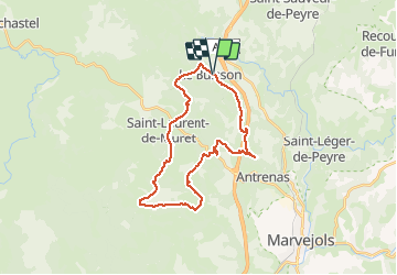
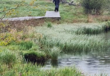
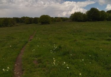
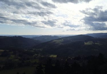
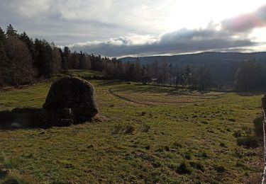
Randonnée V.T.T. de 28 km à découvrir à Occitanie, Lozère, Le Buisson. Cette randonnée est proposée par benoit48.
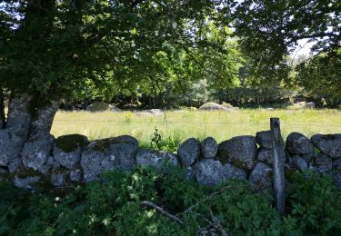
Profil altimétrique

Localisation

Pays :
France
Région :
Occitanie
Département/Province :
Lozère
Commune :
Le Buisson
Localité :
Unknown
Départ:(Dec)
Départ:(UTM)
518642 ; 4941566 (31T) N.

Randonnées à proximité

Randonnée Marche Saint-Laurent-de-Muret - Tour des Monts d'Aubrac - De St Laurent de Muret au refuge des Rajas - Photo
Marche
tracegps

Marche

Moyen
(1)
Saint-Laurent-de-Muret, Occitanie, Lozère, France
15 km | 21 km-effort
3h 30min
Non
Randonnée Marche Saint-Laurent-de-Muret - st Laurent de Muret la Blatte  - Photo
Marche
lecamisard

Marche

Moyen
Saint-Laurent-de-Muret, Occitanie, Lozère, France
18,4 km | 25 km-effort
6h 24min
Oui
Randonnée Marche Le Buisson - Randonnée du moulinet  - Photo
Marche
nicolasdresse

Marche

Moyen
Le Buisson, Occitanie, Lozère, France
9,3 km | 11,9 km-effort
2h 56min
Oui
Randonnée Marche Le Buisson - Rando..Kac du Moulinet...Château de la Baume..14/05/2025 - Photo
Marche
boubou68

Marche

Difficile
Le Buisson, Occitanie, Lozère, France
16,7 km | 21 km-effort
3h 34min
Oui
Randonnée Marche Saint-Laurent-de-Muret - zel st Laurent rajas - Photo
Marche
GUIDE
randodyssée

Marche

Très facile
Saint-Laurent-de-Muret, Occitanie, Lozère, France
18,9 km | 25 km-effort
8h 25min
Non
Randonnée Marche Peyre en Aubrac - 28-12-22 roc de Peyre - Photo
Marche
annefrance70

Marche

Facile
Peyre en Aubrac, Occitanie, Lozère, France
4,4 km | 5,8 km-effort
1h 17min
Oui
Randonnée Marche Peyre en Aubrac - 25-12-2022 lac du Moulinet - Photo
Marche
annefrance70

Marche

Facile
Peyre en Aubrac, Occitanie, Lozère, France
7,6 km | 10,4 km-effort
2h 15min
Oui
Randonnée 4x4 Peyre en Aubrac - autour de Ste Colombe et Aumont-Aubrac - Photo
4x4
annefrance70

4x4

Très facile
Peyre en Aubrac, Occitanie, Lozère, France
37 km | 46 km-effort
1h 41min
Oui
Randonnée Marche Saint-Laurent-de-Muret - Le truc de Crouzet - Photo
Marche
ZITO12

Marche

Très facile
Saint-Laurent-de-Muret, Occitanie, Lozère, France
9,6 km | 12,8 km-effort
4h 11min
Oui


Fermer
Mes abonnements