Randonnée Marche Saint-Pierre-lès-Nemours - pso-170814 - NemoursGréau-Sarrasin - Photo
 randodan
randodan

Utilisateur

© OpenStreetMap contributors
Longueur
Longueur
12,1 km
Altitude max
Altitude max
116 m
Dénivelé positif
Dénivelé positif
237 m
Km-Effort
Km-Effort  
15,3 km
Altitude min
Altitude min
73 m
Dénivelé négatif
Dénivelé négatif
235 m
Boucle
Boucle
Oui
Date de création :
2017-08-28 00:00:00.0
Dernière modification :
2017-08-28 00:00:00.0

(0 Avis)

Marche
Marche
5h00
Difficulté : Facile

Scannez ce code QR pour ouvrir la randonnée dans l'application SityTrail

Application GPS de randonnée GRATUITE

Logo SityTrail SityTrail

IGN / Instituts géographiques

Télécharger SityTrail sur l'App Store Télécharger SityTrail sur Google Play

Logo SityTrail SityTrail World

Le monde est à vous

Télécharger SityTrail sur l'App Store Télécharger SityTrail sur Google Play Télécharger SityTrail sur Huawei AppGallery

À propos

Randonnée Marche de 12,1 km à découvrir à Île-de-France, Seine-et-Marne, Saint-Pierre-lès-Nemours. Cette randonnée est proposée par randodan.

Description

Des Rochers Gréau au Mont Sarrasin.<br>
- Lundi 14 août 2017 -<br>
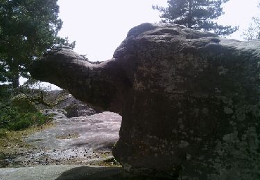
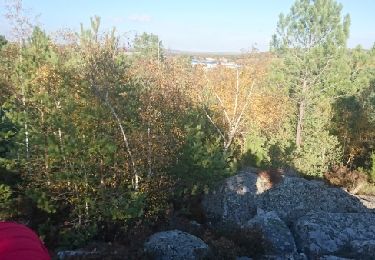
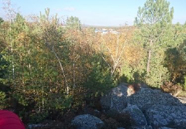
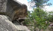
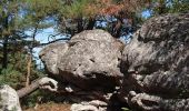
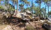
9h, départ du parking près de la piscine Aquasud de Nemours . La Tortue est notre 1er objectif dans les Rochers Gréau . Après les beaux rochers et la 2e bosse, on prend le GR 13 vers le Puiselet . Petite erreur de parcours et nous rectifions par un chouette hors piste . Après le Puiselet, nous attaquons le Mont Sarrasin et son chaos rocheux . Là aussi, de beaux rochers.<br>
12h10 sur la 2e bosse, nous nous installons pour le pique-nique . Soleil plombant, même JP recherche l'ombre ;o).<br>
13h10, redescendons du Mont Sarrasin et direction retour . Intéressé par un "réservoir", je tente son approche en hors piste, mais nous le ratons . Retour par la Tortue et essayons d'en descendre en hors piste, mais ça finit en vrai sentier de lapins.<br>
15h, sommes de retour au parking.<br>
Au départ de la maison, il faisait 9°, de retour à la voiture, il faisait 27° !<br>
JP,Da.<br>
<small><i>Merci à philippepauleau pour ce superbe circuit.</i></small>

Profil altimétrique

Photos

Points d'intérêt

Point d'intérêt Saint-Pierre-lès-Nemours - 01 - La Tortue - Photo
randodan
SAINT-PIERRE-LÈS-NEMOURS 
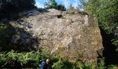
Point d'intérêt Saint-Pierre-lès-Nemours - 02 - Un très gros caillou - Photo
randodan
SAINT-PIERRE-LÈS-NEMOURS 
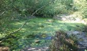
Point d'intérêt Saint-Pierre-lès-Nemours - 03 - Une belle petite mare toute verte de lentilles - Photo
randodan
SAINT-PIERRE-LÈS-NEMOURS 
Point d'intérêt Saint-Pierre-lès-Nemours - 04 - Trop bien aménagé ce sous-bois, y a même des escaliers - Photo
randodan
SAINT-PIERRE-LÈS-NEMOURS 
Point d'intérêt Saint-Pierre-lès-Nemours - 05 - Faut deviner (imaginer) à quoi ressemble ce rocher - Photo
randodan
SAINT-PIERRE-LÈS-NEMOURS 
Point d'intérêt Saint-Pierre-lès-Nemours - 06 - Mickey Mouse ! - Photo
randodan
SAINT-PIERRE-LÈS-NEMOURS 
Point d'intérêt Saint-Pierre-lès-Nemours - 07 - Le premier chaos du Mont Sarrasin - Photo
randodan
SAINT-PIERRE-LÈS-NEMOURS 
Point d'intérêt Saint-Pierre-lès-Nemours - 08 - Un gros toutou - Photo
randodan
SAINT-PIERRE-LÈS-NEMOURS 
Point d'intérêt Saint-Pierre-lès-Nemours - 09 - Pique-Nique sur le Mont Sarrasin (bosse ouest) - Photo
randodan
SAINT-PIERRE-LÈS-NEMOURS 
Point d'intérêt Saint-Pierre-lès-Nemours - 10 - Laissez parler votre imagination... - Photo
randodan
SAINT-PIERRE-LÈS-NEMOURS 
Point d'intérêt Saint-Pierre-lès-Nemours - 11 - Curiosité : un double auvent - Photo
randodan
SAINT-PIERRE-LÈS-NEMOURS 

Localisation

Pays :
France
Région :
Île-de-France
Département/Province :
Seine-et-Marne
Commune :
Saint-Pierre-lès-Nemours
Localité :
Unknown
Départ:(Dec)
Départ:(UTM)
476639 ; 5345126 (31U) N.

Randonnées à proximité

Randonnée Marche Saint-Pierre-lès-Nemours - Rochers Gréau et Puiselet - Photo
Marche
Philippepauleau

Marche

Moyen
(1)
Saint-Pierre-lès-Nemours, Île-de-France, Seine-et-Marne, France
10,8 km | 13,2 km-effort
2h 41min
Oui
Randonnée A pied Saint-Pierre-lès-Nemours - Le Mont Blanc de la Commanderie - Photo
A pied
GUIDE
chessyca

A pied

Moyen
Saint-Pierre-lès-Nemours, Île-de-France, Seine-et-Marne, France
26 km | 30 km-effort
6h 50min
Non
Randonnée Marche Saint-Pierre-lès-Nemours - De Nemours à Moret + halte resto Bourron Marlotte - Photo
Marche
GUIDE
chessyca

Marche

Très facile
Saint-Pierre-lès-Nemours, Île-de-France, Seine-et-Marne, France
33 km | 36 km-effort
6h 14min
Non
Randonnée Marche Nemours - Forêt de Nemours Parking des crottes du loup route de Nemours à Poligny - Photo
Marche
GUIDE
maryse r

Marche

Très difficile
(2)
Nemours, Île-de-France, Seine-et-Marne, France
25 km | 30 km-effort
6h 50min
Oui
Randonnée Marche Poligny - polynoise 2017 - Photo
Marche
joelinou

Marche

Moyen
(2)
Poligny, Île-de-France, Seine-et-Marne, France
19,3 km | 23 km-effort
3h 44min
Oui
Randonnée V.T.T. Poligny - Poligny 55km - Photo
V.T.T.
besn0847

V.T.T.

Difficile
(1)
Poligny, Île-de-France, Seine-et-Marne, France
55 km | 64 km-effort
4h 9min
Non
Randonnée Marche Saint-Pierre-lès-Nemours - Saint Pierre les Nemours - Photo
Marche
pikibangi

Marche

Moyen
Saint-Pierre-lès-Nemours, Île-de-France, Seine-et-Marne, France
6,5 km | 7,9 km-effort
1h 39min
Non
Randonnée Autre activité Nemours - 181109 SVG - Photo
Autre activité
MarcheEtReve

Autre activité

Très facile
Nemours, Île-de-France, Seine-et-Marne, France
12,7 km | 14,7 km-effort
5h 22min
Oui
Randonnée Autre activité Nemours - 181109 EnCours - Photo
Autre activité
MarcheEtReve

Autre activité

Très facile
Nemours, Île-de-France, Seine-et-Marne, France
12,7 km | 14,7 km-effort
5h 22min
Oui


Fermer
Mes abonnements