Randonnée Marche Halinghen - HautPicho-Halinghem - Photo
 Robert62
Robert62

Utilisateur

© OpenStreetMap contributors
Longueur
Longueur
7,2 km
Altitude max
Altitude max
172 m
Dénivelé positif
Dénivelé positif
175 m
Km-Effort
Km-Effort  
9,5 km
Altitude min
Altitude min
82 m
Dénivelé négatif
Dénivelé négatif
176 m
Boucle
Boucle
Oui
Date de création :
2017-08-07 00:00:00.0
Dernière modification :
2022-10-03 18:32:38.332

(1 Avis)

Marche
Marche
1h59
Difficulté : Moyen

Scannez ce code QR pour ouvrir la randonnée dans l'application SityTrail

Application GPS de randonnée GRATUITE

Logo SityTrail SityTrail

IGN / Instituts géographiques

Télécharger SityTrail sur l'App Store Télécharger SityTrail sur Google Play

Logo SityTrail SityTrail World

Le monde est à vous

Télécharger SityTrail sur l'App Store Télécharger SityTrail sur Google Play Télécharger SityTrail sur Huawei AppGallery

À propos

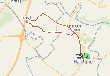
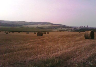
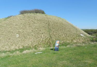
Randonnée Marche de 7,2 km à découvrir à Hauts-de-France, Pas-de-Calais, Halinghen. Cette randonnée est proposée par Robert62.

Description

Petite randonnée en boucle au départ de Halinghen

Profil altimétrique

Localisation

Pays :
France
Région :
Hauts-de-France
Département/Province :
Pas-de-Calais
Commune :
Halinghen
Localité :
Unknown
Départ:(Dec)
Départ:(UTM)
407307 ; 5606373 (31U) N.

Commentaires

Veuillez vous connecter pour laisser un commentaire ou une note


Randonnées à proximité

Randonnée Marche Frencq - Du Witrepin à la Dordonne - Frencq - Photo
Marche
tracegps

Marche

Difficile
(2)
Frencq, Hauts-de-France, Pas-de-Calais, France
13,1 km | 16,6 km-effort
3h 19min
Oui
Randonnée Marche Nesles - Mont Violette - Nesles - Photo
Marche
tracegps

Marche

Moyen
(1)
Nesles, Hauts-de-France, Pas-de-Calais, France
11,6 km | 15,4 km-effort
3h 0min
Oui
Randonnée Marche Samer - Le chemin de Cappe - Samer  - Photo
Marche
tracegps

Marche

Moyen
(1)
Samer, Hauts-de-France, Pas-de-Calais, France
10,7 km | 13,2 km-effort
3h 0min
Oui
Randonnée Marche Samer - Le Mont Corbeau - Samer - Photo
Marche
tracegps

Marche

Difficile
Samer, Hauts-de-France, Pas-de-Calais, France
10,1 km | 12,6 km-effort
3h 0min
Oui
Randonnée V.T.T. Samer - Le Haut Pichot - Samer - Photo
V.T.T.
tracegps

V.T.T.

Difficile
Samer, Hauts-de-France, Pas-de-Calais, France
32 km | 39 km-effort
3h 0min
Oui
Randonnée Marche Samer - Le Haut Pichot - Samer - Photo
Marche
tracegps

Marche

Difficile
Samer, Hauts-de-France, Pas-de-Calais, France
32 km | 39 km-effort
7h 0min
Oui
Randonnée V.T.T. Frencq - Du Witrepin à la Dordonne - Frencq - Photo
V.T.T.
tracegps

V.T.T.

Moyen
Frencq, Hauts-de-France, Pas-de-Calais, France
13,1 km | 16,6 km-effort
1h 30min
Oui
Randonnée Marche Neufchâtel-Hardelot - De la Glaisière au Vouroux - Photo
Marche
tracegps

Marche

Moyen
(1)
Neufchâtel-Hardelot, Hauts-de-France, Pas-de-Calais, France
15,4 km | 17,7 km-effort
3h 30min
Oui
Randonnée Marche Nesles - Sentier de la Motte Castrale - Nesles - Photo
Marche
tracegps

Marche

Facile
Nesles, Hauts-de-France, Pas-de-Calais, France
2,1 km | 2,8 km-effort
30min
Oui


Fermer
Mes abonnements