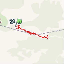
![](/images/other/stat-length.png)
![Randonnée Marche Beauvezer - les gorges de St-Pierre - Photo](https://media.geolcdn.com/t/1900/400/ext.pjpeg?maxdim=2&url=https%3A%2F%2Fservices.sitytrail.com%2FGeolivesWS%2FDownloadMedia.ashx%3FTrailID%3D793443%26Media%3Dfix__20170721123335.jpg)
les gorges de St-Pierre
amiral13
Utilisateur GUIDE
![Longueur](/images/other/stat-length.png)
![Altitude max](https://static1.geolcdn.com/siteimages/upload/files/1508320355ic_sort_altitude_max_24dp.png)
![Dénivelé positif](https://static1.geolcdn.com/siteimages/upload/files/1508320355ic_sort_den_pos_24dp.png)
![Km-Effort](/images/other/stat-length.png)
![Altitude min](https://static1.geolcdn.com/siteimages/upload/files/1508320355ic_sort_altitude_min_24dp.png)
![Dénivelé négatif](https://static1.geolcdn.com/siteimages/upload/files/1508320355ic_sort_den_neg_24dp.png)
![Boucle](https://static1.geolcdn.com/siteimages/upload/files/16400158638029165_repeat_loop_refresh_sync_direction_icon.png)
![Marche](https://static1.geolcdn.com/sitytour/trail-icons/101.png)
2h03
Difficulté : Facile
![Scannez ce code QR pour ouvrir la randonnée dans l'application SityTrail](https://capi.geolives.com/qq0zvz2zws4bq2lad0pu/sitytour/trails/793443/qr.png?size=200)
Application GPS de randonnée GRATUITE
À propos
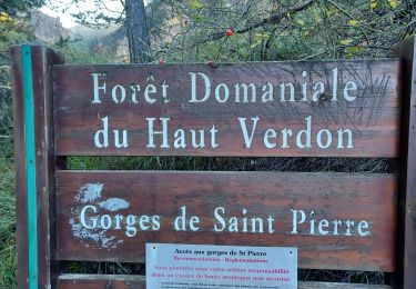
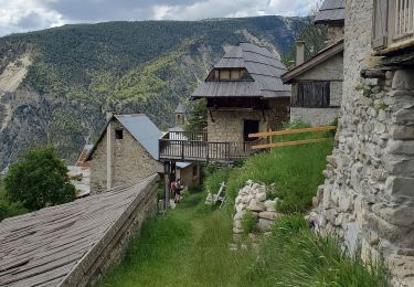
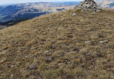
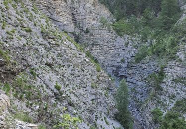
Randonnée Marche de 6,5 km à découvrir à Provence-Alpes-Côte d'Azur, Alpes-de-Haute-Provence, Beauvezer. Cette randonnée est proposée par amiral13.
Description
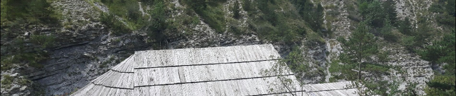
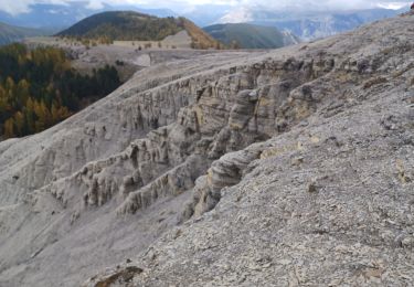
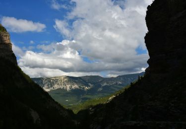
attention sentier vertigineux par endroit. Ne pas y emmener les personnes sensibles au vertige ou les enfants en bas age; si vous prenez le risque une surveillance de tous les instants sera nécessaire. d'autre part, le sentier est fortement exposé aux chutes de pierre, et ce sera à vos risques et périls.
le traçé GPS est très fantaisiste car perturbé par la proximité de la falaise
Localisation
Commentaires
Randonnées à proximité
![Randonnée Marche Thorame-Haute - VILLARS HEYSIER .CABAN DE CONGERMAN - Photo](https://media.geolcdn.com/t/375/260/b251cad8-70ae-4895-901b-fe937d4b0df0.jpg&format=jpg&maxdim=2)
![Marche Marche](https://static1.geolcdn.com/sitytour/trail-icons/101.png)
Marche
![](/images/other/stat-length.png)
![](https://static1.geolcdn.com/siteimages/upload/files/16400158638029165_repeat_loop_refresh_sync_direction_icon.png)
![Randonnée Marche Beauvezer - 04.gorges st pierre 03.08.23 - Photo](https://media.geolcdn.com/t/375/260/ee41afb8-8bbb-46c3-8271-84bbc995eeab.jpg&format=jpg&maxdim=2)
![Marche Marche](https://static1.geolcdn.com/sitytour/trail-icons/101.png)
Marche
![](/images/other/stat-length.png)
![](https://static1.geolcdn.com/siteimages/upload/files/16400158638029165_repeat_loop_refresh_sync_direction_icon.png)
![Randonnée Marche Colmars - Les lacs Lignin - Photo](https://media.geolcdn.com/t/375/260/fbca6767-bae4-46df-a02f-745bbf118b44.jpg&format=jpg&maxdim=2)
![Marche Marche](https://static1.geolcdn.com/sitytour/trail-icons/101.png)
Marche
![](/images/other/stat-length.png)
![](https://static1.geolcdn.com/siteimages/upload/files/16400158638029165_repeat_loop_refresh_sync_direction_icon.png)
![Randonnée Marche Beauvezer - VILLARS HEYSSIER . GORGES DE SAINT PIERRE O - Photo](https://media.geolcdn.com/t/375/260/1711233c-dcfe-4507-8abf-7d44d68d7751.jpg&format=jpg&maxdim=2)
![Marche Marche](https://static1.geolcdn.com/sitytour/trail-icons/101.png)
Marche
![](/images/other/stat-length.png)
![](https://static1.geolcdn.com/siteimages/upload/files/16400158638029165_repeat_loop_refresh_sync_direction_icon.png)
![Randonnée Marche Colmars - Colmars petit coyer 993m 14kms - Photo](https://media.geolcdn.com/t/375/260/34cedc48-3841-4962-bcc9-facfdb32c9cc.jpg&format=jpg&maxdim=2)
![Marche Marche](https://static1.geolcdn.com/sitytour/trail-icons/101.png)
Marche
![](/images/other/stat-length.png)
![](https://static1.geolcdn.com/siteimages/upload/files/16400158638029165_repeat_loop_refresh_sync_direction_icon.png)
![Marche Marche](https://static1.geolcdn.com/sitytour/trail-icons/101.png)
Marche
![](/images/other/stat-length.png)
![](https://static1.geolcdn.com/siteimages/upload/files/16400158638029165_repeat_loop_refresh_sync_direction_icon.png)
![Randonnée Marche Beauvezer - villars heyssier gorges Saint Pierre 19kms 850m - Photo](https://media.geolcdn.com/t/375/260/42591c34-633f-4c89-ba92-2a0e62604bbd.jpg&format=jpg&maxdim=2)
![Marche Marche](https://static1.geolcdn.com/sitytour/trail-icons/101.png)
Marche
![](/images/other/stat-length.png)
![](https://static1.geolcdn.com/siteimages/upload/files/16400158638029165_repeat_loop_refresh_sync_direction_icon.png)
![Randonnée Marche Colmars - petit coyer - Photo](https://media.geolcdn.com/t/375/260/68c25c46-6e07-4761-95ca-0791cf3cb843.jpg&format=jpg&maxdim=2)
![Marche Marche](https://static1.geolcdn.com/sitytour/trail-icons/101.png)
Marche
![](/images/other/stat-length.png)
![](https://static1.geolcdn.com/siteimages/upload/files/16400158638029165_repeat_loop_refresh_sync_direction_icon.png)
![Randonnée Marche Beauvezer - 12-07-2023 Gorges de Saint Pierre - Photo](https://media.geolcdn.com/t/375/260/db4653b5-62bd-4daf-ad56-352822c9fa84.jpg&format=jpg&maxdim=2)
![Marche Marche](https://static1.geolcdn.com/sitytour/trail-icons/101.png)
Marche
![](/images/other/stat-length.png)
![](https://static1.geolcdn.com/siteimages/upload/files/16400158638029165_repeat_loop_refresh_sync_direction_icon.png)