![](/images/other/stat-length.png)
![Randonnée Marche Orbaizeta - 1-Irabia le lac forêt primitive, sommet Lizardoia - Photo](https://media.geolcdn.com/t/1900/400/ext.pjpeg?maxdim=2&url=https%3A%2F%2Fstatic1.geolcdn.com%2Fsiteimages%2Fupload%2Ffiles%2F1553511878bg_sport_marche.png)
1-Irabia le lac forêt primitive, sommet Lizardoia
DECHAMPD
Utilisateur
![Longueur](/images/other/stat-length.png)
Longueur
14,4 km
![Altitude max](https://static1.geolcdn.com/siteimages/upload/files/1508320355ic_sort_altitude_max_24dp.png)
Altitude max
1200 m
![Dénivelé positif](https://static1.geolcdn.com/siteimages/upload/files/1508320355ic_sort_den_pos_24dp.png)
Dénivelé positif
609 m
![Km-Effort](/images/other/stat-length.png)
Km-Effort
23 km
![Altitude min](https://static1.geolcdn.com/siteimages/upload/files/1508320355ic_sort_altitude_min_24dp.png)
Altitude min
820 m
![Dénivelé négatif](https://static1.geolcdn.com/siteimages/upload/files/1508320355ic_sort_den_neg_24dp.png)
Dénivelé négatif
614 m
![Boucle](https://static1.geolcdn.com/siteimages/upload/files/16400158638029165_repeat_loop_refresh_sync_direction_icon.png)
Boucle
Oui
Date de création :
2019-01-14 17:30:38.3
Dernière modification :
2022-08-21 09:33:51.242
![Marche](https://static1.geolcdn.com/sitytour/trail-icons/101.png)
4h51
Difficulté : Inconnu
![Scannez ce code QR pour ouvrir la randonnée dans l'application SityTrail](https://capi.geolives.com/qq0zvz2zws4bq2lad0pu/sitytour/trails/784123/qr.png?size=200)
Application GPS de randonnée GRATUITE
À propos
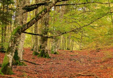
Randonnée Marche de 14,4 km à découvrir à Navarre, Inconnu, Orbaizeta. Cette randonnée est proposée par DECHAMPD.
Description
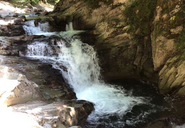
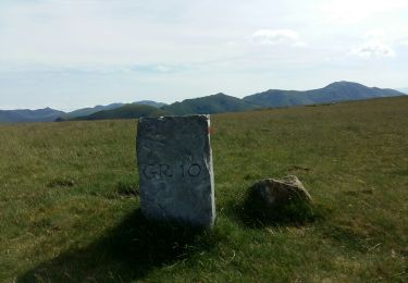
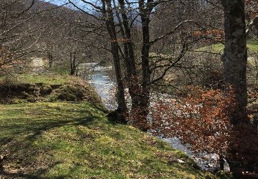
départ borne frontière 225, Loma de Kontrasario, Kontrasario, Lizardoia 1198m, casa del leñador 1081m, Remos (expo), Cascade El Cubo, aire de picnic Iraty 852m, Loma de la vieja, Loma del Cuervo, Loma de la Cuestiòn, Egurgoa retour au départ borne 225.
Points d'intérêt
Localisation
Pays :
Espagne
Région :
Navarre
Département/Province :
Inconnu
Commune :
Orbaizeta
Localité :
Unknown
Départ:(Dec)
Départ:(UTM)
651395 ; 4763567 (30T) N.
Commentaires
Randonnées à proximité
![Randonnée A pied Ochagavía/Otsagabia - Sentier de Beuntza Plaza - Photo](https://media.geolcdn.com/t/375/260/6b03533b-8ee5-40c6-8273-538bc37d3b3d.jpeg&format=jpg&maxdim=2)
![A pied A pied](https://static1.geolcdn.com/sitytour/trail-icons/100.png)
Sentier de Beuntza Plaza
A pied
Facile
Ochagavía/Otsagabia,
Navarre,
Inconnu,
Espagne
![](/images/other/stat-length.png)
3,5 km | 4,8 km-effort
1h 5min
![](https://static1.geolcdn.com/siteimages/upload/files/16400158638029165_repeat_loop_refresh_sync_direction_icon.png)
Oui
![Randonnée A pied Ochagavía/Otsagabia - Vieux sentier de la forêt d'Irati - Photo](https://media.geolcdn.com/t/375/260/202713c9-3093-41eb-a5c0-ca8d123dcc85.jpeg&format=jpg&maxdim=2)
![A pied A pied](https://static1.geolcdn.com/sitytour/trail-icons/100.png)
Vieux sentier de la forêt d'Irati
A pied
Facile
Ochagavía/Otsagabia,
Navarre,
Inconnu,
Espagne
![](/images/other/stat-length.png)
7,8 km | 11,4 km-effort
2h 34min
![](https://static1.geolcdn.com/siteimages/upload/files/16400158638029165_repeat_loop_refresh_sync_direction_icon.png)
Oui
![Randonnée Marche Lecumberry - IRATY Pantano de Irabia Boucle courte - Photo](https://media.geolcdn.com/t/375/260/90e781f7-5f6a-44ca-9b42-ab8081c80bf3.jpg&format=jpg&maxdim=2)
![Marche Marche](https://static1.geolcdn.com/sitytour/trail-icons/101.png)
IRATY Pantano de Irabia Boucle courte
Marche
Très facile
Lecumberry,
Nouvelle-Aquitaine,
Pyrénées-Atlantiques,
France
![](/images/other/stat-length.png)
13,6 km | 20 km-effort
5h 7min
![](https://static1.geolcdn.com/siteimages/upload/files/16400158638029165_repeat_loop_refresh_sync_direction_icon.png)
Oui
![Randonnée Marche Lecumberry - gr10t - Photo](https://media.geolcdn.com/t/375/260/c8d19437-af0a-44a4-afe9-85d3418a077b.jpg&format=jpg&maxdim=2)
![Marche Marche](https://static1.geolcdn.com/sitytour/trail-icons/101.png)
gr10t
Marche
Très difficile
Lecumberry,
Nouvelle-Aquitaine,
Pyrénées-Atlantiques,
France
![](/images/other/stat-length.png)
12 km | 19,6 km-effort
6h 40min
![](https://static1.geolcdn.com/siteimages/upload/files/16400158638029165_repeat_loop_refresh_sync_direction_icon.png)
Non
![Randonnée Marche Lecumberry - okabe - Photo](https://media.geolcdn.com/t/375/260/95f8aa94-d97b-45bf-8dc1-fdbfa64b9b90.jpg&format=jpg&maxdim=2)
![Marche Marche](https://static1.geolcdn.com/sitytour/trail-icons/101.png)
okabe
Marche
Très difficile
Lecumberry,
Nouvelle-Aquitaine,
Pyrénées-Atlantiques,
France
![](/images/other/stat-length.png)
12 km | 19,6 km-effort
2h 27min
![](https://static1.geolcdn.com/siteimages/upload/files/16400158638029165_repeat_loop_refresh_sync_direction_icon.png)
Non
![Randonnée Marche Lecumberry - Okabe magique - Photo](https://media.geolcdn.com/t/375/260/072c8693-4101-429d-bd0b-7f3d41337b96.jpg&format=jpg&maxdim=2)
![Marche Marche](https://static1.geolcdn.com/sitytour/trail-icons/101.png)
Okabe magique
Marche
Difficile
Lecumberry,
Nouvelle-Aquitaine,
Pyrénées-Atlantiques,
France
![](/images/other/stat-length.png)
15,2 km | 25 km-effort
5h 31min
![](https://static1.geolcdn.com/siteimages/upload/files/16400158638029165_repeat_loop_refresh_sync_direction_icon.png)
Oui
![Randonnée Marche Larrau - IRATY Chapelle Notre Dame des Neiges et Casas de Irati - Photo](https://media.geolcdn.com/t/375/260/4820dd3f-a315-4e52-ac6d-42397795308f.jpg&format=jpg&maxdim=2)
![Marche Marche](https://static1.geolcdn.com/sitytour/trail-icons/101.png)
IRATY Chapelle Notre Dame des Neiges et Casas de Irati
Marche
Facile
Larrau,
Nouvelle-Aquitaine,
Pyrénées-Atlantiques,
France
![](/images/other/stat-length.png)
22 km | 33 km-effort
6h 22min
![](https://static1.geolcdn.com/siteimages/upload/files/16400158638029165_repeat_loop_refresh_sync_direction_icon.png)
Oui
![Randonnée Marche Lecumberry - Irabia pantano boucle par gr11 - Photo](https://media.geolcdn.com/t/375/260/caf3f193-3b74-42e5-a88e-7b86b53f8978.jpg&format=jpg&maxdim=2)
![Marche Marche](https://static1.geolcdn.com/sitytour/trail-icons/101.png)
Irabia pantano boucle par gr11
Marche
Moyen
Lecumberry,
Nouvelle-Aquitaine,
Pyrénées-Atlantiques,
France
![](/images/other/stat-length.png)
18,2 km | 27 km-effort
6h 27min
![](https://static1.geolcdn.com/siteimages/upload/files/16400158638029165_repeat_loop_refresh_sync_direction_icon.png)
Oui
![Randonnée Marche Orbaizeta - pantano - Photo](https://media.geolcdn.com/t/375/260/ext.jpg?maxdim=2&url=https%3A%2F%2Fservices.sitytrail.com%2FGeolivesWS%2FDownloadMedia.ashx%3FTrailID%3D729781%26Media%3D20170409150000.jpg)
![Marche Marche](https://static1.geolcdn.com/sitytour/trail-icons/101.png)
pantano
Marche
Très facile
Orbaizeta,
Navarre,
Inconnu,
Espagne
![](/images/other/stat-length.png)
11,2 km | 14,9 km-effort
3h 5min
![](https://static1.geolcdn.com/siteimages/upload/files/16400158638029165_repeat_loop_refresh_sync_direction_icon.png)
Oui