


10,1 km | 14,9 km-effort


Utilisateur


Application GPS de randonnée GRATUITE
 SityTrail
IGN / Instituts géographiques
SityTrail World
Le monde est à vous
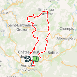
Randonnée Cheval de 31 km à découvrir à Auvergne-Rhône-Alpes, Ardèche, Vernoux-en-Vivarais. Cette randonnée est proposée par giterias.
Boucle équestre de 34 km au départ deVernoux en Vivrais, parcours plutôt roulant pour la région.
Marche

Marche
Marche

Randonnée équestre
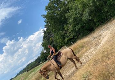
Randonnée équestre
Marche
Marche
Marche
Marche