![](/images/other/stat-length.png)
![Randonnée Marche Tence - Tence-170621 - CreuxLoup-Beaudors - Photo](https://media.geolcdn.com/t/1900/400/ext.pjpeg?maxdim=2&url=https%3A%2F%2Fservices.sitytrail.com%2FGeolivesWS%2FDownloadMedia.ashx%3FTrailID%3D776811%26Media%3Dfix__20170621110107.jpg)
Tence-170621 - CreuxLoup-Beaudors
randodan
Utilisateur
![Longueur](/images/other/stat-length.png)
![Altitude max](https://static1.geolcdn.com/siteimages/upload/files/1508320355ic_sort_altitude_max_24dp.png)
![Dénivelé positif](https://static1.geolcdn.com/siteimages/upload/files/1508320355ic_sort_den_pos_24dp.png)
![Km-Effort](/images/other/stat-length.png)
![Altitude min](https://static1.geolcdn.com/siteimages/upload/files/1508320355ic_sort_altitude_min_24dp.png)
![Dénivelé négatif](https://static1.geolcdn.com/siteimages/upload/files/1508320355ic_sort_den_neg_24dp.png)
![Boucle](https://static1.geolcdn.com/siteimages/upload/files/16400158638029165_repeat_loop_refresh_sync_direction_icon.png)
![Marche](https://static1.geolcdn.com/sitytour/trail-icons/101.png)
3h00
Difficulté : Facile
![Scannez ce code QR pour ouvrir la randonnée dans l'application SityTrail](https://capi.geolives.com/qq0zvz2zws4bq2lad0pu/sitytour/trails/776811/qr.png?size=200)
Application GPS de randonnée GRATUITE
À propos
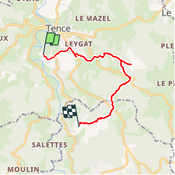
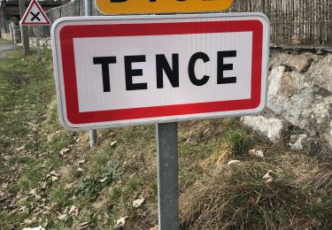
Randonnée Marche de 9,8 km à découvrir à Auvergne-Rhône-Alpes, Haute-Loire, Tence. Cette randonnée est proposée par randodan.
Description
Tence, 21 juin 2017<br>
- Creux du Loup, du VVF à La Celle -<br>
<small>(d'après la fiche "Creux du Loup" du VVF) - Le Creux du Loup est un gîte-roulotte à 300 m au Sud de Maria . Prévu en fin de parcours, nous n'y passerons pas.</small><br>
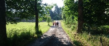
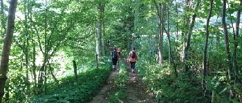
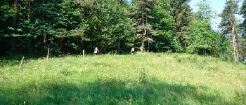
8h25, départ du VVF . Zut, le départ du circuit est bien plus loin que prévu : au pont sur la Sérigoule à Gardalhac, soit 2.2 km plus loin . Et ça continue avec une erreur sur le topo : cote 884, c'est à gauche, pas à droite ! Puis, au lieu dit "les Champs", croisons un autre groupe de randonneurs du VVF . Persuadé qu'ils s'étaient trompés, je leur montre ma trace GPS, et reZut, c'est nous qui étions dans l'erreur... demi-tour pour retrouver le bon chemin.<br>
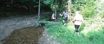
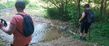
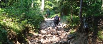
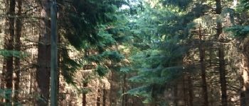
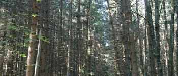
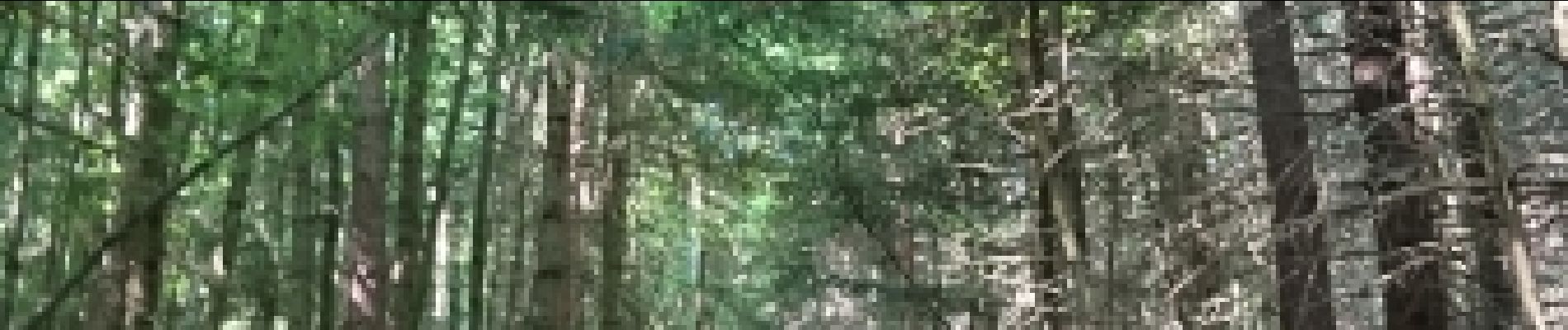
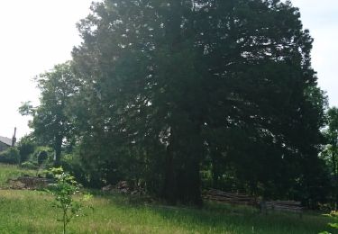
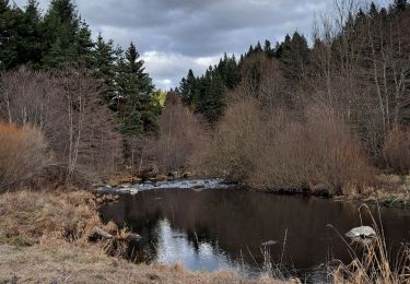
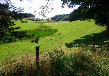
Un premier ruisseau à traverser, cool sur petite passerelle . Mais le 2e, le Ruisseau de la Sérigoule, doit se traverser à gué, heureusement sans problème (dommage, pas eu le scoop d'un plouf ;o) . La longue grimpette dans le Bois des Beaudors, ce n'est que caillasse à se tordre les pattes . Sinon, tous les passages en bois sont superbes sous ces grands pins et sapins qui nous protègent du cagnard.<br>
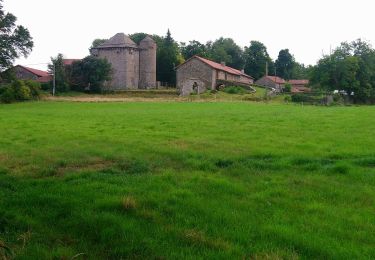
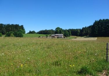
A Montailler, voyant qu'il nous reste encore beaucoup à faire, nous décidons d'appeler Mireille qui nous récupère à la Celle peu après notre arrivée à 11h20.<br>
4 participants (Jo,Ca,Ch,Da).
Localisation
Commentaires
Randonnées à proximité
![Randonnée Marche Chenereilles - Chenereilles, Lac de la Valette - Photo](https://media.geolcdn.com/t/375/260/388ebbcb-d8d6-4d0c-9d4d-f65e45105430.jpg&format=jpg&maxdim=2)
![Marche Marche](https://static1.geolcdn.com/sitytour/trail-icons/101.png)
Marche
![](/images/other/stat-length.png)
![](https://static1.geolcdn.com/siteimages/upload/files/16400158638029165_repeat_loop_refresh_sync_direction_icon.png)
![Randonnée Marche Chenereilles - Chenereilles, le château de Joux - Photo](https://media.geolcdn.com/t/375/260/bc72b279-cf9e-4b33-b880-67c7750c5c1c.jpg&format=jpg&maxdim=2)
![Marche Marche](https://static1.geolcdn.com/sitytour/trail-icons/101.png)
Marche
![](/images/other/stat-length.png)
![](https://static1.geolcdn.com/siteimages/upload/files/16400158638029165_repeat_loop_refresh_sync_direction_icon.png)
![Randonnée Marche Le Chambon-sur-Lignon - Tence-170623 - CreuxLoup-RetourVVF - Photo](https://media.geolcdn.com/t/375/260/ext.jpg?maxdim=2&url=https%3A%2F%2Fservices.sitytrail.com%2FGeolivesWS%2FDownloadMedia.ashx%3FTrailID%3D777775%26Media%3Dfix__20170623092557.jpg)
![Marche Marche](https://static1.geolcdn.com/sitytour/trail-icons/101.png)
Marche
![](/images/other/stat-length.png)
![](https://static1.geolcdn.com/siteimages/upload/files/16400158638029165_repeat_loop_refresh_sync_direction_icon.png)
![Randonnée Marche Tence - Tence-170618 - RocheDruidique-Mazeaux - Photo](https://media.geolcdn.com/t/375/260/ext.jpg?maxdim=2&url=https%3A%2F%2Fservices.sitytrail.com%2FGeolivesWS%2FDownloadMedia.ashx%3FTrailID%3D775243%26Media%3Dfix__20170618111716.jpg)
![Marche Marche](https://static1.geolcdn.com/sitytour/trail-icons/101.png)
Marche
![](/images/other/stat-length.png)
![](https://static1.geolcdn.com/siteimages/upload/files/16400158638029165_repeat_loop_refresh_sync_direction_icon.png)
![Randonnée Autre activité Tence - autour de tence - Photo](https://media.geolcdn.com/t/375/260/ext.jpg?maxdim=2&url=https%3A%2F%2Fservices.sitytrail.com%2FGeolivesWS%2FDownloadMedia.ashx%3FTrailID%3D211927%26Media%3Dfix__20130811102751.jpg)
![Autre activité Autre activité](https://static1.geolcdn.com/sitytour/trail-icons/900.png)
Autre activité
![](/images/other/stat-length.png)
![](https://static1.geolcdn.com/siteimages/upload/files/16400158638029165_repeat_loop_refresh_sync_direction_icon.png)
![Randonnée Marche Mazet-Saint-Voy - Salettes et Mazalibran - Photo](https://media.geolcdn.com/t/375/260/42cfbe72-4434-4356-970f-aa668c703a3b.jpg&format=jpg&maxdim=2)
![Marche Marche](https://static1.geolcdn.com/sitytour/trail-icons/101.png)
Marche
![](/images/other/stat-length.png)
![](https://static1.geolcdn.com/siteimages/upload/files/16400158638029165_repeat_loop_refresh_sync_direction_icon.png)
![Randonnée Marche Tence - Tence (13 km - D. 330 m) - Photo](https://media.geolcdn.com/t/375/260/746c91c5-9841-4de0-8e2b-f2f89040594e.jpg&format=jpg&maxdim=2)
![Marche Marche](https://static1.geolcdn.com/sitytour/trail-icons/101.png)
Marche
![](/images/other/stat-length.png)
![](https://static1.geolcdn.com/siteimages/upload/files/16400158638029165_repeat_loop_refresh_sync_direction_icon.png)
![Randonnée Vélo de route Le Chambon-sur-Lignon - 07,Chambon sur lignon Annonay vélo 21 08 21 - Photo](https://media.geolcdn.com/t/375/260/ext.jpg?maxdim=2&url=https%3A%2F%2Fstatic1.geolcdn.com%2Fsiteimages%2Fupload%2Ffiles%2F1524743154velo.jpg)
![Vélo de route Vélo de route](https://static1.geolcdn.com/sitytour/trail-icons/201.png)
Vélo de route
![](/images/other/stat-length.png)
![](https://static1.geolcdn.com/siteimages/upload/files/16400158638029165_repeat_loop_refresh_sync_direction_icon.png)
![Randonnée Marche Tence - La Pierre Druidique PR40 - Photo](https://media.geolcdn.com/t/375/260/2ddc3905-2840-47da-b7c9-82a3e5848bea.jpg&format=jpg&maxdim=2)
![Marche Marche](https://static1.geolcdn.com/sitytour/trail-icons/101.png)
Marche
![](/images/other/stat-length.png)
![](https://static1.geolcdn.com/siteimages/upload/files/16400158638029165_repeat_loop_refresh_sync_direction_icon.png)