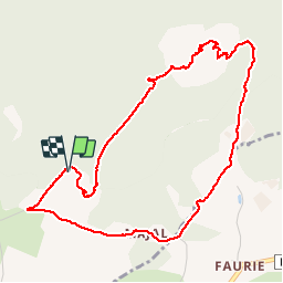
![](/images/other/stat-length.png)
![Randonnée Marche Araules - Tence-170620 - PicLisieux - Photo](https://media.geolcdn.com/t/1900/400/ext.pjpeg?maxdim=2&url=https%3A%2F%2Fservices.sitytrail.com%2FGeolivesWS%2FDownloadMedia.ashx%3FTrailID%3D776323%26Media%3D23dfef1f-c30a-4947-bbbf-c2a486ff054a.jpg)
Tence-170620 - PicLisieux
randodan
Utilisateur
![Longueur](/images/other/stat-length.png)
![Altitude max](https://static1.geolcdn.com/siteimages/upload/files/1508320355ic_sort_altitude_max_24dp.png)
![Dénivelé positif](https://static1.geolcdn.com/siteimages/upload/files/1508320355ic_sort_den_pos_24dp.png)
![Km-Effort](/images/other/stat-length.png)
![Altitude min](https://static1.geolcdn.com/siteimages/upload/files/1508320355ic_sort_altitude_min_24dp.png)
![Dénivelé négatif](https://static1.geolcdn.com/siteimages/upload/files/1508320355ic_sort_den_neg_24dp.png)
![Boucle](https://static1.geolcdn.com/siteimages/upload/files/16400158638029165_repeat_loop_refresh_sync_direction_icon.png)
![Marche](https://static1.geolcdn.com/sitytour/trail-icons/101.png)
1h50
Difficulté : Moyen
![Scannez ce code QR pour ouvrir la randonnée dans l'application SityTrail](https://capi.geolives.com/qq0zvz2zws4bq2lad0pu/sitytour/trails/776323/qr.png?size=200)
Application GPS de randonnée GRATUITE
À propos
Randonnée Marche de 5,2 km à découvrir à Auvergne-Rhône-Alpes, Haute-Loire, Araules. Cette randonnée est proposée par randodan.
Description
Tence, 20 juin 2017<br>
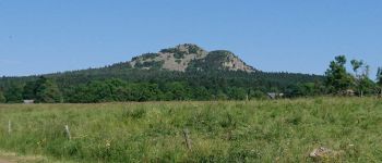
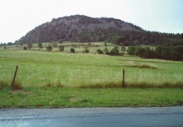
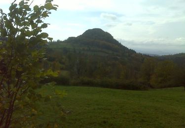
- Pic du Lisieux -<br>
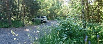
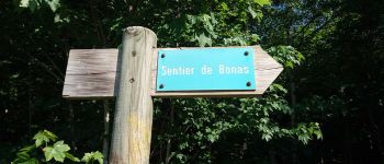
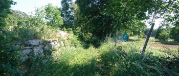
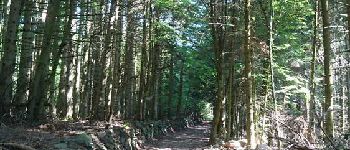
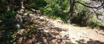
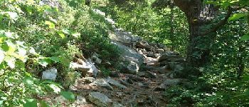
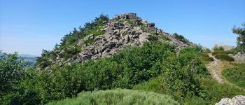
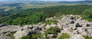
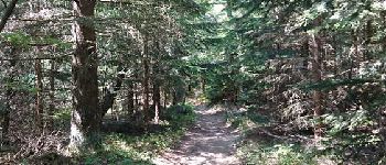
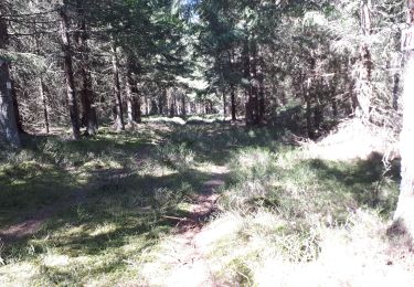
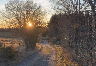
10h, départ du parking de Chièze (1290 m) . 1.7 km de bitume (25 mn) pour prendre le Sentier découverte de Bonas par le Sud-Est, beurk-beurk, surtout sous le cagnard qui sévit déjà . Heureusement, le parcours enchaîne sur une agréable montée régulière, jusqu'au moment où le sentier prend un cap principalement Ouest, il devient alors plus escarpé, et un magnifique panorama me surprend au détour d'un lacet . Suivent alors 20 mn de crapahut dans de gros blocs jusqu'au sommet.<br>
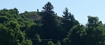
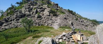
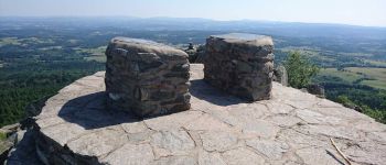
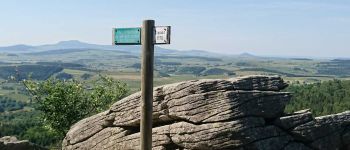
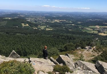
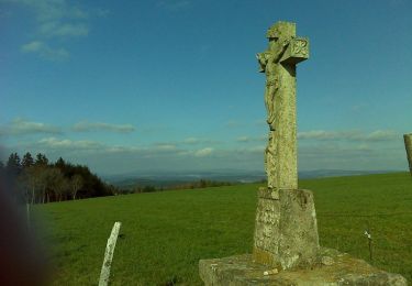
11h15, arrivée au sommet et à la Table d'Orientation du Pic du Lisieux (1388 m).<br>
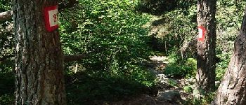
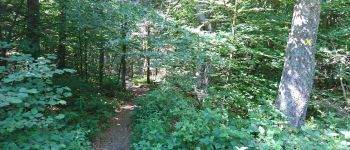
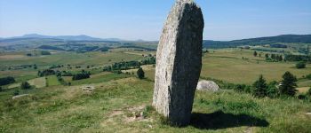
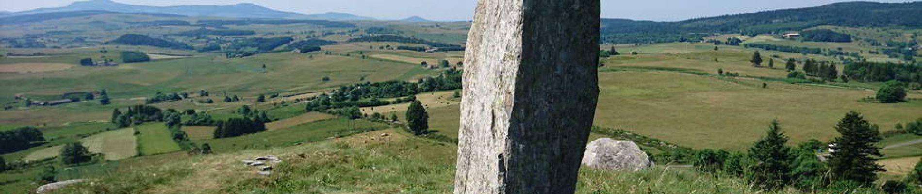
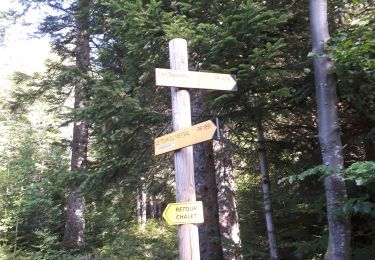
La descente, après les gros blocs, redevient un agréable sentier . Attention, à 1310 m, il faut quitter de balisage jaune et continuer Sud-Ouest . 11h45, au menhir qui surplombe Chièze, et 5 mn après, à la voiture.<br>
La plus belle rando de la semaine, superbe ! (Bien mieux que le Mézinc).<br>
(En solo, et pas un chat).
Points d'intérêt
Localisation
Commentaires
Randonnées à proximité
![Randonnée V.T.T. Champclause - Balade sur le plateau du Mezenc - Champclause - Photo](https://media.geolcdn.com/t/375/260/ext.jpg?maxdim=2&url=https%3A%2F%2Fservices.sitytrail.com%2FGeolivesWS%2FDownloadMedia.ashx%3FTrailID%3D173097%26Media%3D14639_6.jpg)
![V.T.T. V.T.T.](https://static1.geolcdn.com/sitytour/trail-icons/202.png)
V.T.T.
![](/images/other/stat-length.png)
![](https://static1.geolcdn.com/siteimages/upload/files/16400158638029165_repeat_loop_refresh_sync_direction_icon.png)
![Randonnée Marche Araules - Suc de Lizieux - Photo](https://media.geolcdn.com/t/375/260/3244aa12-5792-460e-ba20-16eff7ba3ca0.jpg&format=jpg&maxdim=2)
![Marche Marche](https://static1.geolcdn.com/sitytour/trail-icons/101.png)
Marche
![](/images/other/stat-length.png)
![](https://static1.geolcdn.com/siteimages/upload/files/16400158638029165_repeat_loop_refresh_sync_direction_icon.png)
![Randonnée Marche Araules - le sentier de Bonas - Photo](https://media.geolcdn.com/t/375/260/d68ee2be-74cb-4667-89e5-08e6c8a501e3.jpg&format=jpg&maxdim=2)
![Marche Marche](https://static1.geolcdn.com/sitytour/trail-icons/101.png)
Marche
![](/images/other/stat-length.png)
![](https://static1.geolcdn.com/siteimages/upload/files/16400158638029165_repeat_loop_refresh_sync_direction_icon.png)
![Randonnée Marche Champclause - PR tour des Bastiers - Photo](https://media.geolcdn.com/t/375/260/deb7925a-5b72-4caa-8141-71d6032ee56d.jpg&format=jpg&maxdim=2)
![Marche Marche](https://static1.geolcdn.com/sitytour/trail-icons/101.png)
Marche
![](/images/other/stat-length.png)
![](https://static1.geolcdn.com/siteimages/upload/files/16400158638029165_repeat_loop_refresh_sync_direction_icon.png)
![Randonnée Marche Champclause - PR Les Bastiers - Photo](https://media.geolcdn.com/t/375/260/939826de-0b21-4f39-ad45-3bd2913594bf.jpg&format=jpg&maxdim=2)
![Marche Marche](https://static1.geolcdn.com/sitytour/trail-icons/101.png)
Marche
![](/images/other/stat-length.png)
![](https://static1.geolcdn.com/siteimages/upload/files/16400158638029165_repeat_loop_refresh_sync_direction_icon.png)
![Randonnée Marche Champclause - Balade sur le plateau du Mezenc - Champclause - Photo](https://media.geolcdn.com/t/375/260/ext.jpg?maxdim=2&url=https%3A%2F%2Fservices.sitytrail.com%2FGeolivesWS%2FDownloadMedia.ashx%3FTrailID%3D173096%26Media%3D14639_6.jpg)
![Marche Marche](https://static1.geolcdn.com/sitytour/trail-icons/101.png)
Marche
![](/images/other/stat-length.png)
![](https://static1.geolcdn.com/siteimages/upload/files/16400158638029165_repeat_loop_refresh_sync_direction_icon.png)
![Randonnée Marche Champclause - Virée dans le Meygal - Boussoulet - Photo](https://media.geolcdn.com/t/375/260/ext.jpg?maxdim=2&url=https%3A%2F%2Fservices.sitytrail.com%2FGeolivesWS%2FDownloadMedia.ashx%3FTrailID%3D172915%26Media%3D14378_4.jpg)
![Marche Marche](https://static1.geolcdn.com/sitytour/trail-icons/101.png)
Marche
![](/images/other/stat-length.png)
![](https://static1.geolcdn.com/siteimages/upload/files/16400158638029165_repeat_loop_refresh_sync_direction_icon.png)
![Randonnée V.T.T. Saint-Jeures - Les champs de St Jeures - Photo](https://media.geolcdn.com/t/375/260/ext.jpg?maxdim=2&url=https%3A%2F%2Fservices.sitytrail.com%2FGeolivesWS%2FDownloadMedia.ashx%3FTrailID%3D129689%26Media%3D13222_4.jpg)
![V.T.T. V.T.T.](https://static1.geolcdn.com/sitytour/trail-icons/202.png)
V.T.T.
![](/images/other/stat-length.png)
![](https://static1.geolcdn.com/siteimages/upload/files/16400158638029165_repeat_loop_refresh_sync_direction_icon.png)
![Randonnée Marche Saint-Jeures - Les champs de St Jeures - Photo](https://media.geolcdn.com/t/375/260/ext.jpg?maxdim=2&url=https%3A%2F%2Fservices.sitytrail.com%2FGeolivesWS%2FDownloadMedia.ashx%3FTrailID%3D129688%26Media%3D13222_4.jpg)
![Marche Marche](https://static1.geolcdn.com/sitytour/trail-icons/101.png)
Marche
![](/images/other/stat-length.png)
![](https://static1.geolcdn.com/siteimages/upload/files/16400158638029165_repeat_loop_refresh_sync_direction_icon.png)