![](/images/other/stat-length.png)
![Randonnée Marche Mortcerf - la touffe de Mortcerf - Photo](https://media.geolcdn.com/t/1900/400/ext.pjpeg?maxdim=2&url=https%3A%2F%2Fstatic1.geolcdn.com%2Fsiteimages%2Fupload%2Ffiles%2F1553511878bg_sport_marche.png)
la touffe de Mortcerf
pikibangi
Utilisateur
![Longueur](/images/other/stat-length.png)
![Altitude max](https://static1.geolcdn.com/siteimages/upload/files/1508320355ic_sort_altitude_max_24dp.png)
![Dénivelé positif](https://static1.geolcdn.com/siteimages/upload/files/1508320355ic_sort_den_pos_24dp.png)
![Km-Effort](/images/other/stat-length.png)
![Altitude min](https://static1.geolcdn.com/siteimages/upload/files/1508320355ic_sort_altitude_min_24dp.png)
![Dénivelé négatif](https://static1.geolcdn.com/siteimages/upload/files/1508320355ic_sort_den_neg_24dp.png)
![Boucle](https://static1.geolcdn.com/siteimages/upload/files/16400158638029165_repeat_loop_refresh_sync_direction_icon.png)
![Marche](https://static1.geolcdn.com/sitytour/trail-icons/101.png)
6h07
Difficulté : Difficile
![Scannez ce code QR pour ouvrir la randonnée dans l'application SityTrail](https://capi.geolives.com/qq0zvz2zws4bq2lad0pu/sitytour/trails/771927/qr.png?size=200)
Application GPS de randonnée GRATUITE
À propos
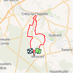
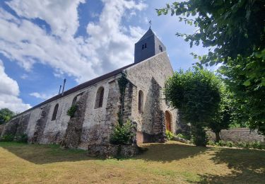
Randonnée Marche de 23 km à découvrir à Île-de-France, Seine-et-Marne, Mortcerf. Cette randonnée est proposée par pikibangi.
Description
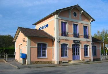
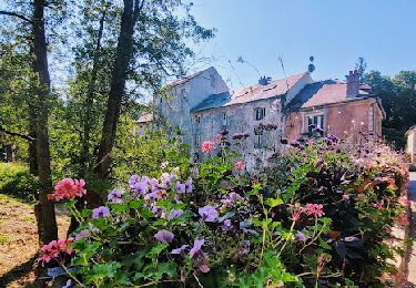
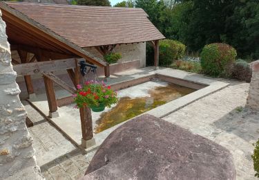
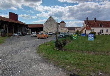
Randonnée au départ de la gare de Mortcef, cette rando que j'ai agrandi après un parcours de Trail de MN de 8km.Descente difficile avant la traversée du grand Morin"le champ Vié". Elle est bien agréable, mieux le faire en été quand hiver. Certains chemins servent de ruisseau.Déjeuner à Crécy la Chapelle "La Venise Briard" tables couvertes et bancs.Possibilité de visité la ville
Localisation
Commentaires
Randonnées à proximité
![Randonnée V.T.T. Mortcerf - Espace VTT FFC - Les Coteaux du Morin et de l'Aubetin - Circuit n° 12 - Mortcerf - Photo](https://media.geolcdn.com/t/375/260/ext.jpg?maxdim=2&url=https%3A%2F%2Fservices.sitytrail.com%2FGeolivesWS%2FDownloadMedia.ashx%3FTrailID%3D104876%26Media%3D8399_1.jpg)
![V.T.T. V.T.T.](https://static1.geolcdn.com/sitytour/trail-icons/202.png)
V.T.T.
![](/images/other/stat-length.png)
![](https://static1.geolcdn.com/siteimages/upload/files/16400158638029165_repeat_loop_refresh_sync_direction_icon.png)
![Randonnée A pied Mortcerf - Boucle autour de Mortcerf - Photo](https://media.geolcdn.com/t/375/260/59e379b2-0348-4e21-a816-ab3e2c16cdc1.jpg&format=jpg&maxdim=2)
![A pied A pied](https://static1.geolcdn.com/sitytour/trail-icons/100.png)
A pied
![](/images/other/stat-length.png)
![](https://static1.geolcdn.com/siteimages/upload/files/16400158638029165_repeat_loop_refresh_sync_direction_icon.png)
![Randonnée Marche Mortcerf - Le tour du Grand Paris via le GR1 - Etape 11 Morcerf - Verneuil l'Etang - Photo](https://media.geolcdn.com/t/375/260/7c77b534-b6ca-4f92-9593-6e4e45d1fef2.jpg&format=jpg&maxdim=2)
![Marche Marche](https://static1.geolcdn.com/sitytour/trail-icons/101.png)
Marche
![](/images/other/stat-length.png)
![](https://static1.geolcdn.com/siteimages/upload/files/16400158638029165_repeat_loop_refresh_sync_direction_icon.png)
![Randonnée Marche Mortcerf - Boucle 20 km autour de Mortcerf - Photo](https://media.geolcdn.com/t/375/260/7dccf5cc-6d2c-4b9e-bfab-f503983628ba.jpg&format=jpg&maxdim=2)
![Marche Marche](https://static1.geolcdn.com/sitytour/trail-icons/101.png)
Marche
![](/images/other/stat-length.png)
![](https://static1.geolcdn.com/siteimages/upload/files/16400158638029165_repeat_loop_refresh_sync_direction_icon.png)
![Randonnée Marche Guérard - Guérard - Photo](https://media.geolcdn.com/t/375/260/604a5cf1-31c1-4e64-b7ed-ed1e6e2756f8.jpg&format=jpg&maxdim=2)
![Marche Marche](https://static1.geolcdn.com/sitytour/trail-icons/101.png)
Marche
![](/images/other/stat-length.png)
![](https://static1.geolcdn.com/siteimages/upload/files/16400158638029165_repeat_loop_refresh_sync_direction_icon.png)
![Randonnée Marche Tigeaux - Tigeaux - Photo](https://media.geolcdn.com/t/375/260/ext.jpg?maxdim=2&url=https%3A%2F%2Fstatic1.geolcdn.com%2Fsiteimages%2Fupload%2Ffiles%2F1553511878bg_sport_marche.png)
![Marche Marche](https://static1.geolcdn.com/sitytour/trail-icons/101.png)
Marche
![](/images/other/stat-length.png)
![](https://static1.geolcdn.com/siteimages/upload/files/16400158638029165_repeat_loop_refresh_sync_direction_icon.png)
![Randonnée Marche Crèvecœur-en-Brie - Crèvecoeur-en-Brie - Photo](https://media.geolcdn.com/t/375/260/2b87ef65-5f63-49b7-96fa-665b4a148457.jpg&format=jpg&maxdim=2)
![Marche Marche](https://static1.geolcdn.com/sitytour/trail-icons/101.png)
Marche
![](/images/other/stat-length.png)
![](https://static1.geolcdn.com/siteimages/upload/files/16400158638029165_repeat_loop_refresh_sync_direction_icon.png)
![Randonnée sport Hautefeuille - 2019-08-10_23h17m35_parcours_Hautefeuille - Photo](https://media.geolcdn.com/t/375/260/ext.jpg?maxdim=2&url=https%3A%2F%2Fsecurestorage.geolives.com%2Fsitytour%2Ftrail-bg%2Fdefault.jpg)
sport
![](/images/other/stat-length.png)
![](https://static1.geolcdn.com/siteimages/upload/files/16400158638029165_repeat_loop_refresh_sync_direction_icon.png)
![Randonnée Marche Mortcerf - obelisque - Photo](https://media.geolcdn.com/t/375/260/78cdb237-79f3-4d4d-8955-60b0b7b069b2.jpg&format=jpg&maxdim=2)
![Marche Marche](https://static1.geolcdn.com/sitytour/trail-icons/101.png)
Marche
![](/images/other/stat-length.png)
![](https://static1.geolcdn.com/siteimages/upload/files/16400158638029165_repeat_loop_refresh_sync_direction_icon.png)