![](/images/other/stat-length.png)
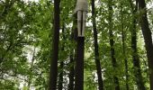
![Randonnée Marche Zonhoven - De Wijers Geel - Photo](https://media.geolcdn.com/t/1900/400/ext.pjpeg?maxdim=2&url=https%3A%2F%2Fservices.sitytrail.com%2FGeolivesWS%2FDownloadMedia.ashx%3FTrailID%3D757014%26Media%3D20170521153354.jpg)
De Wijers Geel
krislamotte
Utilisateur
![Longueur](/images/other/stat-length.png)
Longueur
14,2 km
![Altitude max](https://static1.geolcdn.com/siteimages/upload/files/1508320355ic_sort_altitude_max_24dp.png)
Altitude max
48 m
![Dénivelé positif](https://static1.geolcdn.com/siteimages/upload/files/1508320355ic_sort_den_pos_24dp.png)
Dénivelé positif
99 m
![Km-Effort](/images/other/stat-length.png)
Km-Effort
15,5 km
![Altitude min](https://static1.geolcdn.com/siteimages/upload/files/1508320355ic_sort_altitude_min_24dp.png)
Altitude min
26 m
![Dénivelé négatif](https://static1.geolcdn.com/siteimages/upload/files/1508320355ic_sort_den_neg_24dp.png)
Dénivelé négatif
98 m
![Boucle](https://static1.geolcdn.com/siteimages/upload/files/16400158638029165_repeat_loop_refresh_sync_direction_icon.png)
Boucle
Oui
Date de création :
2017-05-21 00:00:00.0
Dernière modification :
2017-05-21 00:00:00.0
![Marche](https://static1.geolcdn.com/sitytour/trail-icons/101.png)
2h54
Difficulté : Très difficile
![Scannez ce code QR pour ouvrir la randonnée dans l'application SityTrail](https://capi.geolives.com/qq0zvz2zws4bq2lad0pu/sitytour/trails/757014/qr.png?size=200)
Application GPS de randonnée GRATUITE
À propos
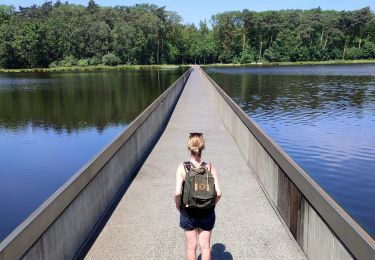
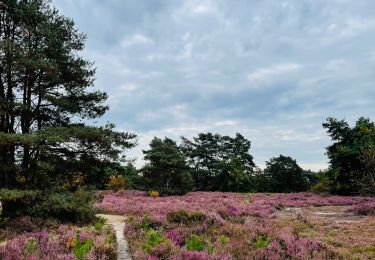
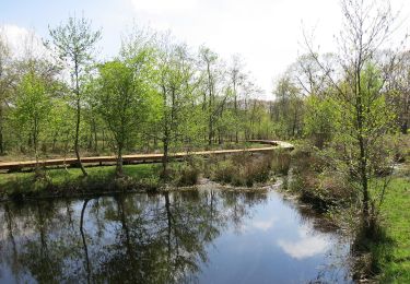
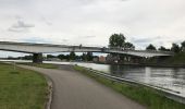
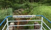
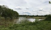
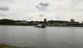
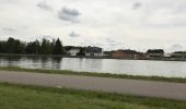
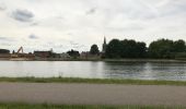
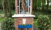
Randonnée Marche de 14,2 km à découvrir à Flandre, Limbourg, Zonhoven. Cette randonnée est proposée par krislamotte.
Description
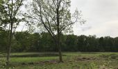
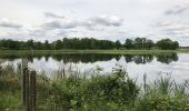
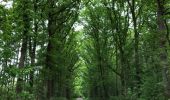
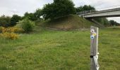
Platwijers, De Wijers, Wijvenheide gele route 12,6 km
Localisation
Pays :
Belgique
Région :
Flandre
Département/Province :
Limbourg
Commune :
Zonhoven
Localité :
Hasselt
Départ:(Dec)
Départ:(UTM)
664308 ; 5648306 (31U) N.
Commentaires
Randonnées à proximité
![Randonnée Marche Hasselt - Domaine Kiewit &](https://media.geolcdn.com/t/375/260/24e338e2-ab75-48fb-ae32-0abbc38a1902.jpg&format=jpg&maxdim=2)
![Marche Marche](https://static1.geolcdn.com/sitytour/trail-icons/101.png)
Domaine Kiewit & " Fietsen door het water"
Marche
Facile
Hasselt,
Flandre,
Limbourg,
Belgique
![](/images/other/stat-length.png)
10,9 km | 12,1 km-effort
2h 33min
![](https://static1.geolcdn.com/siteimages/upload/files/16400158638029165_repeat_loop_refresh_sync_direction_icon.png)
Oui
![Randonnée Marche Genk - Promenade vers la piste dans l'eau, dans le magnifique domaine de Bokrijk - Photo](https://media.geolcdn.com/t/375/260/45cc0ed2-db94-4d5d-a7c6-1096a930a2ab.jpg&format=jpg&maxdim=2)
![Marche Marche](https://static1.geolcdn.com/sitytour/trail-icons/101.png)
Promenade vers la piste dans l'eau, dans le magnifique domaine de Bokrijk
Marche
Facile
(3)
Genk,
Flandre,
Limbourg,
Belgique
![](/images/other/stat-length.png)
4,1 km | 4,6 km-effort
1h 2min
![](https://static1.geolcdn.com/siteimages/upload/files/16400158638029165_repeat_loop_refresh_sync_direction_icon.png)
Oui
![Randonnée Marche Zonhoven - La réserve naturelle De Teut à Zonhoven - Photo](https://media.geolcdn.com/t/375/260/b2e8aeaf-7e73-4433-bd25-55a9739e6f87.jpeg&format=jpg&maxdim=2)
![Marche Marche](https://static1.geolcdn.com/sitytour/trail-icons/101.png)
La réserve naturelle De Teut à Zonhoven
Marche
Facile
Zonhoven,
Flandre,
Limbourg,
Belgique
![](/images/other/stat-length.png)
3,8 km | 4,3 km-effort
58min
![](https://static1.geolcdn.com/siteimages/upload/files/16400158638029165_repeat_loop_refresh_sync_direction_icon.png)
Oui
![Randonnée A pied Hasselt - Herkenrode blauwe ruit - Photo](https://media.geolcdn.com/t/375/260/296970a9-7b43-43a0-a936-aff8c5f739c4.jpeg&format=jpg&maxdim=2)
![A pied A pied](https://static1.geolcdn.com/sitytour/trail-icons/100.png)
Herkenrode blauwe ruit
A pied
Facile
Hasselt,
Flandre,
Limbourg,
Belgique
![](/images/other/stat-length.png)
3,1 km | 3,3 km-effort
45min
![](https://static1.geolcdn.com/siteimages/upload/files/16400158638029165_repeat_loop_refresh_sync_direction_icon.png)
Non
![Randonnée A pied Hasselt - Abdijsite Herkenrode Rode driehoek - Photo](https://media.geolcdn.com/t/375/260/20f8e330-81ae-4697-aadc-20260e930bf3.jpeg&format=jpg&maxdim=2)
![A pied A pied](https://static1.geolcdn.com/sitytour/trail-icons/100.png)
Abdijsite Herkenrode Rode driehoek
A pied
Facile
Hasselt,
Flandre,
Limbourg,
Belgique
![](/images/other/stat-length.png)
9,2 km | 9,9 km-effort
2h 15min
![](https://static1.geolcdn.com/siteimages/upload/files/16400158638029165_repeat_loop_refresh_sync_direction_icon.png)
Oui
![Randonnée A pied Hasselt - Kiewit Wildernis route - Photo](https://media.geolcdn.com/t/375/260/3dbc744d-9453-4105-ac17-d803e722e0e9.jpeg&format=jpg&maxdim=2)
![A pied A pied](https://static1.geolcdn.com/sitytour/trail-icons/100.png)
Kiewit Wildernis route
A pied
Facile
Hasselt,
Flandre,
Limbourg,
Belgique
![](/images/other/stat-length.png)
3,3 km | 3,7 km-effort
49min
![](https://static1.geolcdn.com/siteimages/upload/files/16400158638029165_repeat_loop_refresh_sync_direction_icon.png)
Oui
![Randonnée A pied Hasselt - Kiewit Wijer route - Photo](https://media.geolcdn.com/t/375/260/3dbc744d-9453-4105-ac17-d803e722e0e9.jpeg&format=jpg&maxdim=2)
![A pied A pied](https://static1.geolcdn.com/sitytour/trail-icons/100.png)
Kiewit Wijer route
A pied
Facile
Hasselt,
Flandre,
Limbourg,
Belgique
![](/images/other/stat-length.png)
4,1 km | 4,6 km-effort
1h 3min
![](https://static1.geolcdn.com/siteimages/upload/files/16400158638029165_repeat_loop_refresh_sync_direction_icon.png)
Oui
![Randonnée A pied Zonhoven - Wijvenheide Oranje bol - Photo](https://media.geolcdn.com/t/375/260/7214b598-b8ed-4652-9797-66bd7779c6eb.jpeg&format=jpg&maxdim=2)
![A pied A pied](https://static1.geolcdn.com/sitytour/trail-icons/100.png)
Wijvenheide Oranje bol
A pied
Facile
Zonhoven,
Flandre,
Limbourg,
Belgique
![](/images/other/stat-length.png)
5,2 km | 5,6 km-effort
1h 16min
![](https://static1.geolcdn.com/siteimages/upload/files/16400158638029165_repeat_loop_refresh_sync_direction_icon.png)
Oui
![Randonnée A pied Zonhoven - Platwijers-Wijvenheide Rode driehoek - Photo](https://media.geolcdn.com/t/375/260/7214b598-b8ed-4652-9797-66bd7779c6eb.jpeg&format=jpg&maxdim=2)
![A pied A pied](https://static1.geolcdn.com/sitytour/trail-icons/100.png)
Platwijers-Wijvenheide Rode driehoek
A pied
Facile
Zonhoven,
Flandre,
Limbourg,
Belgique
![](/images/other/stat-length.png)
9,1 km | 9,8 km-effort
2h 14min
![](https://static1.geolcdn.com/siteimages/upload/files/16400158638029165_repeat_loop_refresh_sync_direction_icon.png)
Oui