![](/images/other/stat-length.png)
![Randonnée Marche Méthamis - ISLE-sur-la-Sorgue (METHAMIS - Gorges de la Nesque) - Photo](https://media.geolcdn.com/t/1900/400/ext.pjpeg?maxdim=2&url=https%3A%2F%2Fservices.sitytrail.com%2FGeolivesWS%2FDownloadMedia.ashx%3FTrailID%3D754493%26Media%3Dfix__20170517143127.jpg)
ISLE-sur-la-Sorgue (METHAMIS - Gorges de la Nesque)
GerardBouche
Utilisateur
![Longueur](/images/other/stat-length.png)
![Altitude max](https://static1.geolcdn.com/siteimages/upload/files/1508320355ic_sort_altitude_max_24dp.png)
![Dénivelé positif](https://static1.geolcdn.com/siteimages/upload/files/1508320355ic_sort_den_pos_24dp.png)
![Km-Effort](/images/other/stat-length.png)
![Altitude min](https://static1.geolcdn.com/siteimages/upload/files/1508320355ic_sort_altitude_min_24dp.png)
![Dénivelé négatif](https://static1.geolcdn.com/siteimages/upload/files/1508320355ic_sort_den_neg_24dp.png)
![Boucle](https://static1.geolcdn.com/siteimages/upload/files/16400158638029165_repeat_loop_refresh_sync_direction_icon.png)
![Marche](https://static1.geolcdn.com/sitytour/trail-icons/101.png)
3h33
Difficulté : Moyen
![Scannez ce code QR pour ouvrir la randonnée dans l'application SityTrail](https://capi.geolives.com/qq0zvz2zws4bq2lad0pu/sitytour/trails/754493/qr.png?size=200)
Application GPS de randonnée GRATUITE
À propos
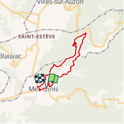
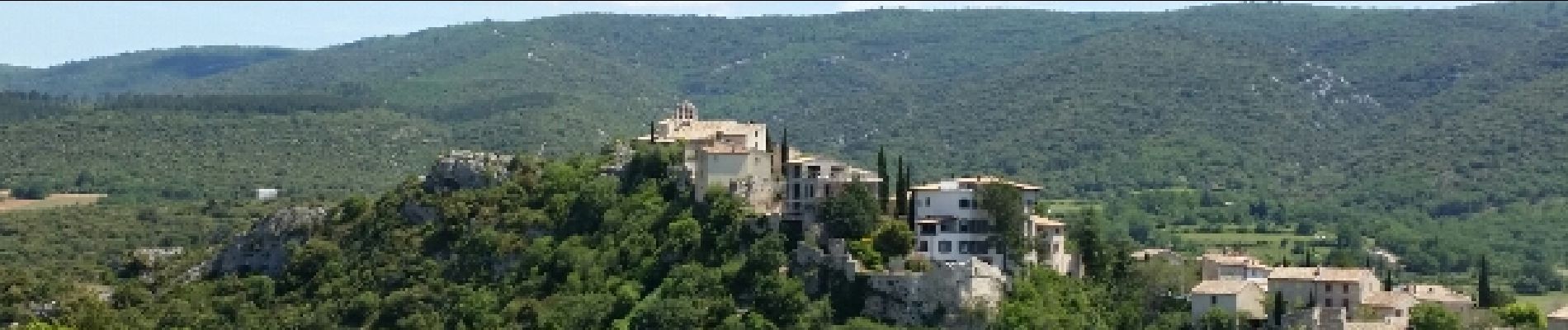
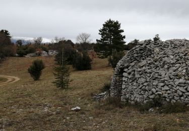
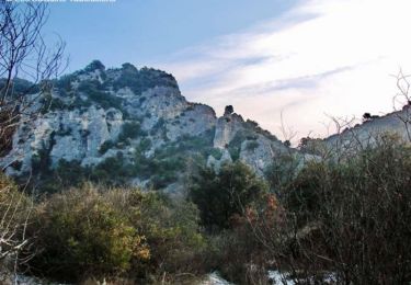
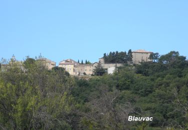
Randonnée Marche de 12,5 km à découvrir à Provence-Alpes-Côte d'Azur, Vaucluse, Méthamis. Cette randonnée est proposée par GerardBouche.
Description
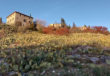
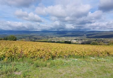
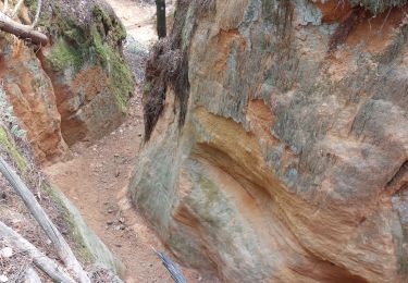
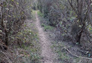
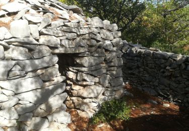
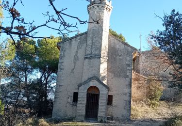
Au départ de Méthamis, un Très beau parcours ... d'abord caillouteux pendant 3,5 km dans le lit asséché de la Nesque. Par le "Ravin de Malaval" rejoindre les hauteurs et le retour par de petits sentiers dans la garrigue de buis-chênes "kermès/vert"romarin et senteurs provençales... un itinéraire agréable avec vue sur le Ventoux et au lieu dit "La Togne"un ancien four à chaux.
Localisation
Commentaires
Randonnées à proximité
![Randonnée Marche Villes-sur-Auzon - villes sur auzon - Photo](https://media.geolcdn.com/t/375/260/0e280ec1-76df-4cda-81c1-92933dd2eb5d.jpg&format=jpg&maxdim=2)
![Marche Marche](https://static1.geolcdn.com/sitytour/trail-icons/101.png)
Marche
![](/images/other/stat-length.png)
![](https://static1.geolcdn.com/siteimages/upload/files/16400158638029165_repeat_loop_refresh_sync_direction_icon.png)
![Randonnée Marche Méthamis - De Méthamis au four à chaux par la Gorge de la Nesque - Photo](https://media.geolcdn.com/t/375/260/ext.jpg?maxdim=2&url=https%3A%2F%2Fservices.sitytrail.com%2FGeolivesWS%2FDownloadMedia.ashx%3FTrailID%3D103445%26Media%3D5566_1.jpg)
![Marche Marche](https://static1.geolcdn.com/sitytour/trail-icons/101.png)
Marche
![](/images/other/stat-length.png)
![](https://static1.geolcdn.com/siteimages/upload/files/16400158638029165_repeat_loop_refresh_sync_direction_icon.png)
![Randonnée Marche Méthamis - Sentiers sauvage de Méthamis - Photo](https://media.geolcdn.com/t/375/260/e268b0c0-fd60-4bfd-99f0-644b7c3d5e6d.jpg&format=jpg&maxdim=2)
![Marche Marche](https://static1.geolcdn.com/sitytour/trail-icons/101.png)
Marche
![](/images/other/stat-length.png)
![](https://static1.geolcdn.com/siteimages/upload/files/16400158638029165_repeat_loop_refresh_sync_direction_icon.png)
![Randonnée Marche Blauvac - Un automne à Blauvac - Photo](https://media.geolcdn.com/t/375/260/c48d342f-3f81-4d97-866a-e8feb5b6e068.jpg&format=jpg&maxdim=2)
![Marche Marche](https://static1.geolcdn.com/sitytour/trail-icons/101.png)
Marche
![](/images/other/stat-length.png)
![](https://static1.geolcdn.com/siteimages/upload/files/16400158638029165_repeat_loop_refresh_sync_direction_icon.png)
![Randonnée Marche Mormoiron - Ocres et forêt - Photo](https://media.geolcdn.com/t/375/260/35d12fb1-6bc6-4830-93b7-60e66fd303e1.jpg&format=jpg&maxdim=2)
![Marche Marche](https://static1.geolcdn.com/sitytour/trail-icons/101.png)
Marche
![](/images/other/stat-length.png)
![](https://static1.geolcdn.com/siteimages/upload/files/16400158638029165_repeat_loop_refresh_sync_direction_icon.png)
![Randonnée Marche Mazan - Boucle NdA - Photo](https://media.geolcdn.com/t/375/260/161268ed-640e-4568-9c07-c4e064f489f3.jpg&format=jpg&maxdim=2)
![Marche Marche](https://static1.geolcdn.com/sitytour/trail-icons/101.png)
Marche
![](/images/other/stat-length.png)
![](https://static1.geolcdn.com/siteimages/upload/files/16400158638029165_repeat_loop_refresh_sync_direction_icon.png)
![Randonnée Marche Blauvac - Passichaud Bergerie Pas du loup - Photo](https://media.geolcdn.com/t/375/260/61b46099-d063-4c59-b83e-1f9759560630.jpg&format=jpg&maxdim=2)
![Marche Marche](https://static1.geolcdn.com/sitytour/trail-icons/101.png)
Marche
![](/images/other/stat-length.png)
![](https://static1.geolcdn.com/siteimages/upload/files/16400158638029165_repeat_loop_refresh_sync_direction_icon.png)
![Randonnée Marche Mazan - Mazan vers Blauvac, Notre Dame des Anges - Photo](https://media.geolcdn.com/t/375/260/653a59fb-5ee8-44e0-a576-e43e7ca3fd4c.jpg&format=jpg&maxdim=2)
![Marche Marche](https://static1.geolcdn.com/sitytour/trail-icons/101.png)
Marche
![](/images/other/stat-length.png)
![](https://static1.geolcdn.com/siteimages/upload/files/16400158638029165_repeat_loop_refresh_sync_direction_icon.png)
![Marche Marche](https://static1.geolcdn.com/sitytour/trail-icons/101.png)
Marche
![](/images/other/stat-length.png)
![](https://static1.geolcdn.com/siteimages/upload/files/16400158638029165_repeat_loop_refresh_sync_direction_icon.png)