


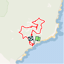

10,4 km | 17,5 km-effort

Utilisateur


Application GPS de randonnée GRATUITE
 SityTrail
IGN / Instituts géographiques
SityTrail World
Le monde est à vous
Randonnée Marche de 8,6 km à découvrir à Provence-Alpes-Côte d'Azur, Var, Saint-Raphaël. Cette randonnée est proposée par SabetMick.
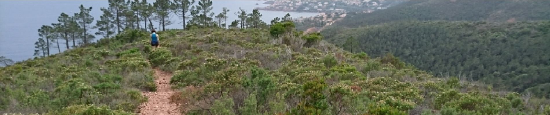
Très très jolie randonnée dans un paysage méditerranéen magnifique avec de superbes vues sur le littoral tout le long de la rando. Prévoir de bonnes chaussures de rando car vous ne rencontrerez que des chemins très caillouteux.


Marche

Marche

Marche

Marche

Marche

Marche

Marche

Marche

Marche