Randonnée Marche Saint-Vallier-de-Thiey - Montée de la Siagne a Escragolles   - Photo
 Palimpseste
Palimpseste

Utilisateur

© OpenStreetMap contributors
Longueur
Longueur
9,7 km
Altitude max
Altitude max
1094 m
Dénivelé positif
Dénivelé positif
510 m
Km-Effort
Km-Effort  
16,6 km
Altitude min
Altitude min
589 m
Dénivelé négatif
Dénivelé négatif
513 m
Boucle
Boucle
Oui
Date de création :
2018-08-05 15:27:37.325
Dernière modification :
2018-08-05 15:27:37.411

(0 Avis)

Marche
Marche
2h43
Difficulté : Moyen

Scannez ce code QR pour ouvrir la randonnée dans l'application SityTrail

Application GPS de randonnée GRATUITE

Logo SityTrail SityTrail

IGN / Instituts géographiques

Télécharger SityTrail sur l'App Store Télécharger SityTrail sur Google Play

Logo SityTrail SityTrail World

Le monde est à vous

Télécharger SityTrail sur l'App Store Télécharger SityTrail sur Google Play Télécharger SityTrail sur Huawei AppGallery

À propos

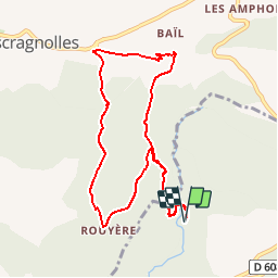
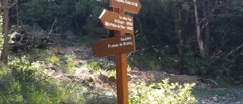
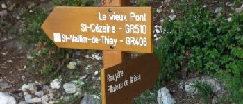
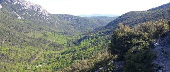
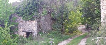
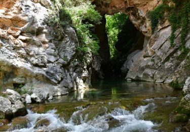
Randonnée Marche de 9,7 km à découvrir à Provence-Alpes-Côte d'Azur, Alpes-Maritimes, Saint-Vallier-de-Thiey. Cette randonnée est proposée par Palimpseste.

Description

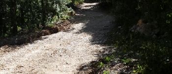
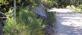
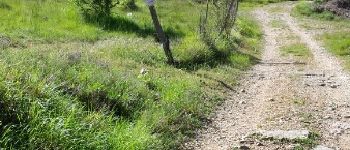
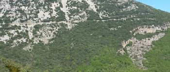
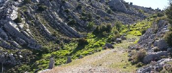
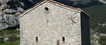
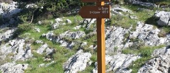
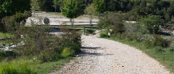
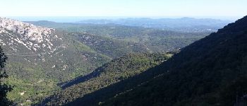
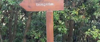
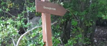
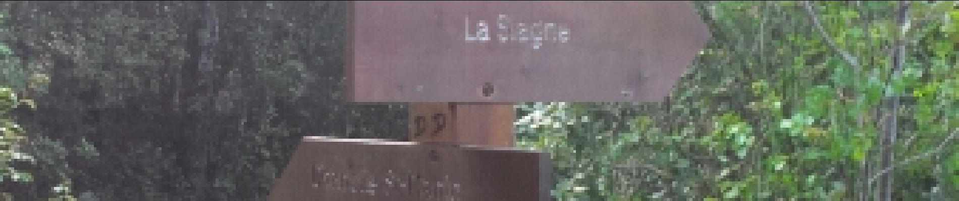
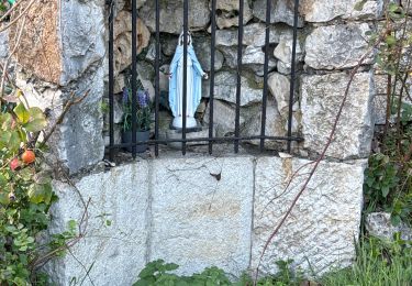
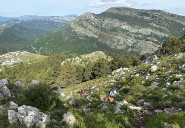
Belle boucle permettant de partir de la Siagne a la chapelle saint Jean a Escragnolles et retour avec des superbes points de vue

Profil altimétrique

Photos

Points d'intérêt

Point d'intérêt Saint-Vallier-de-Thiey - Point 1 - Photo
Palimpseste
SAINT-VALLIER-DE-THIEY 
Point d'intérêt Saint-Vallier-de-Thiey - La Siagne vers l amont - Photo
Palimpseste
SAINT-VALLIER-DE-THIEY 
Point d'intérêt Saint-Vallier-de-Thiey - Le pont sur la Siagne - Photo
Palimpseste
SAINT-VALLIER-DE-THIEY 
Point d'intérêt Saint-Vallier-de-Thiey - Un debut de montee facile - Photo
Palimpseste
SAINT-VALLIER-DE-THIEY 
Point d'intérêt Saint-Vallier-de-Thiey - Commune d Escragnolles - Photo
Palimpseste
SAINT-VALLIER-DE-THIEY 
Point d'intérêt Escragnolles - Point 7 - Photo
Palimpseste
ESCRAGNOLLES 
Point d'intérêt Escragnolles - Du cailloux !!! - Photo
Palimpseste
ESCRAGNOLLES 
Point d'intérêt Escragnolles - Point 9 - Photo
Palimpseste
ESCRAGNOLLES 
Point d'intérêt Escragnolles - La RN  dans le lointain - Photo
Palimpseste
Point d'intérêt Escragnolles - Point 11 - Photo
Palimpseste
ESCRAGNOLLES 
Point d'intérêt Escragnolles - Point 12 - Photo
Palimpseste
ESCRAGNOLLES 
Point d'intérêt Escragnolles - L Estérel - Photo
Palimpseste
ESCRAGNOLLES 
Point d'intérêt Escragnolles - Un chemin plus carrossable - Photo
Palimpseste
Point d'intérêt Escragnolles - Bientot le sommet - Photo
Palimpseste
ESCRAGNOLLES 
Point d'intérêt Escragnolles - La chapelle saint Jean - Photo
Palimpseste
Point d'intérêt Escragnolles - Arivee au sommet - Photo
Palimpseste
ESCRAGNOLLES 
Point d'intérêt Escragnolles - Point 21 - Photo
Palimpseste
ESCRAGNOLLES 
Point d'intérêt Escragnolles - Point 22 - Photo
Palimpseste
ESCRAGNOLLES 
Point d'intérêt Escragnolles - la mer - Photo
Palimpseste
ESCRAGNOLLES 
Point d'intérêt Escragnolles - Panneau - Photo
Palimpseste
ESCRAGNOLLES 
Point d'intérêt Escragnolles - le raccourci - Photo
Palimpseste
ESCRAGNOLLES 
Point d'intérêt Escragnolles - Point 26 - Photo
Palimpseste
ESCRAGNOLLES 
Point d'intérêt Escragnolles - ruines - Photo
Palimpseste
ESCRAGNOLLES 
Point d'intérêt Escragnolles - La bifurcation a ne pas rater - Photo
Palimpseste

Localisation

Pays :
France
Région :
Provence-Alpes-Côte d'Azur
Département/Province :
Alpes-Maritimes
Commune :
Saint-Vallier-de-Thiey
Localité :
Unknown
Départ:(Dec)
Départ:(UTM)
323344 ; 4841981 (32T) N.

Commentaires

Veuillez vous connecter pour laisser un commentaire ou une note


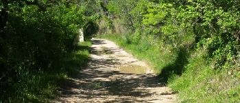
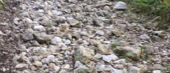
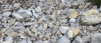
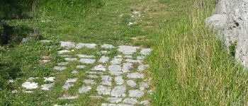
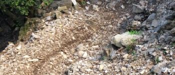
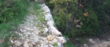
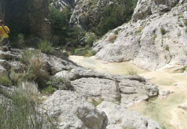
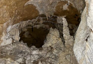
Belle balade, même si la montée est parfois un peu raide avec les pierres


Randonnées à proximité

Randonnée Marche Escragnolles - Casade du Ray (Clars) depuis les Gallants - Photo
Marche
Reich

Marche

Très facile
(1)
Escragnolles, Provence-Alpes-Côte d'Azur, Alpes-Maritimes, France
938 m | 1,3 km-effort
20min
Non
Randonnée Marche Saint-Vallier-de-Thiey - Arche de Ponadieu Source de la Pare Baou Mourine Vieux Pont  - Photo
Marche
GUIDE
jouans

Marche

Très difficile
Saint-Vallier-de-Thiey, Provence-Alpes-Côte d'Azur, Alpes-Maritimes, France
19,2 km | 32 km-effort
7h 20min
Oui
Randonnée A pied Escragnolles - Plateau de Briasq - Photo
A pied
PRO

A pied

Moyen
Escragnolles, Provence-Alpes-Côte d'Azur, Alpes-Maritimes, France
14,1 km | 22 km-effort
4h 56min
Oui
Randonnée Marche Saint-Vallier-de-Thiey - Saint-Vallier-de-Thiey - la Montagne de Thiey - 14.9km 720m 4h55 (0h35) - 2015 06 11 - Photo
Marche
GUIDE
Orcal37

Marche

Moyen
Saint-Vallier-de-Thiey, Provence-Alpes-Côte d'Azur, Alpes-Maritimes, France
14,9 km | 25 km-effort
4h 54min
Oui
Randonnée Marche Saint-Vallier-de-Thiey - St Vallier : Colle du  maçon doublier  - Photo
Marche
ETMU5496

Marche

Difficile
Saint-Vallier-de-Thiey, Provence-Alpes-Côte d'Azur, Alpes-Maritimes, France
18,2 km | 29 km-effort
6h 35min
Oui
Randonnée Marche Saint-Vallier-de-Thiey - St Vallier de Thiey - Col de la Lèque - Chapelle St Jean - Arche Ponadieu - Photo
Marche
LtZIP

Marche

Moyen
Saint-Vallier-de-Thiey, Provence-Alpes-Côte d'Azur, Alpes-Maritimes, France
14,1 km | 21 km-effort
4h 44min
Oui
Randonnée Marche Saint-Vallier-de-Thiey - St Vallier : Pare2 - Photo
Marche
ETMU5496

Marche

Difficile
Saint-Vallier-de-Thiey, Provence-Alpes-Côte d'Azur, Alpes-Maritimes, France
17,7 km | 29 km-effort
6h 35min
Oui
Randonnée Marche Saint-Vallier-de-Thiey - St Vallier de Thiey - Col du Ferrier - Castellaras de la Malle - Col du Pilon - Pierre Druidique - Photo
Marche
LtZIP

Marche

Moyen
Saint-Vallier-de-Thiey, Provence-Alpes-Côte d'Azur, Alpes-Maritimes, France
18,9 km | 28 km-effort
6h 18min
Oui
Randonnée Marche Saint-Vallier-de-Thiey - Montagne de Thiey 2 - Photo
Marche
ETMU5496

Marche

Moyen
Saint-Vallier-de-Thiey, Provence-Alpes-Côte d'Azur, Alpes-Maritimes, France
19,3 km | 31 km-effort
6h 57min
Oui


Fermer
Mes abonnements