


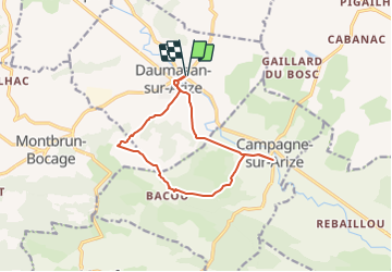


17,2 km | 24 km-effort


Utilisateur


Application GPS de randonnée GRATUITE
 SityTrail
IGN / Instituts géographiques
SityTrail World
Le monde est à vous
Randonnée Marche de 12,5 km à découvrir à Occitanie, Ariège, Daumazan-sur-Arize. Cette randonnée est proposée par pidjam.
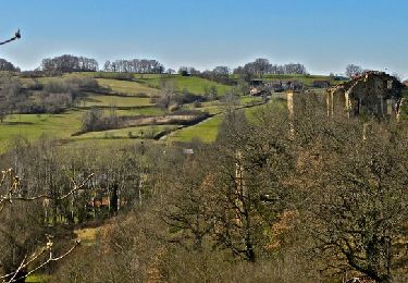
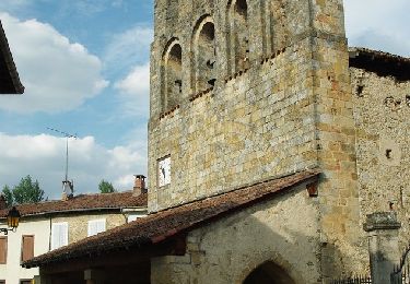
Après une visite de la ville de Daumazan et son église particulière, vous marcherez dans la campagne vallonnée en contournant les propriétés privées (balisage jaune parfois difficile à trouver ou manquant)

V.T.T.
Marche
A pied

A pied

Marche

Vélo
Vélo
Marche