![](/images/other/stat-length.png)
![Randonnée Marche Anduze - Anduze - Les berges du Gardon - Photo](https://media.geolcdn.com/t/1900/400/ext.pjpeg?maxdim=2&url=https%3A%2F%2Fstatic1.geolcdn.com%2Fsiteimages%2Fupload%2Ffiles%2F1553511878bg_sport_marche.png)
Anduze - Les berges du Gardon
NICOLLETMICHEL
Utilisateur
![Longueur](/images/other/stat-length.png)
![Altitude max](https://static1.geolcdn.com/siteimages/upload/files/1508320355ic_sort_altitude_max_24dp.png)
![Dénivelé positif](https://static1.geolcdn.com/siteimages/upload/files/1508320355ic_sort_den_pos_24dp.png)
![Km-Effort](/images/other/stat-length.png)
![Altitude min](https://static1.geolcdn.com/siteimages/upload/files/1508320355ic_sort_altitude_min_24dp.png)
![Dénivelé négatif](https://static1.geolcdn.com/siteimages/upload/files/1508320355ic_sort_den_neg_24dp.png)
![Boucle](https://static1.geolcdn.com/siteimages/upload/files/16400158638029165_repeat_loop_refresh_sync_direction_icon.png)
![Marche](https://static1.geolcdn.com/sitytour/trail-icons/101.png)
--
Difficulté : Moyen
![Scannez ce code QR pour ouvrir la randonnée dans l'application SityTrail](https://capi.geolives.com/qq0zvz2zws4bq2lad0pu/sitytour/trails/717592/qr.png?size=200)
Application GPS de randonnée GRATUITE
À propos
Randonnée Marche de 16 km à découvrir à Occitanie, Gard, Anduze. Cette randonnée est proposée par NICOLLETMICHEL.
Description
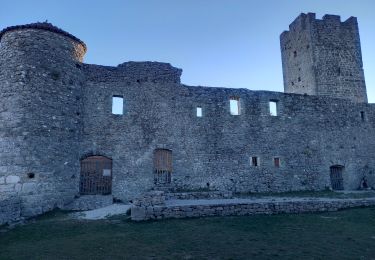
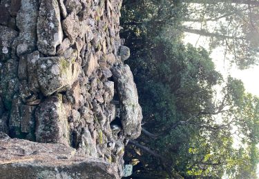
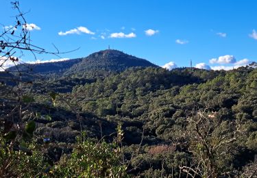
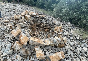
Randonnée sur les rives du Gardon qui commence par une montée dantesque sur les hauts d'Anduze pour descendre à Gaujac sur la rive gauche du Gardon... Il faudra traverser un magnifique pont pour gagner la rive droite du Gardon et finir le parcour comme un train sur l'ancienne voie de Chemin de Fer. Alors le moment est venu de profiter des excellentes terrasses anduziennes. particularité : rando au bord de la rivière, quelques passages délicats, bâtons pour la montée, outil indispensable : sécateur pour se rendre la vie plus agréable...Environ 17 km sous le soleil : eau en quantité, chapeau, lunegttes de soleil, crème solaire... Rando assez difficile.
Localisation
Commentaires
Randonnées à proximité
![Randonnée Marche Mialet - vallée et gardon de Mialet - Photo](https://media.geolcdn.com/t/375/260/021e196f-ee4c-443f-ac78-42eb7635b014.jpg&format=jpg&maxdim=2)
![Marche Marche](https://static1.geolcdn.com/sitytour/trail-icons/101.png)
Marche
![](/images/other/stat-length.png)
![](https://static1.geolcdn.com/siteimages/upload/files/16400158638029165_repeat_loop_refresh_sync_direction_icon.png)
![Randonnée Marche Tornac - Autour d'Anduze - Photo](https://media.geolcdn.com/t/375/260/65973ae1-558c-4968-9679-8c475762af6d.jpg&format=jpg&maxdim=2)
![Marche Marche](https://static1.geolcdn.com/sitytour/trail-icons/101.png)
![Randonnée Marche Boisset-et-Gaujac - LG078CévennesEntr - Photo](https://media.geolcdn.com/t/375/260/ext.jpg?maxdim=2&url=https%3A%2F%2Fstatic1.geolcdn.com%2Fsiteimages%2Fupload%2Ffiles%2F1553511878bg_sport_marche.png)
![Marche Marche](https://static1.geolcdn.com/sitytour/trail-icons/101.png)
Marche
![](/images/other/stat-length.png)
![](https://static1.geolcdn.com/siteimages/upload/files/16400158638029165_repeat_loop_refresh_sync_direction_icon.png)
![Randonnée Marche Anduze - Anduze - Photo](https://media.geolcdn.com/t/375/260/c22a781c-e346-400e-b548-8d1ef0e47769.jpg&format=jpg&maxdim=2)
![Marche Marche](https://static1.geolcdn.com/sitytour/trail-icons/101.png)
![Randonnée V.T.T. Boisset-et-Gaujac - Boisset Anduze Tornac Massane Ribaute - Photo](https://media.geolcdn.com/t/375/260/ext.jpg?maxdim=2&url=https%3A%2F%2Fstatic1.geolcdn.com%2Fsiteimages%2Fupload%2Ffiles%2F1524743154velo.jpg)
![V.T.T. V.T.T.](https://static1.geolcdn.com/sitytour/trail-icons/202.png)
V.T.T.
![](/images/other/stat-length.png)
![](https://static1.geolcdn.com/siteimages/upload/files/16400158638029165_repeat_loop_refresh_sync_direction_icon.png)
![Randonnée Marche Tornac - Autour de Tornac - Photo](https://media.geolcdn.com/t/375/260/1d211d66-2cc5-4472-b0ca-b92a41958a24.jpg&format=jpg&maxdim=2)
![Marche Marche](https://static1.geolcdn.com/sitytour/trail-icons/101.png)
![Randonnée Marche Mialet - Les villages Camisards - Photo](https://media.geolcdn.com/t/375/260/50d5ac0d-c889-4103-9b03-dad713519615.jpg&format=jpg&maxdim=2)
![Marche Marche](https://static1.geolcdn.com/sitytour/trail-icons/101.png)
Marche
![](/images/other/stat-length.png)
![](https://static1.geolcdn.com/siteimages/upload/files/16400158638029165_repeat_loop_refresh_sync_direction_icon.png)
![Randonnée Vélo Boisset-et-Gaujac - Boisset - Boucoiran - Photo](https://media.geolcdn.com/t/375/260/ext.jpg?maxdim=2&url=https%3A%2F%2Fstatic1.geolcdn.com%2Fsiteimages%2Fupload%2Ffiles%2F1524743154velo.jpg)
![Vélo Vélo](https://static1.geolcdn.com/sitytour/trail-icons/200.png)
Vélo
![](/images/other/stat-length.png)
![](https://static1.geolcdn.com/siteimages/upload/files/16400158638029165_repeat_loop_refresh_sync_direction_icon.png)
![Randonnée Marche Anduze - Anduze - Photo](https://media.geolcdn.com/t/375/260/7ee5a127-52de-4b35-816e-d40496febc88.jpg&format=jpg&maxdim=2)
![Marche Marche](https://static1.geolcdn.com/sitytour/trail-icons/101.png)
J’ai pas réussi à suivre le parcours initial, 2a3fois aucun passage comme indiqué.. donc coupé court à la rando, de plus on suit de temps en temps un balisage jaune, et on le quitte pour le retrouver plus loin …