![](/images/other/stat-length.png)
![Randonnée Marche Bizou - Bizou 10.1 Km - Photo](https://media.geolcdn.com/t/1900/400/4d9e3be8-2feb-4dcb-8c0c-693e0d367f80.jpeg&format=pjpeg&maxdim=2)
Bizou 10.1 Km
ODDAD78
Utilisateur
![Longueur](/images/other/stat-length.png)
Longueur
10,1 km
![Altitude max](https://static1.geolcdn.com/siteimages/upload/files/1508320355ic_sort_altitude_max_24dp.png)
Altitude max
253 m
![Dénivelé positif](https://static1.geolcdn.com/siteimages/upload/files/1508320355ic_sort_den_pos_24dp.png)
Dénivelé positif
148 m
![Km-Effort](/images/other/stat-length.png)
Km-Effort
12 km
![Altitude min](https://static1.geolcdn.com/siteimages/upload/files/1508320355ic_sort_altitude_min_24dp.png)
Altitude min
195 m
![Dénivelé négatif](https://static1.geolcdn.com/siteimages/upload/files/1508320355ic_sort_den_neg_24dp.png)
Dénivelé négatif
147 m
![Boucle](https://static1.geolcdn.com/siteimages/upload/files/16400158638029165_repeat_loop_refresh_sync_direction_icon.png)
Boucle
Oui
Date de création :
2019-04-13 16:34:07.718
Dernière modification :
2023-05-25 15:49:36.39
![Marche](https://static1.geolcdn.com/sitytour/trail-icons/101.png)
2h44
Difficulté : Difficile
![Scannez ce code QR pour ouvrir la randonnée dans l'application SityTrail](https://capi.geolives.com/qq0zvz2zws4bq2lad0pu/sitytour/trails/717573/qr.png?size=200)
Application GPS de randonnée GRATUITE
À propos
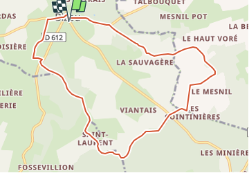
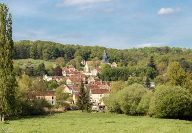
Randonnée Marche de 10,1 km à découvrir à Normandie, Orne, Bizou. Cette randonnée est proposée par ODDAD78.
Description
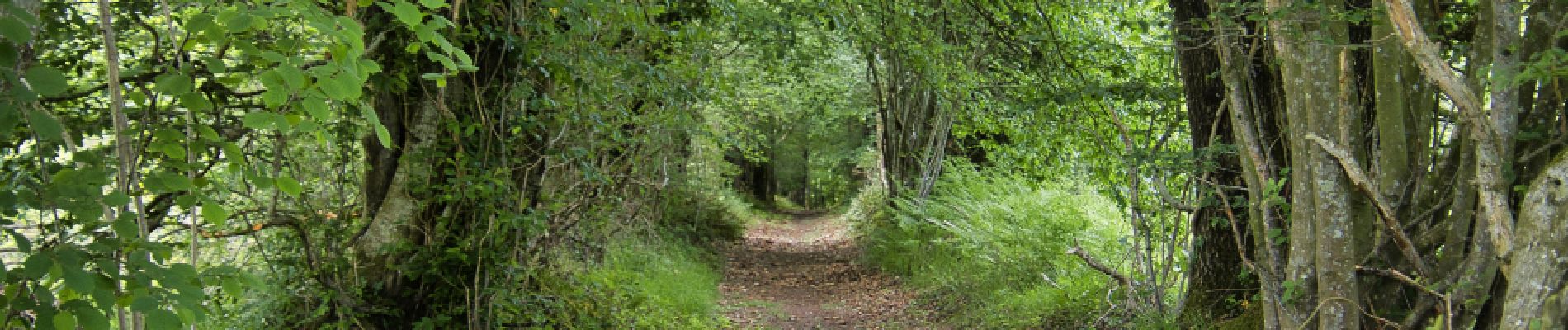
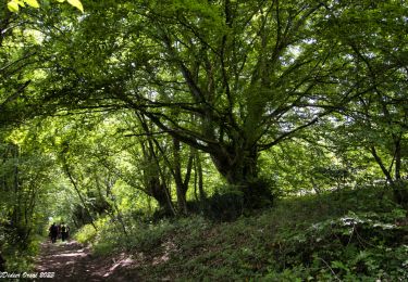
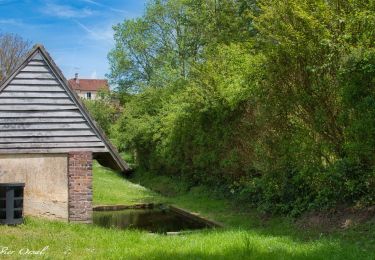
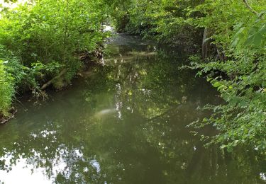
Une variante du PR 'Les Sables du Perche" qui, en contournant la Pannetière emprunte un chemin bordé de très beaux arbres
Les sables du Perche sur Sitytrail :
https://www.sitytrail.com/fr/trails/3673978-bizou--bizou-x-les-sables-du-perche-9x2-kmm/
Localisation
Pays :
France
Région :
Normandie
Département/Province :
Orne
Commune :
Bizou
Localité :
Unknown
Départ:(Dec)
Départ:(UTM)
333829 ; 5373788 (31U) N.
Commentaires
Randonnées à proximité
![Randonnée Marche Longny les Villages - Monceaux au Perche (Boucle) - Photo](https://media.geolcdn.com/t/375/260/ext.jpg?maxdim=2&url=https%3A%2F%2Fstatic1.geolcdn.com%2Fsiteimages%2Fupload%2Ffiles%2F1553511878bg_sport_marche.png)
![Marche Marche](https://static1.geolcdn.com/sitytour/trail-icons/101.png)
Monceaux au Perche (Boucle)
Marche
Facile
(2)
Longny les Villages,
Normandie,
Orne,
France
![](/images/other/stat-length.png)
10,6 km | 13,5 km-effort
2h 30min
![](https://static1.geolcdn.com/siteimages/upload/files/16400158638029165_repeat_loop_refresh_sync_direction_icon.png)
Oui
![Randonnée Marche Longny les Villages - Longny-au-Perche La Brisardière 3,5 km - Photo](https://media.geolcdn.com/t/375/260/19108d03-3d8a-43b4-b05b-172408edde68.jpeg&format=jpg&maxdim=2)
![Marche Marche](https://static1.geolcdn.com/sitytour/trail-icons/101.png)
Longny-au-Perche La Brisardière 3,5 km
Marche
Facile
Longny les Villages,
Normandie,
Orne,
France
![](/images/other/stat-length.png)
3,5 km | 4,4 km-effort
1h 0min
![](https://static1.geolcdn.com/siteimages/upload/files/16400158638029165_repeat_loop_refresh_sync_direction_icon.png)
Oui
![Randonnée Marche Bizou - Bizou - Les sables du Perche 9,2 km - Photo](https://media.geolcdn.com/t/375/260/6b586e88-fad3-40df-be07-9b2a61186b9b.jpeg&format=jpg&maxdim=2)
![Marche Marche](https://static1.geolcdn.com/sitytour/trail-icons/101.png)
Bizou - Les sables du Perche 9,2 km
Marche
Moyen
Bizou,
Normandie,
Orne,
France
![](/images/other/stat-length.png)
9,2 km | 11 km-effort
2h 29min
![](https://static1.geolcdn.com/siteimages/upload/files/16400158638029165_repeat_loop_refresh_sync_direction_icon.png)
Oui
![Randonnée A pied Longny les Villages - Attelage - Forêt et Panoramas - forêt de Réno-Valdieu - Photo](https://media.geolcdn.com/t/375/260/db99a0ed-9413-4500-8368-446623bccd86.jpeg&format=jpg&maxdim=2)
![A pied A pied](https://static1.geolcdn.com/sitytour/trail-icons/100.png)
Attelage - Forêt et Panoramas - forêt de Réno-Valdieu
A pied
Facile
Longny les Villages,
Normandie,
Orne,
France
![](/images/other/stat-length.png)
7,6 km | 9,3 km-effort
2h 7min
![](https://static1.geolcdn.com/siteimages/upload/files/16400158638029165_repeat_loop_refresh_sync_direction_icon.png)
Non
![Randonnée Marche Cour-Maugis sur Huisne - Maison Maugis 22.37 - Photo](https://media.geolcdn.com/t/375/260/ext.jpg?maxdim=2&url=https%3A%2F%2Fstatic1.geolcdn.com%2Fsiteimages%2Fupload%2Ffiles%2F1553511878bg_sport_marche.png)
![Marche Marche](https://static1.geolcdn.com/sitytour/trail-icons/101.png)
Maison Maugis 22.37
Marche
Moyen
(1)
Cour-Maugis sur Huisne,
Normandie,
Orne,
France
![](/images/other/stat-length.png)
22 km | 28 km-effort
Inconnu
![](https://static1.geolcdn.com/siteimages/upload/files/16400158638029165_repeat_loop_refresh_sync_direction_icon.png)
Oui
![Randonnée Marche Le Mage - Le Mage - Longny-au-Perche (Longny les Villages) 11 km - Photo](https://media.geolcdn.com/t/375/260/7da85c06-6bc5-432c-afb8-5444ae0d01ad.jpg&format=jpg&maxdim=2)
![Marche Marche](https://static1.geolcdn.com/sitytour/trail-icons/101.png)
Le Mage - Longny-au-Perche (Longny les Villages) 11 km
Marche
Difficile
Le Mage,
Normandie,
Orne,
France
![](/images/other/stat-length.png)
11,2 km | 13,5 km-effort
3h 17min
![](https://static1.geolcdn.com/siteimages/upload/files/16400158638029165_repeat_loop_refresh_sync_direction_icon.png)
Non
![Randonnée Marche Le Mage - Le Mage - Moutiers-au-Perche 9,2 km - Photo](https://media.geolcdn.com/t/375/260/2d6a74b1-d9ee-4f0d-9acb-9c00ceb2d8ab.jpg&format=jpg&maxdim=2)
![Marche Marche](https://static1.geolcdn.com/sitytour/trail-icons/101.png)
Le Mage - Moutiers-au-Perche 9,2 km
Marche
Moyen
Le Mage,
Normandie,
Orne,
France
![](/images/other/stat-length.png)
9,2 km | 11,5 km-effort
2h 33min
![](https://static1.geolcdn.com/siteimages/upload/files/16400158638029165_repeat_loop_refresh_sync_direction_icon.png)
Non
![Randonnée Marche Longny les Villages - Monceaux et le Manoir - Photo](https://media.geolcdn.com/t/375/260/2c895f3a-5924-449a-a873-4ad274746411.jpg&format=jpg&maxdim=2)
![Marche Marche](https://static1.geolcdn.com/sitytour/trail-icons/101.png)
Monceaux et le Manoir
Marche
Facile
Longny les Villages,
Normandie,
Orne,
France
![](/images/other/stat-length.png)
7,6 km | 9,6 km-effort
3h 0min
![](https://static1.geolcdn.com/siteimages/upload/files/16400158638029165_repeat_loop_refresh_sync_direction_icon.png)
Oui
![Randonnée Marche Longny les Villages - Minceaux 2 - Photo](https://media.geolcdn.com/t/375/260/7d79a233-230a-4321-b3f2-9bfbb749ff7a.jpg&format=jpg&maxdim=2)
![Marche Marche](https://static1.geolcdn.com/sitytour/trail-icons/101.png)
Minceaux 2
Marche
Très facile
Longny les Villages,
Normandie,
Orne,
France
![](/images/other/stat-length.png)
10,6 km | 13,5 km-effort
2h 7min
![](https://static1.geolcdn.com/siteimages/upload/files/16400158638029165_repeat_loop_refresh_sync_direction_icon.png)
Oui