


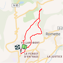

8,6 km | 18,5 km-effort


Utilisateur


Application GPS de randonnée GRATUITE
 SityTrail
IGN / Instituts géographiques
SityTrail World
Le monde est à vous
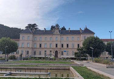
Randonnée Marche de 7,3 km à découvrir à Provence-Alpes-Côte d'Azur, Hautes-Alpes, Gap. Cette randonnée est proposée par Dervalmarc.
Vestige d'une ligne de chemin de fer reliant Gap au Champsaur.Cette ligne fut arrêté en raison de la déclaration de la grande guerre.Il en reste de très beaux vestiges dont ce viaduc.
 - Photo 1")
 - Photo 2")
 - Photo 3")
 - Photo 4")
 - Photo 5")
 - Photo 6")
 - Photo 7")
 - Photo 8")

Marche

Marche

Marche

Marche

Marche
Marche
Marche
Marche
Marche