![](/images/other/stat-length.png)
![Randonnée Marche Baztan - AUTZA depuis le col d'Elhorrieta - Photo](https://media.geolcdn.com/t/1900/400/ext.pjpeg?maxdim=2&url=https%3A%2F%2Fstatic1.geolcdn.com%2Fsiteimages%2Fupload%2Ffiles%2F1553511878bg_sport_marche.png)
AUTZA depuis le col d'Elhorrieta
DECHAMPD
Utilisateur
![Longueur](/images/other/stat-length.png)
Longueur
3,7 km
![Altitude max](https://static1.geolcdn.com/siteimages/upload/files/1508320355ic_sort_altitude_max_24dp.png)
Altitude max
1290 m
![Dénivelé positif](https://static1.geolcdn.com/siteimages/upload/files/1508320355ic_sort_den_pos_24dp.png)
Dénivelé positif
463 m
![Km-Effort](/images/other/stat-length.png)
Km-Effort
9,9 km
![Altitude min](https://static1.geolcdn.com/siteimages/upload/files/1508320355ic_sort_altitude_min_24dp.png)
Altitude min
832 m
![Dénivelé négatif](https://static1.geolcdn.com/siteimages/upload/files/1508320355ic_sort_den_neg_24dp.png)
Dénivelé négatif
460 m
![Boucle](https://static1.geolcdn.com/siteimages/upload/files/16400158638029165_repeat_loop_refresh_sync_direction_icon.png)
Boucle
Oui
Date de création :
2019-01-14 17:30:55.089
Dernière modification :
2019-01-14 17:30:55.179
![Marche](https://static1.geolcdn.com/sitytour/trail-icons/101.png)
1h53
Difficulté : Moyen
![Scannez ce code QR pour ouvrir la randonnée dans l'application SityTrail](https://capi.geolives.com/qq0zvz2zws4bq2lad0pu/sitytour/trails/714607/qr.png?size=200)
Application GPS de randonnée GRATUITE
À propos
Randonnée Marche de 3,7 km à découvrir à Navarre, Inconnu, Baztan. Cette randonnée est proposée par DECHAMPD.
Description
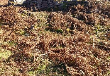
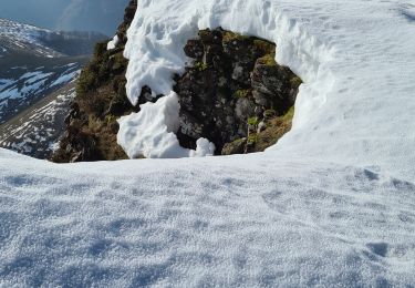
passage entre point 1 et 2 aucune trace ou repère
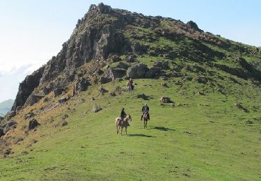
sommet parfois enneigé
du départ à point3 repères "BLANC et ROUGE"
du repère 5 à 25 trace non trouvé
Points d'intérêt
Localisation
Pays :
Espagne
Région :
Navarre
Département/Province :
Inconnu
Commune :
Baztan
Localité :
Unknown
Départ:(Dec)
Départ:(UTM)
629483 ; 4779312 (30T) N.
Commentaires
Randonnées à proximité
![Randonnée A pied Baztan - SL-NA 12 Xorroxin - Photo](https://media.geolcdn.com/t/375/260/c70a4708-6618-4ddb-8631-b64345aa0ab6.jpeg&format=jpg&maxdim=2)
![A pied A pied](https://static1.geolcdn.com/sitytour/trail-icons/100.png)
SL-NA 12 Xorroxin
A pied
Facile
Baztan,
Navarre,
Inconnu,
Espagne
![](/images/other/stat-length.png)
4,2 km | 5,7 km-effort
1h 18min
![](https://static1.geolcdn.com/siteimages/upload/files/16400158638029165_repeat_loop_refresh_sync_direction_icon.png)
Non
![Randonnée A pied Saint-Étienne-de-Baïgorry - SL-NA Elorrieta - Photo](https://media.geolcdn.com/t/375/260/69fa3b6a-5100-4dfb-99ea-46b44a00f11d.jpeg&format=jpg&maxdim=2)
![A pied A pied](https://static1.geolcdn.com/sitytour/trail-icons/100.png)
SL-NA Elorrieta
A pied
Facile
Saint-Étienne-de-Baïgorry,
Nouvelle-Aquitaine,
Pyrénées-Atlantiques,
France
![](/images/other/stat-length.png)
5,8 km | 10 km-effort
2h 15min
![](https://static1.geolcdn.com/siteimages/upload/files/16400158638029165_repeat_loop_refresh_sync_direction_icon.png)
Oui
![Randonnée Marche Saint-Étienne-de-Baïgorry - 20210520 tour depuis Izpegi - Photo](https://media.geolcdn.com/t/375/260/e95b452d-8dd6-4fd8-a386-b8e9176ca32d.jpg&format=jpg&maxdim=2)
![Marche Marche](https://static1.geolcdn.com/sitytour/trail-icons/101.png)
20210520 tour depuis Izpegi
Marche
Facile
Saint-Étienne-de-Baïgorry,
Nouvelle-Aquitaine,
Pyrénées-Atlantiques,
France
![](/images/other/stat-length.png)
8,6 km | 14,7 km-effort
2h 59min
![](https://static1.geolcdn.com/siteimages/upload/files/16400158638029165_repeat_loop_refresh_sync_direction_icon.png)
Oui
![Randonnée Marche Baztan - Berdaritz, Urriska, Pago Zelai, Arlegi, Basagar, Burga, Antsoneko, Goisemets depuis Beartzun - Photo](https://media.geolcdn.com/t/375/260/ext.jpg?maxdim=2&url=https%3A%2F%2Fservices.sitytrail.com%2FGeolivesWS%2FDownloadMedia.ashx%3FTrailID%3D780217%26Media%3Dfix__20161201135752.jpg)
![Marche Marche](https://static1.geolcdn.com/sitytour/trail-icons/101.png)
Berdaritz, Urriska, Pago Zelai, Arlegi, Basagar, Burga, Antsoneko, Goisemets ...
Marche
Moyen
Baztan,
Navarre,
Inconnu,
Espagne
![](/images/other/stat-length.png)
14 km | 23 km-effort
4h 47min
![](https://static1.geolcdn.com/siteimages/upload/files/16400158638029165_repeat_loop_refresh_sync_direction_icon.png)
Oui
![Randonnée Autre activité Saint-Étienne-de-Baïgorry - TDP N°5 ST ÉTIENNE DE BAIGORRY ST JEAN PIEDS DE PORT - Photo](https://media.geolcdn.com/t/375/260/ext.jpg?maxdim=2&url=https%3A%2F%2Fservices.sitytrail.com%2FGeolivesWS%2FDownloadMedia.ashx%3FTrailID%3D747974%26Media%3Dfix__20170507140146.jpg)
![Autre activité Autre activité](https://static1.geolcdn.com/sitytour/trail-icons/900.png)
TDP N°5 ST ÉTIENNE DE BAIGORRY ST JEAN PIEDS DE PORT
Autre activité
Très facile
Saint-Étienne-de-Baïgorry,
Nouvelle-Aquitaine,
Pyrénées-Atlantiques,
France
![](/images/other/stat-length.png)
19,6 km | 33 km-effort
7h 7min
![](https://static1.geolcdn.com/siteimages/upload/files/16400158638029165_repeat_loop_refresh_sync_direction_icon.png)
Non
![Randonnée Cheval Banca - Sentier des Contrebandiers - du Col d'Ehorrieta à St - Martin d'Arossa au Pays Basque - Photo](https://media.geolcdn.com/t/375/260/ext.jpg?maxdim=2&url=https%3A%2F%2Fservices.sitytrail.com%2FGeolivesWS%2FDownloadMedia.ashx%3FTrailID%3D317121%26Media%3D16270_3.jpg)
![Cheval Cheval](https://static1.geolcdn.com/sitytour/trail-icons/300.png)
Sentier des Contrebandiers - du Col d'Ehorrieta à St - Martin d'Arossa au Pay...
Cheval
Difficile
Banca,
Nouvelle-Aquitaine,
Pyrénées-Atlantiques,
France
![](/images/other/stat-length.png)
18,9 km | 30 km-effort
4h 30min
![](https://static1.geolcdn.com/siteimages/upload/files/16400158638029165_repeat_loop_refresh_sync_direction_icon.png)
Non
![Randonnée Marche Saint-Étienne-de-Baïgorry - L](https://media.geolcdn.com/t/375/260/f5369d2f-55a7-4bd6-b872-20629db98fde.jpg&format=jpg&maxdim=2)
![Marche Marche](https://static1.geolcdn.com/sitytour/trail-icons/101.png)
L"Autza depuis le col d'Ispeguy
Marche
Difficile
Saint-Étienne-de-Baïgorry,
Nouvelle-Aquitaine,
Pyrénées-Atlantiques,
France
![](/images/other/stat-length.png)
9,8 km | 20 km-effort
3h 57min
![](https://static1.geolcdn.com/siteimages/upload/files/16400158638029165_repeat_loop_refresh_sync_direction_icon.png)
Oui
![Randonnée Marche Baztan - ispeguy astate - Photo](https://media.geolcdn.com/t/375/260/39031ecb-0451-4474-8089-fea795b5e04e.jpg&format=jpg&maxdim=2)
![Marche Marche](https://static1.geolcdn.com/sitytour/trail-icons/101.png)
ispeguy astate
Marche
Difficile
Baztan,
Navarre,
Inconnu,
Espagne
![](/images/other/stat-length.png)
9,4 km | 16,7 km-effort
3h 19min
![](https://static1.geolcdn.com/siteimages/upload/files/16400158638029165_repeat_loop_refresh_sync_direction_icon.png)
Oui
![Randonnée Marche Saint-Étienne-de-Baïgorry - GR10 2 - Photo](https://media.geolcdn.com/t/375/260/5ffc78e6-2d15-43aa-bd2c-9f1d4ecedd7e.jpg&format=jpg&maxdim=2)
![Marche Marche](https://static1.geolcdn.com/sitytour/trail-icons/101.png)
GR10 2
Marche
Très difficile
Saint-Étienne-de-Baïgorry,
Nouvelle-Aquitaine,
Pyrénées-Atlantiques,
France
![](/images/other/stat-length.png)
19 km | 35 km-effort
7h 41min
![](https://static1.geolcdn.com/siteimages/upload/files/16400158638029165_repeat_loop_refresh_sync_direction_icon.png)
Non