![](/images/other/stat-length.png)
![Randonnée Marche Narbonne - ABBAYE DE FONTFROIDE - LA VOIE DOMITIENNE - Photo](https://media.geolcdn.com/t/1900/400/ext.pjpeg?maxdim=2&url=https%3A%2F%2Fstatic1.geolcdn.com%2Fsiteimages%2Fupload%2Ffiles%2F1553511878bg_sport_marche.png)
ABBAYE DE FONTFROIDE - LA VOIE DOMITIENNE
cbouttes
Utilisateur
![Longueur](/images/other/stat-length.png)
![Altitude max](https://static1.geolcdn.com/siteimages/upload/files/1508320355ic_sort_altitude_max_24dp.png)
![Dénivelé positif](https://static1.geolcdn.com/siteimages/upload/files/1508320355ic_sort_den_pos_24dp.png)
![Km-Effort](/images/other/stat-length.png)
![Altitude min](https://static1.geolcdn.com/siteimages/upload/files/1508320355ic_sort_altitude_min_24dp.png)
![Dénivelé négatif](https://static1.geolcdn.com/siteimages/upload/files/1508320355ic_sort_den_neg_24dp.png)
![Boucle](https://static1.geolcdn.com/siteimages/upload/files/16400158638029165_repeat_loop_refresh_sync_direction_icon.png)
![Marche](https://static1.geolcdn.com/sitytour/trail-icons/101.png)
4h29
Difficulté : Inconnu
![Scannez ce code QR pour ouvrir la randonnée dans l'application SityTrail](https://capi.geolives.com/qq0zvz2zws4bq2lad0pu/sitytour/trails/711778/qr.png?size=200)
Application GPS de randonnée GRATUITE
À propos
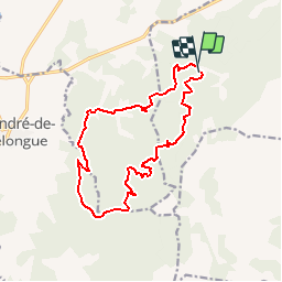
Randonnée Marche de 16 km à découvrir à Occitanie, Aude, Narbonne. Cette randonnée est proposée par cbouttes.
Description
http://www.randogps.net/randonnee-pedestre-gps-aude-11.php?num=182
Dist. à plat:16.5Km Durée estimée :04:30 Hrs
ABBAYE DE FONTFROIDE - LA VOIE DOMITIENNE
Départ randonnée : Depuis autoroute A9, prendre la sortie 38 (Narbonne-sud) puis suivre la direction de Lézignan-Corbières.
Depuis l'A61, sortie 25 (Lézignan) prendre la direction de Ferrals les Corbières (D106) puis Narbonne (D613).
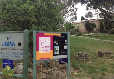
parking gratuit à l'Abbaye.
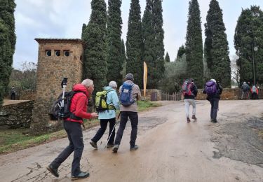
Départ de la randonnée devant l'Abbaye, vous la contournerez pour emprunter la voie domitienne qui longe le ruisseau de Fontfroide.
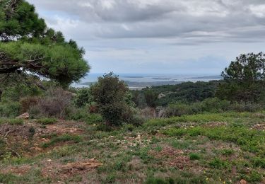
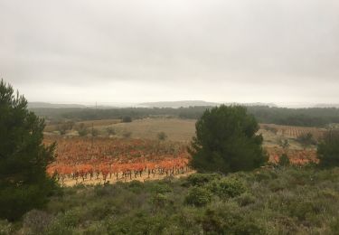
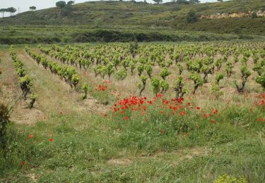
Vous continuerez dans le massif de Fontfroide en alternant les zones boisées et les découverts.
pas de difficulté particulière sur ce parcours.
Attention en période de chasse, il peut y avoir des battues.
Ne pas faire ce parcours en plein été, le risque d'incendie étant trop important.
Localisation
Commentaires
Randonnées à proximité
![Randonnée Autre activité Bizanet - Abbaye de Fontdefroide - Photo](https://media.geolcdn.com/t/375/260/ext.jpg?maxdim=2&url=https%3A%2F%2Fservices.sitytrail.com%2FGeolivesWS%2FDownloadMedia.ashx%3FTrailID%3D458985%26Media%3D20150814175939.jpg)
![Autre activité Autre activité](https://static1.geolcdn.com/sitytour/trail-icons/900.png)
Autre activité
![](/images/other/stat-length.png)
![](https://static1.geolcdn.com/siteimages/upload/files/16400158638029165_repeat_loop_refresh_sync_direction_icon.png)
![Randonnée Marche Narbonne - bois de Fontfroide - Photo](https://media.geolcdn.com/t/375/260/04a41b67-1fb3-45d4-94a9-cff686aa19ae.jpg&format=jpg&maxdim=2)
![Marche Marche](https://static1.geolcdn.com/sitytour/trail-icons/101.png)
Marche
![](/images/other/stat-length.png)
![](https://static1.geolcdn.com/siteimages/upload/files/16400158638029165_repeat_loop_refresh_sync_direction_icon.png)
![Randonnée Marche Narbonne - L'Aragnon de Frontfroide - Photo](https://media.geolcdn.com/t/375/260/ext.jpg?maxdim=2&url=https%3A%2F%2Fstatic1.geolcdn.com%2Fsiteimages%2Fupload%2Ffiles%2F1553511878bg_sport_marche.png)
![Marche Marche](https://static1.geolcdn.com/sitytour/trail-icons/101.png)
Marche
![](/images/other/stat-length.png)
![](https://static1.geolcdn.com/siteimages/upload/files/16400158638029165_repeat_loop_refresh_sync_direction_icon.png)
![Randonnée Marche Saint-André-de-Roquelongue - ACAD - TBG - Saint-Andre-de-Roquelongue reco 23 octobre - Photo](https://media.geolcdn.com/t/375/260/77fdfb1e-6863-402e-bac4-396dcd015702.jpg&format=jpg&maxdim=2)
![Marche Marche](https://static1.geolcdn.com/sitytour/trail-icons/101.png)
Marche
![](/images/other/stat-length.png)
![](https://static1.geolcdn.com/siteimages/upload/files/16400158638029165_repeat_loop_refresh_sync_direction_icon.png)
![Randonnée Marche Narbonne - La combe d'enfer en Narbonnais - Photo](https://media.geolcdn.com/t/375/260/28cc313a-8a47-482c-81b5-28081d16a224.jpg&format=jpg&maxdim=2)
![Marche Marche](https://static1.geolcdn.com/sitytour/trail-icons/101.png)
Marche
![](/images/other/stat-length.png)
![](https://static1.geolcdn.com/siteimages/upload/files/16400158638029165_repeat_loop_refresh_sync_direction_icon.png)
![Randonnée Marche Narbonne - Fontfroide (aude) Près de Narbonne - Photo](https://media.geolcdn.com/t/375/260/740c9163-f8f4-4dac-b59d-2c6335707879.jpg&format=jpg&maxdim=2)
![Marche Marche](https://static1.geolcdn.com/sitytour/trail-icons/101.png)
Marche
![](/images/other/stat-length.png)
![](https://static1.geolcdn.com/siteimages/upload/files/16400158638029165_repeat_loop_refresh_sync_direction_icon.png)
![Randonnée Marche Bages - Prat-de-Cest - Abbaye de Fontfroide - Photo](https://media.geolcdn.com/t/375/260/fd3516f0-d21c-487d-b7cc-d412f56ad9ce.jpg&format=jpg&maxdim=2)
![Marche Marche](https://static1.geolcdn.com/sitytour/trail-icons/101.png)
Marche
![](/images/other/stat-length.png)
![](https://static1.geolcdn.com/siteimages/upload/files/16400158638029165_repeat_loop_refresh_sync_direction_icon.png)
![Randonnée Marche Bizanet - Bizanet - Photo](https://media.geolcdn.com/t/375/260/ext.jpg?maxdim=2&url=https%3A%2F%2Fservices.sitytrail.com%2FGeolivesWS%2FDownloadMedia.ashx%3FTrailID%3D172253%26Media%3D8562_5.jpg)
![Marche Marche](https://static1.geolcdn.com/sitytour/trail-icons/101.png)
![Randonnée Marche Narbonne - Narbonne Etang De Jonquières - Photo](https://media.geolcdn.com/t/375/260/ext.jpg?maxdim=2&url=https%3A%2F%2Fservices.sitytrail.com%2FGeolivesWS%2FDownloadMedia.ashx%3FTrailID%3D121016%26Media%3D20120410133338.jpg)
![Marche Marche](https://static1.geolcdn.com/sitytour/trail-icons/101.png)
Marche
![](/images/other/stat-length.png)
![](https://static1.geolcdn.com/siteimages/upload/files/16400158638029165_repeat_loop_refresh_sync_direction_icon.png)