Randonnée Marche Serrières-sur-Ain - Serrières sur ain - Photo
 btx
btx

Utilisateur

© OpenStreetMap contributors
Longueur
Longueur
18,1 km
Altitude max
Altitude max
656 m
Dénivelé positif
Dénivelé positif
725 m
Km-Effort
Km-Effort  
28 km
Altitude min
Altitude min
270 m
Dénivelé négatif
Dénivelé négatif
718 m
Boucle
Boucle
Oui
Date de création :
2017-02-28 00:00:00.0
Dernière modification :
2017-02-28 00:00:00.0

(0 Avis)

Marche
Marche
5h43
Difficulté : Moyen

Scannez ce code QR pour ouvrir la randonnée dans l'application SityTrail

Application GPS de randonnée GRATUITE

Logo SityTrail SityTrail

IGN / Instituts géographiques

Télécharger SityTrail sur l'App Store Télécharger SityTrail sur Google Play

Logo SityTrail SityTrail World

Le monde est à vous

Télécharger SityTrail sur l'App Store Télécharger SityTrail sur Google Play Télécharger SityTrail sur Huawei AppGallery

À propos

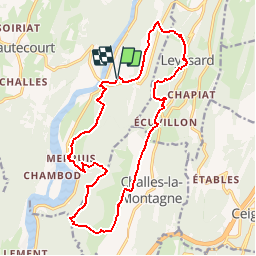
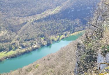
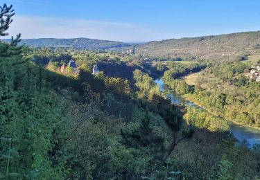
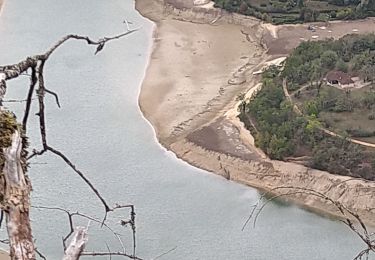
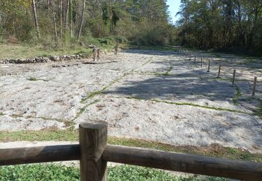
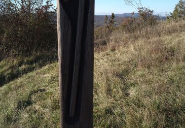
Randonnée Marche de 18,1 km à découvrir à Auvergne-Rhône-Alpes, Ain, Serrières-sur-Ain. Cette randonnée est proposée par btx.

Profil altimétrique

Localisation

Pays :
France
Région :
Auvergne-Rhône-Alpes
Département/Province :
Ain
Commune :
Serrières-sur-Ain
Localité :
Unknown
Départ:(Dec)
Départ:(UTM)
689333 ; 5113830 (31T) N.

Randonnées à proximité

Randonnée Marche Nurieux-Volognat - mornay  - Photo
Marche
colomb24

Marche

Facile
(1)
Nurieux-Volognat, Auvergne-Rhône-Alpes, Ain, France
10,5 km | 14,5 km-effort
3h 4min
Oui
Randonnée Marche Hautecourt-Romanèche - romaneche - Photo
Marche
loca.yves

Marche

Très difficile
Hautecourt-Romanèche, Auvergne-Rhône-Alpes, Ain, France
13 km | 19,2 km-effort
5h 20min
Oui
Randonnée Marche Challes-la-Montagne - challes la montagne barrage lallement la cueille sameriat - Photo
Marche
loca.yves

Marche

Facile
Challes-la-Montagne, Auvergne-Rhône-Alpes, Ain, France
10 km | 14,3 km-effort
3h 10min
Oui
Randonnée sport Hautecourt-Romanèche - 2023-07-08_15h37m22_Romanèche MR projet 2023 - Photo
sport
loca.yves

sport

Très facile
(1)
Hautecourt-Romanèche, Auvergne-Rhône-Alpes, Ain, France
10,8 km | 15,7 km-effort
Inconnu
Oui
Randonnée Marche Poncin - La Cueille - Cizod  - Photo
Marche
Jackoyo

Marche

Moyen
Poncin, Auvergne-Rhône-Alpes, Ain, France
8,6 km | 12,8 km-effort
1h 56min
Oui
Randonnée Marche Hautecourt-Romanèche - romaneche - Photo
Marche
Mer0708

Marche

Très difficile
Hautecourt-Romanèche, Auvergne-Rhône-Alpes, Ain, France
16 km | 23 km-effort
4h 5min
Oui
Randonnée Marche Nurieux-Volognat - Le Mornay - Photo
Marche
Jackoyo

Marche

Facile
Nurieux-Volognat, Auvergne-Rhône-Alpes, Ain, France
12,8 km | 18,2 km-effort
2h 52min
Oui
Randonnée Marche Serrières-sur-Ain - Serrières Leyssard - Photo
Marche
Jackoyo

Marche

Difficile
Serrières-sur-Ain, Auvergne-Rhône-Alpes, Ain, France
16,6 km | 26 km-effort
4h 2min
Oui
Randonnée Marche Peyriat - Peyriat Étables  - Photo
Marche
Jackoyo

Marche

Très facile
Peyriat, Auvergne-Rhône-Alpes, Ain, France
13,8 km | 18 km-effort
2h 32min
Oui


Fermer
Mes abonnements