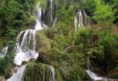
Randonnée V.T.T. Ouhans - Club VTT Bivouac 1 2011-07-11 18h39m46 - Photo

Club VTT Bivouac 1 2011-07-11 18h39m46

 norbertmarteau
norbertmarteau

Utilisateur

© OpenStreetMap contributors
Longueur
Longueur
25 km
Altitude max
Altitude max
915 m
Dénivelé positif
Dénivelé positif
1005 m
Km-Effort
Km-Effort  
39 km
Altitude min
Altitude min
346 m
Dénivelé négatif
Dénivelé négatif
1292 m
Boucle
Boucle
Non
Date de création :
2014-12-10 00:00:00.0
Dernière modification :
2014-12-10 00:00:00.0

(0 Avis)

V.T.T.
V.T.T.
--
Difficulté : Difficile

Scannez ce code QR pour ouvrir la randonnée dans l'application SityTrail

Application GPS de randonnée GRATUITE

Logo SityTrail SityTrail

IGN / Instituts géographiques

Télécharger SityTrail sur l'App Store Télécharger SityTrail sur Google Play

Logo SityTrail SityTrail World

Le monde est à vous

Télécharger SityTrail sur l'App Store Télécharger SityTrail sur Google Play Télécharger SityTrail sur Huawei AppGallery

À propos

Randonnée V.T.T. de 25 km à découvrir à Bourgogne-Franche-Comté, Doubs, Ouhans. Cette randonnée est proposée par norbertmarteau.

Profil altimétrique

Photos

23 photos au total. Cliquez sur une photo pour les afficher toutes dans la galerie.

Points d'intérêt

Point d'intérêt Chantrans - Point 20 - Photo
norbertmarteau
CHANTRANS 
Point d'intérêt Châteauvieux-les-Fossés - Point 22 - Photo
norbertmarteau
CHÂTEAUVIEUX-LES-FOSSÉS 

Localisation

Pays :
France
Région :
Bourgogne-Franche-Comté
Département/Province :
Doubs
Commune :
Ouhans
Localité :
Unknown
Départ:(Dec)
Départ:(UTM)
294269 ; 5208553 (32T) N.

Randonnées à proximité

Randonnée Marche Mouthier-Haute-Pierre - gorges de noailles  - Photo
Marche
eltonnermou

Marche

Très difficile
(2)
Mouthier-Haute-Pierre, Bourgogne-Franche-Comté, Doubs, France
14,8 km | 23 km-effort
5h 13min
Oui
Randonnée Marche Ouhans - la source de la loue - Photo
Marche
msergio

Marche

Moyen
(1)
Ouhans, Bourgogne-Franche-Comté, Doubs, France
16,1 km | 25 km-effort
4h 21min
Oui
Randonnée Marche Mouthier-Haute-Pierre - Source de la Loue - Mouthier Haute Pierre - Photo
Marche
tracegps

Marche

Moyen
(1)
Mouthier-Haute-Pierre, Bourgogne-Franche-Comté, Doubs, France
10,6 km | 16,5 km-effort
2h 19min
Oui
Randonnée Marche Goux-les-Usiers - val d'usier Goux (les usiers) - Photo
Marche
eltonnermou

Marche

Très difficile
(1)
Goux-les-Usiers, Bourgogne-Franche-Comté, Doubs, France
15,9 km | 20 km-effort
4h 32min
Oui
Randonnée Marche Mouthier-Haute-Pierre - Roche de Hautepierre (881 m) - Photo
Marche
tracegps

Marche

Difficile
(1)
Mouthier-Haute-Pierre, Bourgogne-Franche-Comté, Doubs, France
11,6 km | 19,1 km-effort
4h 30min
Oui
Randonnée A pied Mouthier-Haute-Pierre - Mouthier Haute Pierre - Photo
A pied
grasgilbert

A pied

Moyen
(1)
Mouthier-Haute-Pierre, Bourgogne-Franche-Comté, Doubs, France
14,1 km | 23 km-effort
5h 11min
Oui
Randonnée Marche Mouthier-Haute-Pierre - Gorges de Nouailles - Source de la Loue - Photo
Marche
GUIDE
David25400

Marche

Facile
Mouthier-Haute-Pierre, Bourgogne-Franche-Comté, Doubs, France
11,6 km | 17,6 km-effort
4h 7min
Oui
Randonnée Marche Ouhans - boucle de la source de la loue - Photo
Marche
fab0202

Marche

Moyen
Ouhans, Bourgogne-Franche-Comté, Doubs, France
16,5 km | 25 km-effort
4h 21min
Oui
Randonnée Marche Mouthier-Haute-Pierre - les gorges de Nouailles - Photo
Marche
Yoann Hervé

Marche

Facile
Mouthier-Haute-Pierre, Bourgogne-Franche-Comté, Doubs, France
10,2 km | 16,6 km-effort
9h 29min
Non


Fermer
Mes abonnements