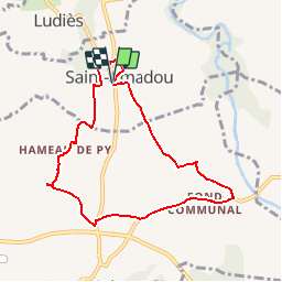
![](/images/other/stat-length.png)
![Randonnée Marche Saint-Amadou - St Amadou sentier de l'eau - Photo](https://media.geolcdn.com/t/1900/400/ext.pjpeg?maxdim=2&url=https%3A%2F%2Fstatic1.geolcdn.com%2Fsiteimages%2Fupload%2Ffiles%2F1553511878bg_sport_marche.png)
St Amadou sentier de l'eau
pidjam
Utilisateur
![Longueur](/images/other/stat-length.png)
Longueur
8,3 km
![Altitude max](https://static1.geolcdn.com/siteimages/upload/files/1508320355ic_sort_altitude_max_24dp.png)
Altitude max
326 m
![Dénivelé positif](https://static1.geolcdn.com/siteimages/upload/files/1508320355ic_sort_den_pos_24dp.png)
Dénivelé positif
110 m
![Km-Effort](/images/other/stat-length.png)
Km-Effort
9,8 km
![Altitude min](https://static1.geolcdn.com/siteimages/upload/files/1508320355ic_sort_altitude_min_24dp.png)
Altitude min
263 m
![Dénivelé négatif](https://static1.geolcdn.com/siteimages/upload/files/1508320355ic_sort_den_neg_24dp.png)
Dénivelé négatif
111 m
![Boucle](https://static1.geolcdn.com/siteimages/upload/files/16400158638029165_repeat_loop_refresh_sync_direction_icon.png)
Boucle
Oui
Date de création :
2017-01-12 00:00:00.0
Dernière modification :
2017-01-12 00:00:00.0
![Marche](https://static1.geolcdn.com/sitytour/trail-icons/101.png)
2h09
Difficulté : Très facile
![Scannez ce code QR pour ouvrir la randonnée dans l'application SityTrail](https://capi.geolives.com/qq0zvz2zws4bq2lad0pu/sitytour/trails/683525/qr.png?size=200)
Application GPS de randonnée GRATUITE
À propos
Randonnée Marche de 8,3 km à découvrir à Occitanie, Ariège, Saint-Amadou. Cette randonnée est proposée par pidjam.
Description
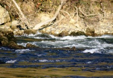
Petite marche sur le thème de l'eau bien renseignée (panneaux)(à voir: fontaines,circuits d'eau,lavoir, réservoir...)en suivant les "libellules" (balisage).
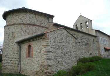
A proximité,curiosité à visiter: l'église semi-rupestre de Vals.
Localisation
Pays :
France
Région :
Occitanie
Département/Province :
Ariège
Commune :
Saint-Amadou
Localité :
Unknown
Départ:(Dec)
Départ:(UTM)
396085 ; 4773878 (31T) N.
Commentaires
Randonnées à proximité
![Randonnée Marche Vals - Collines de Vals - Photo](https://media.geolcdn.com/t/375/260/ext.jpg?maxdim=2&url=https%3A%2F%2Fstatic1.geolcdn.com%2Fsiteimages%2Fupload%2Ffiles%2F1553511878bg_sport_marche.png)
![Marche Marche](https://static1.geolcdn.com/sitytour/trail-icons/101.png)
![Randonnée Marche Vals - CC_Piemont_BE_10_Vals_Pamiers_20240621 - Photo](https://media.geolcdn.com/t/375/260/c0c5e250-79c3-473a-907b-1a4f942e8c8b.jpg&format=jpg&maxdim=2)
![Marche Marche](https://static1.geolcdn.com/sitytour/trail-icons/101.png)
CC_Piemont_BE_10_Vals_Pamiers_20240621
Marche
Facile
Vals,
Occitanie,
Ariège,
France
![](/images/other/stat-length.png)
20 km | 24 km-effort
4h 35min
![](https://static1.geolcdn.com/siteimages/upload/files/16400158638029165_repeat_loop_refresh_sync_direction_icon.png)
Non
![Randonnée Marche Ludiès - Chemin du Piémont Pyrénéen - de Ludiès au château de la Hille - Photo](https://media.geolcdn.com/t/375/260/ext.jpg?maxdim=2&url=https%3A%2F%2Fservices.sitytrail.com%2FGeolivesWS%2FDownloadMedia.ashx%3FTrailID%3D106674%26Media%3D11302_3.jpg)
![Marche Marche](https://static1.geolcdn.com/sitytour/trail-icons/101.png)
Chemin du Piémont Pyrénéen - de Ludiès au château de la Hille
Marche
Difficile
Ludiès,
Occitanie,
Ariège,
France
![](/images/other/stat-length.png)
33 km | 41 km-effort
7h 0min
![](https://static1.geolcdn.com/siteimages/upload/files/16400158638029165_repeat_loop_refresh_sync_direction_icon.png)
Non
![Randonnée Cheval Ludiès - Chemin de St Jacques de Compostelle - Ludiès - Pamiers - Photo](https://media.geolcdn.com/t/375/260/ext.jpg?maxdim=2&url=https%3A%2F%2Fservices.sitytrail.com%2FGeolivesWS%2FDownloadMedia.ashx%3FTrailID%3D108237%26Media%3D879_1.jpg)
![Cheval Cheval](https://static1.geolcdn.com/sitytour/trail-icons/300.png)
Chemin de St Jacques de Compostelle - Ludiès - Pamiers
Cheval
Moyen
Ludiès,
Occitanie,
Ariège,
France
![](/images/other/stat-length.png)
12,4 km | 13,4 km-effort
1h 0min
![](https://static1.geolcdn.com/siteimages/upload/files/16400158638029165_repeat_loop_refresh_sync_direction_icon.png)
Non
![Randonnée Cheval Ludiès - Boucle de la Vallée de l'Hers - Ludiès - Verniolle - Photo](https://media.geolcdn.com/t/375/260/ext.jpg?maxdim=2&url=https%3A%2F%2Fservices.sitytrail.com%2FGeolivesWS%2FDownloadMedia.ashx%3FTrailID%3D108234%26Media%3D876_1.jpg)
![Cheval Cheval](https://static1.geolcdn.com/sitytour/trail-icons/300.png)
Boucle de la Vallée de l'Hers - Ludiès - Verniolle
Cheval
Moyen
Ludiès,
Occitanie,
Ariège,
France
![](/images/other/stat-length.png)
13,6 km | 14,6 km-effort
1h 30min
![](https://static1.geolcdn.com/siteimages/upload/files/16400158638029165_repeat_loop_refresh_sync_direction_icon.png)
Non
![Randonnée V.T.T. Saint-Amadou - Grande Traversée VTT FFC Arièges Pyrénées - Etape 7 - St Amadou - Pamiers - Photo](https://media.geolcdn.com/t/375/260/ext.jpg?maxdim=2&url=https%3A%2F%2Fservices.sitytrail.com%2FGeolivesWS%2FDownloadMedia.ashx%3FTrailID%3D104278%26Media%3D7484_2.jpg)
![V.T.T. V.T.T.](https://static1.geolcdn.com/sitytour/trail-icons/202.png)
Grande Traversée VTT FFC Arièges Pyrénées - Etape 7 - St Amadou - Pamiers
V.T.T.
Moyen
Saint-Amadou,
Occitanie,
Ariège,
France
![](/images/other/stat-length.png)
14 km | 15,6 km-effort
1h 15min
![](https://static1.geolcdn.com/siteimages/upload/files/16400158638029165_repeat_loop_refresh_sync_direction_icon.png)
Non
![Randonnée Marche Rieucros - Compostelle Rieucros Teilhet-Pamiers - Photo](https://media.geolcdn.com/t/375/260/ext.jpg?maxdim=2&url=https%3A%2F%2Fstatic1.geolcdn.com%2Fsiteimages%2Fupload%2Ffiles%2F1553511878bg_sport_marche.png)
![Marche Marche](https://static1.geolcdn.com/sitytour/trail-icons/101.png)
Compostelle Rieucros Teilhet-Pamiers
Marche
Très difficile
Rieucros,
Occitanie,
Ariège,
France
![](/images/other/stat-length.png)
24 km | 29 km-effort
6h 30min
![](https://static1.geolcdn.com/siteimages/upload/files/16400158638029165_repeat_loop_refresh_sync_direction_icon.png)
Non
![Randonnée Marche Le Carlaret - Le Carlaret- Montégut plantauret - Photo](https://media.geolcdn.com/t/375/260/ext.jpg?maxdim=2&url=https%3A%2F%2Fstatic1.geolcdn.com%2Fsiteimages%2Fupload%2Ffiles%2F1553511878bg_sport_marche.png)
![Marche Marche](https://static1.geolcdn.com/sitytour/trail-icons/101.png)
Le Carlaret- Montégut plantauret
Marche
Moyen
Le Carlaret,
Occitanie,
Ariège,
France
![](/images/other/stat-length.png)
28 km | 35 km-effort
8h 34min
![](https://static1.geolcdn.com/siteimages/upload/files/16400158638029165_repeat_loop_refresh_sync_direction_icon.png)
Non
![Randonnée Marche Le Carlaret - GR78 - Etape 4-5 Quartier de la gare - Caoué - Photo](https://media.geolcdn.com/t/375/260/ext.jpg?maxdim=2&url=https%3A%2F%2Fstatic1.geolcdn.com%2Fsiteimages%2Fupload%2Ffiles%2F1553511878bg_sport_marche.png)
![Marche Marche](https://static1.geolcdn.com/sitytour/trail-icons/101.png)
GR78 - Etape 4-5 Quartier de la gare - Caoué
Marche
Moyen
Le Carlaret,
Occitanie,
Ariège,
France
![](/images/other/stat-length.png)
49 km | 62 km-effort
13h 7min
![](https://static1.geolcdn.com/siteimages/upload/files/16400158638029165_repeat_loop_refresh_sync_direction_icon.png)
Non