![](/images/other/stat-length.png)
![Randonnée Marche Lagorce - leyris - Photo](https://media.geolcdn.com/t/1900/400/ext.pjpeg?maxdim=2&url=https%3A%2F%2Fservices.sitytrail.com%2FGeolivesWS%2FDownloadMedia.ashx%3FTrailID%3D683438%26Media%3Dfix__20170111144822.jpg)
leyris
JDEL84
Utilisateur
![Longueur](/images/other/stat-length.png)
![Altitude max](https://static1.geolcdn.com/siteimages/upload/files/1508320355ic_sort_altitude_max_24dp.png)
![Dénivelé positif](https://static1.geolcdn.com/siteimages/upload/files/1508320355ic_sort_den_pos_24dp.png)
![Km-Effort](/images/other/stat-length.png)
![Altitude min](https://static1.geolcdn.com/siteimages/upload/files/1508320355ic_sort_altitude_min_24dp.png)
![Dénivelé négatif](https://static1.geolcdn.com/siteimages/upload/files/1508320355ic_sort_den_neg_24dp.png)
![Boucle](https://static1.geolcdn.com/siteimages/upload/files/16400158638029165_repeat_loop_refresh_sync_direction_icon.png)
![Marche](https://static1.geolcdn.com/sitytour/trail-icons/101.png)
4h31
Difficulté : Moyen
![Scannez ce code QR pour ouvrir la randonnée dans l'application SityTrail](https://capi.geolives.com/qq0zvz2zws4bq2lad0pu/sitytour/trails/683438/qr.png?size=200)
Application GPS de randonnée GRATUITE
À propos
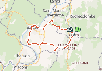
Randonnée Marche de 15,4 km à découvrir à Auvergne-Rhône-Alpes, Ardèche, Lagorce. Cette randonnée est proposée par JDEL84.
Description
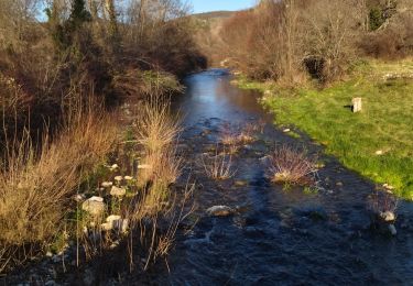
Départ de Leyris et descente vers l'Ardèche avec un léger dénivellé au milieu de vignobles.
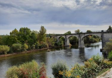
Nous empruntons une ancienne ligne de chemin de fer avec passage sur un viaduc. Traversée de la D579
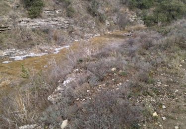
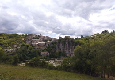
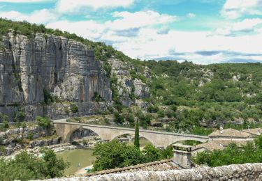
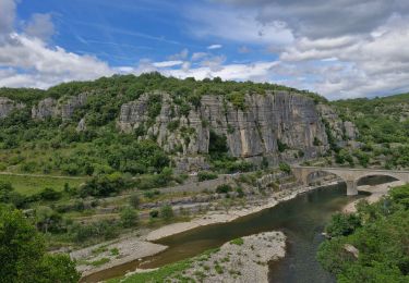
Nous apercevons l'Ardèche et Balazuc que nous traverseront.
Nous nous dirigeons vers le Sud pendant 1 km, et remontons vers Leyrus.
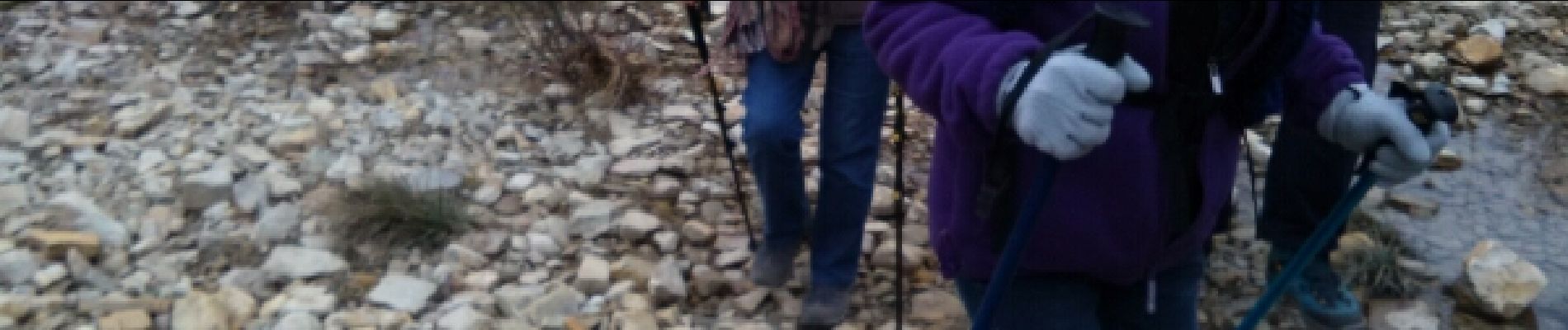
Localisation
Commentaires
Randonnées à proximité
![Randonnée Marche Vogüé - Vogue Gare Lanas 7km5 - Photo](https://media.geolcdn.com/t/375/260/9aa975b1-7a6b-4ed1-96ac-4f4c9e1e47b3.jpg&format=jpg&maxdim=2)
![Marche Marche](https://static1.geolcdn.com/sitytour/trail-icons/101.png)
Marche
![](/images/other/stat-length.png)
![](https://static1.geolcdn.com/siteimages/upload/files/16400158638029165_repeat_loop_refresh_sync_direction_icon.png)
![Randonnée Marche Rochecolombe - 07 rochecompmbe gour sompe - Photo](https://media.geolcdn.com/t/375/260/7497dab0-2442-416d-a2d3-895bfda1b0d4.jpg&format=jpg&maxdim=2)
![Marche Marche](https://static1.geolcdn.com/sitytour/trail-icons/101.png)
Marche
![](/images/other/stat-length.png)
![](https://static1.geolcdn.com/siteimages/upload/files/16400158638029165_repeat_loop_refresh_sync_direction_icon.png)
![Randonnée Marche Saint-Maurice-d'Ibie - 07 st Maurice d ibis a revoir - Photo](https://media.geolcdn.com/t/375/260/0ed10fbf-b0fd-4958-865e-0a1b6897ff8f.jpg&format=jpg&maxdim=2)
![Marche Marche](https://static1.geolcdn.com/sitytour/trail-icons/101.png)
Marche
![](/images/other/stat-length.png)
![](https://static1.geolcdn.com/siteimages/upload/files/16400158638029165_repeat_loop_refresh_sync_direction_icon.png)
![Randonnée Marche Chauzon - camping le coin charmant Chauzon à Balazuc - Photo](https://media.geolcdn.com/t/375/260/9e3472da-95e6-4ca9-9834-4874ef8e1852.jpg&format=jpg&maxdim=2)
![Marche Marche](https://static1.geolcdn.com/sitytour/trail-icons/101.png)
Marche
![](/images/other/stat-length.png)
![](https://static1.geolcdn.com/siteimages/upload/files/16400158638029165_repeat_loop_refresh_sync_direction_icon.png)
![Randonnée Marche Pradons - Pradons Gens Abeille 19km - Photo](https://media.geolcdn.com/t/375/260/c0a42803-b9d9-46b0-bff8-8a8a9dfe0f63.jpg&format=jpg&maxdim=2)
![Marche Marche](https://static1.geolcdn.com/sitytour/trail-icons/101.png)
Marche
![](/images/other/stat-length.png)
![](https://static1.geolcdn.com/siteimages/upload/files/16400158638029165_repeat_loop_refresh_sync_direction_icon.png)
![Randonnée Marche Saint-Maurice-d'Ibie - St-Maurice-d'Ibie 16km. - Photo](https://media.geolcdn.com/t/375/260/d48b08a8-b5c8-4347-b7f1-d8bc50d9b72e.jpg&format=jpg&maxdim=2)
![Marche Marche](https://static1.geolcdn.com/sitytour/trail-icons/101.png)
Marche
![](/images/other/stat-length.png)
![](https://static1.geolcdn.com/siteimages/upload/files/16400158638029165_repeat_loop_refresh_sync_direction_icon.png)
![Randonnée Marche Balazuc - Balazuc Cirque de Gens 19km. - Photo](https://media.geolcdn.com/t/375/260/6d01c6fd-5949-41a2-b340-daa374c534bc.jpg&format=jpg&maxdim=2)
![Marche Marche](https://static1.geolcdn.com/sitytour/trail-icons/101.png)
Marche
![](/images/other/stat-length.png)
![](https://static1.geolcdn.com/siteimages/upload/files/16400158638029165_repeat_loop_refresh_sync_direction_icon.png)
![Randonnée Marche Balazuc - Balazuc Servieres Viel-Audon 9km. - Photo](https://media.geolcdn.com/t/375/260/c62c36d0-f3c1-47de-a635-486a1871b8d7.jpg&format=jpg&maxdim=2)
![Marche Marche](https://static1.geolcdn.com/sitytour/trail-icons/101.png)
Marche
![](/images/other/stat-length.png)
![](https://static1.geolcdn.com/siteimages/upload/files/16400158638029165_repeat_loop_refresh_sync_direction_icon.png)
![Randonnée sport Balazuc - Balazuc la tour de Jeanne le Viel Audon - Photo](https://media.geolcdn.com/t/375/260/d8c1c8fe-95e6-4adc-b1ae-0d66c200e42e.jpg&format=jpg&maxdim=2)
sport
![](/images/other/stat-length.png)
![](https://static1.geolcdn.com/siteimages/upload/files/16400158638029165_repeat_loop_refresh_sync_direction_icon.png)