![](/images/other/stat-length.png)
![Randonnée Marche Dio-et-Valquières - GR7 E19 Dio-Lamalou - Photo](https://media.geolcdn.com/t/1900/400/ext.pjpeg?maxdim=2&url=https%3A%2F%2Fstatic1.geolcdn.com%2Fsiteimages%2Fupload%2Ffiles%2F1553511878bg_sport_marche.png)
GR7 E19 Dio-Lamalou
richard21220
Utilisateur
![Longueur](/images/other/stat-length.png)
Longueur
21 km
![Altitude max](https://static1.geolcdn.com/siteimages/upload/files/1508320355ic_sort_altitude_max_24dp.png)
Altitude max
430 m
![Dénivelé positif](https://static1.geolcdn.com/siteimages/upload/files/1508320355ic_sort_den_pos_24dp.png)
Dénivelé positif
389 m
![Km-Effort](/images/other/stat-length.png)
Km-Effort
27 km
![Altitude min](https://static1.geolcdn.com/siteimages/upload/files/1508320355ic_sort_altitude_min_24dp.png)
Altitude min
183 m
![Dénivelé négatif](https://static1.geolcdn.com/siteimages/upload/files/1508320355ic_sort_den_neg_24dp.png)
Dénivelé négatif
625 m
![Boucle](https://static1.geolcdn.com/siteimages/upload/files/16400158638029165_repeat_loop_refresh_sync_direction_icon.png)
Boucle
Non
Date de création :
2017-03-10 00:00:00.0
Dernière modification :
2017-03-10 00:00:00.0
![Marche](https://static1.geolcdn.com/sitytour/trail-icons/101.png)
5h32
Difficulté : Facile
![Scannez ce code QR pour ouvrir la randonnée dans l'application SityTrail](https://capi.geolives.com/qq0zvz2zws4bq2lad0pu/sitytour/trails/680941/qr.png?size=200)
Application GPS de randonnée GRATUITE
À propos
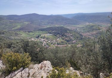
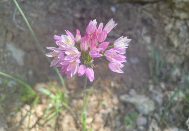
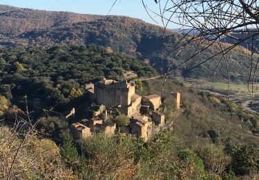
Randonnée Marche de 21 km à découvrir à Occitanie, Hérault, Dio-et-Valquières. Cette randonnée est proposée par richard21220.
Description
Hôtels à 34240 LAMALOU LES BAINS Tél OT 04 67 95 70 91
Gîtes et Chambres d'Hôtes à 34240 LAMALOU LES BAINS Tél OT 04 67 95 70 91
Localisation
Pays :
France
Région :
Occitanie
Département/Province :
Hérault
Commune :
Dio-et-Valquières
Localité :
Unknown
Départ:(Dec)
Départ:(UTM)
516880 ; 4835144 (31T) N.
Commentaires
Randonnées à proximité
![Randonnée Marche Lunas - Laval de Nize - Briandes - ND de Nize - Photo](https://media.geolcdn.com/t/375/260/a871bb29-ae4b-4227-a102-498b734b8914.jpg&format=jpg&maxdim=2)
![Marche Marche](https://static1.geolcdn.com/sitytour/trail-icons/101.png)
Laval de Nize - Briandes - ND de Nize
Marche
Difficile
(1)
Lunas,
Occitanie,
Hérault,
France
![](/images/other/stat-length.png)
9,6 km | 13,7 km-effort
3h 7min
![](https://static1.geolcdn.com/siteimages/upload/files/16400158638029165_repeat_loop_refresh_sync_direction_icon.png)
Oui
![Randonnée Marche Mérifons - Chemin Vicinal N°13 de Carlencas - Photo](https://media.geolcdn.com/t/375/260/ext.jpg?maxdim=2&url=https%3A%2F%2Fservices.sitytrail.com%2FGeolivesWS%2FDownloadMedia.ashx%3FTrailID%3D924493%26Media%3D40107a9e-9964-4bb5-99a1-0b5e778d47e3.jpg)
![Marche Marche](https://static1.geolcdn.com/sitytour/trail-icons/101.png)
Chemin Vicinal N°13 de Carlencas
Marche
Moyen
(2)
Mérifons,
Occitanie,
Hérault,
France
![](/images/other/stat-length.png)
8,5 km | 12 km-effort
2h 30min
![](https://static1.geolcdn.com/siteimages/upload/files/16400158638029165_repeat_loop_refresh_sync_direction_icon.png)
Oui
![Randonnée Marche Le Bousquet-d'Orb - Bousquet d orb Le Mont Sénégra - Photo](https://media.geolcdn.com/t/375/260/ext.jpg?maxdim=2&url=https%3A%2F%2Fstatic1.geolcdn.com%2Fsiteimages%2Fupload%2Ffiles%2F1553511878bg_sport_marche.png)
![Marche Marche](https://static1.geolcdn.com/sitytour/trail-icons/101.png)
Bousquet d orb Le Mont Sénégra
Marche
Difficile
(1)
Le Bousquet-d'Orb,
Occitanie,
Hérault,
France
![](/images/other/stat-length.png)
11,4 km | 17,6 km-effort
4h 0min
![](https://static1.geolcdn.com/siteimages/upload/files/16400158638029165_repeat_loop_refresh_sync_direction_icon.png)
Oui
![Randonnée Marche Lavalette - Laval de Nize - Photo](https://media.geolcdn.com/t/375/260/ext.jpg?maxdim=2&url=https%3A%2F%2Fstatic1.geolcdn.com%2Fsiteimages%2Fupload%2Ffiles%2F1553511878bg_sport_marche.png)
![Marche Marche](https://static1.geolcdn.com/sitytour/trail-icons/101.png)
Laval de Nize
Marche
Facile
(1)
Lavalette,
Occitanie,
Hérault,
France
![](/images/other/stat-length.png)
7,4 km | 11,2 km-effort
2h 26min
![](https://static1.geolcdn.com/siteimages/upload/files/16400158638029165_repeat_loop_refresh_sync_direction_icon.png)
Oui
![Randonnée Marche Carlencas-et-Levas - Carlencas - Photo](https://media.geolcdn.com/t/375/260/0339a666-2d2a-4cee-8c31-0571be47d361.jpg&format=jpg&maxdim=2)
![Marche Marche](https://static1.geolcdn.com/sitytour/trail-icons/101.png)
Carlencas
Marche
Facile
Carlencas-et-Levas,
Occitanie,
Hérault,
France
![](/images/other/stat-length.png)
44 km | 60 km-effort
4h 30min
![](https://static1.geolcdn.com/siteimages/upload/files/16400158638029165_repeat_loop_refresh_sync_direction_icon.png)
Non
![Randonnée Marche Lunas - Minas - Photo](https://media.geolcdn.com/t/375/260/973aced9-2f4c-49f6-8497-38a7aa10afcc.jpg&format=jpg&maxdim=2)
![Marche Marche](https://static1.geolcdn.com/sitytour/trail-icons/101.png)
![Randonnée Marche Dio-et-Valquières - rando gourmande - Photo](https://media.geolcdn.com/t/375/260/aad3ee6f-3e75-4d4e-8792-5c2b1fc59800.jpg&format=jpg&maxdim=2)
![Marche Marche](https://static1.geolcdn.com/sitytour/trail-icons/101.png)
rando gourmande
Marche
Moyen
Dio-et-Valquières,
Occitanie,
Hérault,
France
![](/images/other/stat-length.png)
14,4 km | 19,3 km-effort
3h 27min
![](https://static1.geolcdn.com/siteimages/upload/files/16400158638029165_repeat_loop_refresh_sync_direction_icon.png)
Oui
![Randonnée Marche Lunas - Les pins de Lunas - Photo](https://media.geolcdn.com/t/375/260/9a20561d-f40b-4f22-addf-c2ec1b9698f2.jpg&format=jpg&maxdim=2)
![Marche Marche](https://static1.geolcdn.com/sitytour/trail-icons/101.png)
Les pins de Lunas
Marche
Moyen
Lunas,
Occitanie,
Hérault,
France
![](/images/other/stat-length.png)
13,2 km | 18,5 km-effort
5h 33min
![](https://static1.geolcdn.com/siteimages/upload/files/16400158638029165_repeat_loop_refresh_sync_direction_icon.png)
Oui
![Randonnée Marche Dio-et-Valquières - Valquières - Plo du Laurier - Photo](https://media.geolcdn.com/t/375/260/6a9b546c-011f-40ca-aac8-545905aab989.jpg&format=jpg&maxdim=2)
![Marche Marche](https://static1.geolcdn.com/sitytour/trail-icons/101.png)
Valquières - Plo du Laurier
Marche
Difficile
Dio-et-Valquières,
Occitanie,
Hérault,
France
![](/images/other/stat-length.png)
14,9 km | 21 km-effort
5h 7min
![](https://static1.geolcdn.com/siteimages/upload/files/16400158638029165_repeat_loop_refresh_sync_direction_icon.png)
Oui