![](/images/other/stat-length.png)
![Randonnée Marche Bidarray - BIDARRAY le tour - Photo](https://media.geolcdn.com/t/1900/400/ext.pjpeg?maxdim=2&url=https%3A%2F%2Fservices.sitytrail.com%2FGeolivesWS%2FDownloadMedia.ashx%3FTrailID%3D679629%26Media%3Dfix__20140916101828.jpg)
BIDARRAY le tour
DECHAMPD
Utilisateur
![Longueur](/images/other/stat-length.png)
Longueur
7,8 km
![Altitude max](https://static1.geolcdn.com/siteimages/upload/files/1508320355ic_sort_altitude_max_24dp.png)
Altitude max
366 m
![Dénivelé positif](https://static1.geolcdn.com/siteimages/upload/files/1508320355ic_sort_den_pos_24dp.png)
Dénivelé positif
379 m
![Km-Effort](/images/other/stat-length.png)
Km-Effort
12,8 km
![Altitude min](https://static1.geolcdn.com/siteimages/upload/files/1508320355ic_sort_altitude_min_24dp.png)
Altitude min
75 m
![Dénivelé négatif](https://static1.geolcdn.com/siteimages/upload/files/1508320355ic_sort_den_neg_24dp.png)
Dénivelé négatif
377 m
![Boucle](https://static1.geolcdn.com/siteimages/upload/files/16400158638029165_repeat_loop_refresh_sync_direction_icon.png)
Boucle
Oui
Date de création :
2019-01-14 17:31:03.09
Dernière modification :
2019-01-14 17:31:03.137
![Marche](https://static1.geolcdn.com/sitytour/trail-icons/101.png)
3h08
Difficulté : Facile
![Scannez ce code QR pour ouvrir la randonnée dans l'application SityTrail](https://capi.geolives.com/qq0zvz2zws4bq2lad0pu/sitytour/trails/679629/qr.png?size=200)
Application GPS de randonnée GRATUITE
À propos
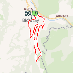
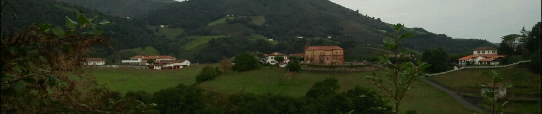
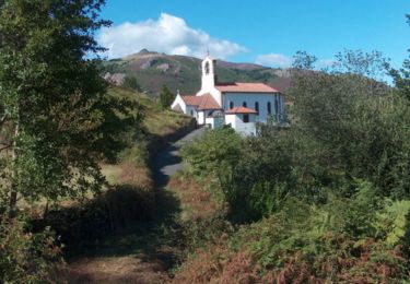
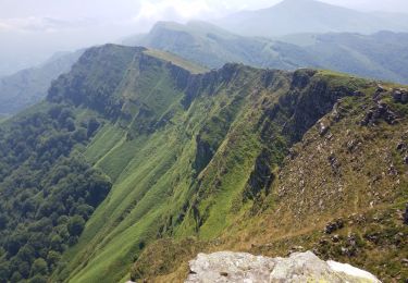
Randonnée Marche de 7,8 km à découvrir à Nouvelle-Aquitaine, Pyrénées-Atlantiques, Bidarray. Cette randonnée est proposée par DECHAMPD.
Description
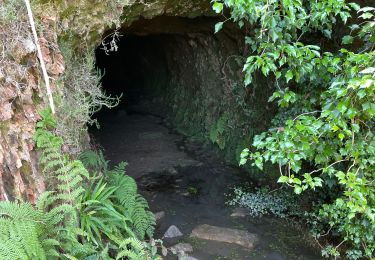
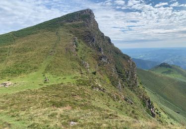
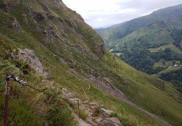
sur les hauteurs de Bidarray en passant par Kuxiborda, Otsandaburua, Harlepoko et le pont Noblia.
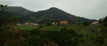
Circuit permettant de partir du village perché de Bidarray, de le traverser et d'y revenir en ayant pris un peu de hauteur.
Localisation
Pays :
France
Région :
Nouvelle-Aquitaine
Département/Province :
Pyrénées-Atlantiques
Commune :
Bidarray
Localité :
Unknown
Départ:(Dec)
Départ:(UTM)
633911 ; 4791634 (30T) N.
Commentaires
Randonnées à proximité
![Randonnée Marche Ossès - haltzamendi - Photo](https://media.geolcdn.com/t/375/260/ext.jpg?maxdim=2&url=https%3A%2F%2Fservices.sitytrail.com%2FGeolivesWS%2FDownloadMedia.ashx%3FTrailID%3D131438%26Media%3D20120601120504.jpg)
![Marche Marche](https://static1.geolcdn.com/sitytour/trail-icons/101.png)
haltzamendi
Marche
Très facile
(1)
Ossès,
Nouvelle-Aquitaine,
Pyrénées-Atlantiques,
France
![](/images/other/stat-length.png)
14,5 km | 26 km-effort
5h 13min
![](https://static1.geolcdn.com/siteimages/upload/files/16400158638029165_repeat_loop_refresh_sync_direction_icon.png)
Oui
![Randonnée Marche Saint-Martin-d'Arrossa - 2023-05-31_09h58m49_st-martin-d-arrossa-larla-sentier-des-mines - Photo](https://media.geolcdn.com/t/375/260/081fd08b-686b-4593-b7f3-5f772f60fe1d.jpg&format=jpg&maxdim=2)
![Marche Marche](https://static1.geolcdn.com/sitytour/trail-icons/101.png)
2023-05-31_09h58m49_st-martin-d-arrossa-larla-sentier-des-mines
Marche
Difficile
(1)
Saint-Martin-d'Arrossa,
Nouvelle-Aquitaine,
Pyrénées-Atlantiques,
France
![](/images/other/stat-length.png)
9,7 km | 16 km-effort
3h 38min
![](https://static1.geolcdn.com/siteimages/upload/files/16400158638029165_repeat_loop_refresh_sync_direction_icon.png)
Oui
![Randonnée Marche Bidarray - Peñas d'Itxusi - Photo](https://media.geolcdn.com/t/375/260/ext.jpg?maxdim=2&url=https%3A%2F%2Fservices.sitytrail.com%2FGeolivesWS%2FDownloadMedia.ashx%3FTrailID%3D609763%26Media%3D20160806162954.jpg)
![Marche Marche](https://static1.geolcdn.com/sitytour/trail-icons/101.png)
Peñas d'Itxusi
Marche
Facile
(2)
Bidarray,
Nouvelle-Aquitaine,
Pyrénées-Atlantiques,
France
![](/images/other/stat-length.png)
11 km | 19,5 km-effort
3h 25min
![](https://static1.geolcdn.com/siteimages/upload/files/16400158638029165_repeat_loop_refresh_sync_direction_icon.png)
Oui
![Randonnée Marche Saint-Martin-d'Arrossa - Sommet de Larla en boucle de Saint Martin d'Arrossa - Photo](https://media.geolcdn.com/t/375/260/ext.jpg?maxdim=2&url=https%3A%2F%2Fservices.sitytrail.com%2FGeolivesWS%2FDownloadMedia.ashx%3FTrailID%3D105703%26Media%3D9545_1.jpg)
![Marche Marche](https://static1.geolcdn.com/sitytour/trail-icons/101.png)
Sommet de Larla en boucle de Saint Martin d'Arrossa
Marche
Difficile
(2)
Saint-Martin-d'Arrossa,
Nouvelle-Aquitaine,
Pyrénées-Atlantiques,
France
![](/images/other/stat-length.png)
9,5 km | 15,9 km-effort
4h 0min
![](https://static1.geolcdn.com/siteimages/upload/files/16400158638029165_repeat_loop_refresh_sync_direction_icon.png)
Oui
![Randonnée Marche Itxassou - L'ARTZAMENDI - Photo](https://media.geolcdn.com/t/375/260/ext.jpg?maxdim=2&url=https%3A%2F%2Fstatic1.geolcdn.com%2Fsiteimages%2Fupload%2Ffiles%2F1553511878bg_sport_marche.png)
![Marche Marche](https://static1.geolcdn.com/sitytour/trail-icons/101.png)
L'ARTZAMENDI
Marche
Facile
(1)
Itxassou,
Nouvelle-Aquitaine,
Pyrénées-Atlantiques,
France
![](/images/other/stat-length.png)
8,3 km | 18,8 km-effort
Inconnu
![](https://static1.geolcdn.com/siteimages/upload/files/16400158638029165_repeat_loop_refresh_sync_direction_icon.png)
Oui
![Randonnée Marche Saint-Martin-d'Arrossa - Chemin des mineurs - Photo](https://media.geolcdn.com/t/375/260/a7158dce-4b46-40b4-90d2-26adeb29ea9e.jpg&format=jpg&maxdim=2)
![Marche Marche](https://static1.geolcdn.com/sitytour/trail-icons/101.png)
Chemin des mineurs
Marche
Moyen
(1)
Saint-Martin-d'Arrossa,
Nouvelle-Aquitaine,
Pyrénées-Atlantiques,
France
![](/images/other/stat-length.png)
9,7 km | 16 km-effort
3h 23min
![](https://static1.geolcdn.com/siteimages/upload/files/16400158638029165_repeat_loop_refresh_sync_direction_icon.png)
Oui
![Randonnée Marche Bidarray - GR 10 - 4ème étape : Bidarray - St Etienne de Baigorryg - Photo](https://media.geolcdn.com/t/375/260/53e7114b-32dc-49a5-bdd1-cbb91a0bddd1.jpg&format=jpg&maxdim=2)
![Marche Marche](https://static1.geolcdn.com/sitytour/trail-icons/101.png)
GR 10 - 4ème étape : Bidarray - St Etienne de Baigorryg
Marche
Très difficile
Bidarray,
Nouvelle-Aquitaine,
Pyrénées-Atlantiques,
France
![](/images/other/stat-length.png)
18,1 km | 34 km-effort
4h 58min
![](https://static1.geolcdn.com/siteimages/upload/files/16400158638029165_repeat_loop_refresh_sync_direction_icon.png)
Non
![Randonnée Marche Bidarray - col de mehatse - Photo](https://media.geolcdn.com/t/375/260/9c828f55-e725-48bd-9628-d9cca0627ae9.jpg&format=jpg&maxdim=2)
![Marche Marche](https://static1.geolcdn.com/sitytour/trail-icons/101.png)
col de mehatse
Marche
Facile
Bidarray,
Nouvelle-Aquitaine,
Pyrénées-Atlantiques,
France
![](/images/other/stat-length.png)
17,7 km | 29 km-effort
4h 32min
![](https://static1.geolcdn.com/siteimages/upload/files/16400158638029165_repeat_loop_refresh_sync_direction_icon.png)
Oui
![Randonnée Marche Bidarray - bidarray Iparla - Photo](https://media.geolcdn.com/t/375/260/94a45b77-9edd-43fb-b462-24a6c9e75566.jpg&format=jpg&maxdim=2)
![Marche Marche](https://static1.geolcdn.com/sitytour/trail-icons/101.png)
bidarray Iparla
Marche
Difficile
Bidarray,
Nouvelle-Aquitaine,
Pyrénées-Atlantiques,
France
![](/images/other/stat-length.png)
25 km | 44 km-effort
6h 49min
![](https://static1.geolcdn.com/siteimages/upload/files/16400158638029165_repeat_loop_refresh_sync_direction_icon.png)
Oui