![](/images/other/stat-length.png)
![Randonnée Autre activité Abbeville - Picardie - Ligne 289 - St-Pol-de-Ternoise - Abbeville (Section Auxi-le-Château Abbeville) - Photo](https://media.geolcdn.com/t/1900/400/ext.pjpeg?maxdim=2&url=https%3A%2F%2Fstatic1.geolcdn.com%2Fsiteimages%2Fupload%2Ffiles%2F1545311037marcheuse_200dpi.jpg)
Picardie - Ligne 289 - St-Pol-de-Ternoise - Abbeville (Section Auxi-le-Château Abbeville)
mich54
Utilisateur
![Longueur](/images/other/stat-length.png)
![Altitude max](https://static1.geolcdn.com/siteimages/upload/files/1508320355ic_sort_altitude_max_24dp.png)
![Dénivelé positif](https://static1.geolcdn.com/siteimages/upload/files/1508320355ic_sort_den_pos_24dp.png)
![Km-Effort](/images/other/stat-length.png)
![Altitude min](https://static1.geolcdn.com/siteimages/upload/files/1508320355ic_sort_altitude_min_24dp.png)
![Dénivelé négatif](https://static1.geolcdn.com/siteimages/upload/files/1508320355ic_sort_den_neg_24dp.png)
![Boucle](https://static1.geolcdn.com/siteimages/upload/files/16400158638029165_repeat_loop_refresh_sync_direction_icon.png)
![Autre activité](https://static1.geolcdn.com/sitytour/trail-icons/900.png)
5m
Difficulté : Inconnu
![Scannez ce code QR pour ouvrir la randonnée dans l'application SityTrail](https://capi.geolives.com/qq0zvz2zws4bq2lad0pu/sitytour/trails/667441/qr.png?size=200)
Application GPS de randonnée GRATUITE
À propos
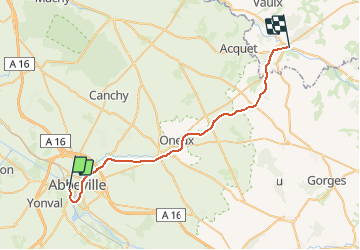
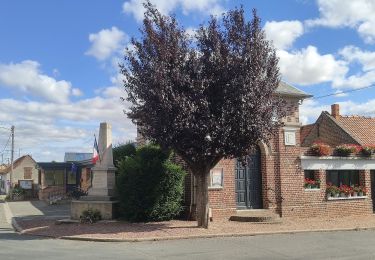
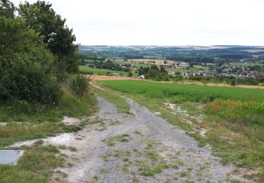
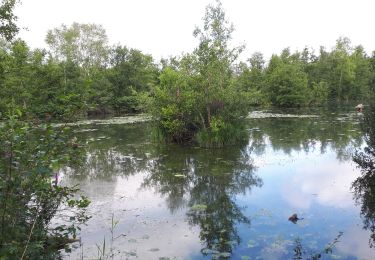
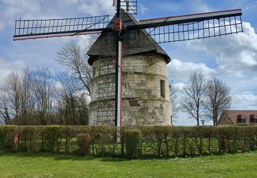
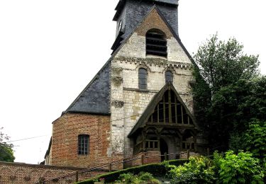
Randonnée Autre activité de 32 km à découvrir à Hauts-de-France, Somme, Abbeville. Cette randonnée est proposée par mich54.
Description
La ligne de Fives à Abbeville est une ligne ferroviaire française à écartement standard de la région Hauts-de-France. Elle relie la gare de Lille-Flandres à celle de Saint-Pol-sur-Ternoise. Elle continuait autrefois jusqu'à la gare d'Abbeville.
Elle constitue la ligne no 289 0001 du réseau ferré national.
Déclassement:
Section de Auxi-le-Château à Abbeville (PK 102,300 à 134,130) : 17 octobre 1994.(Source Wikipédia)
Localisation
Commentaires
Randonnées à proximité
![Randonnée Marche Yonval - Les 3 Fétus - Yonval - Photo](https://media.geolcdn.com/t/375/260/ext.jpg?maxdim=2&url=https%3A%2F%2Fservices.sitytrail.com%2FGeolivesWS%2FDownloadMedia.ashx%3FTrailID%3D108581%26Media%3D1489_1.jpg)
![Marche Marche](https://static1.geolcdn.com/sitytour/trail-icons/101.png)
Marche
![](/images/other/stat-length.png)
![](https://static1.geolcdn.com/siteimages/upload/files/16400158638029165_repeat_loop_refresh_sync_direction_icon.png)
![Randonnée A pied Eaucourt-sur-Somme - Le Moulin d'Eaucourt - Photo](https://media.geolcdn.com/t/375/260/9b9489ba-5456-4746-a4ec-6f9e1c594e14.jpeg&format=jpg&maxdim=2)
![A pied A pied](https://static1.geolcdn.com/sitytour/trail-icons/100.png)
A pied
![](/images/other/stat-length.png)
![](https://static1.geolcdn.com/siteimages/upload/files/16400158638029165_repeat_loop_refresh_sync_direction_icon.png)
![Randonnée Marche Eaucourt-sur-Somme - le moulin d'Eaucourt - Photo](https://media.geolcdn.com/t/375/260/4264d59a-a879-4d1d-a4fc-208df5e572be.jpg&format=jpg&maxdim=2)
![Marche Marche](https://static1.geolcdn.com/sitytour/trail-icons/101.png)
Marche
![](/images/other/stat-length.png)
![](https://static1.geolcdn.com/siteimages/upload/files/16400158638029165_repeat_loop_refresh_sync_direction_icon.png)
![Randonnée Marche Mareuil-Caubert - Au travers des étangs - Photo](https://media.geolcdn.com/t/375/260/3d0ba1a8-2447-466c-a227-2f133fd97408.jpg&format=jpg&maxdim=2)
![Marche Marche](https://static1.geolcdn.com/sitytour/trail-icons/101.png)
Marche
![](/images/other/stat-length.png)
![](https://static1.geolcdn.com/siteimages/upload/files/16400158638029165_repeat_loop_refresh_sync_direction_icon.png)
![Randonnée Vélo Abbeville - la baie de Somme à vélo - Photo](https://media.geolcdn.com/t/375/260/ext.jpg?maxdim=2&url=https%3A%2F%2Fservices.sitytrail.com%2FGeolivesWS%2FDownloadMedia.ashx%3FTrailID%3D1132041%26Media%3D20190407095358.jpg)
![Vélo Vélo](https://static1.geolcdn.com/sitytour/trail-icons/200.png)
Vélo
![](/images/other/stat-length.png)
![](https://static1.geolcdn.com/siteimages/upload/files/16400158638029165_repeat_loop_refresh_sync_direction_icon.png)
![Randonnée Marche Abbeville - Abbeville chemin du Pâtis - Photo](https://media.geolcdn.com/t/375/260/ba947a24-30d5-4d85-9868-f6de26ac7666.jpg&format=jpg&maxdim=2)
![Marche Marche](https://static1.geolcdn.com/sitytour/trail-icons/101.png)
Marche
![](/images/other/stat-length.png)
![](https://static1.geolcdn.com/siteimages/upload/files/16400158638029165_repeat_loop_refresh_sync_direction_icon.png)
![Randonnée Marche Eaucourt-sur-Somme - lp80_eaucourt - Photo](https://media.geolcdn.com/t/375/260/9ce553b3-b2ee-49ec-b994-ab1db0443503.jpg&format=jpg&maxdim=2)
![Marche Marche](https://static1.geolcdn.com/sitytour/trail-icons/101.png)
Marche
![](/images/other/stat-length.png)
![](https://static1.geolcdn.com/siteimages/upload/files/16400158638029165_repeat_loop_refresh_sync_direction_icon.png)
![Randonnée Marche Abbeville - Abbeville Grands Lavier - Photo](https://media.geolcdn.com/t/375/260/978d0648-091c-45aa-876f-de0aec8e1ab5.jpg&format=jpg&maxdim=2)
![Marche Marche](https://static1.geolcdn.com/sitytour/trail-icons/101.png)
Marche
![](/images/other/stat-length.png)
![](https://static1.geolcdn.com/siteimages/upload/files/16400158638029165_repeat_loop_refresh_sync_direction_icon.png)
![Randonnée A pied Mareuil-Caubert - La Vallée de Frosme - Photo](https://media.geolcdn.com/t/375/260/cf87097c-bd8e-42ef-880c-3a413e4f1840.jpeg&format=jpg&maxdim=2)
![A pied A pied](https://static1.geolcdn.com/sitytour/trail-icons/100.png)
A pied
![](/images/other/stat-length.png)
![](https://static1.geolcdn.com/siteimages/upload/files/16400158638029165_repeat_loop_refresh_sync_direction_icon.png)