


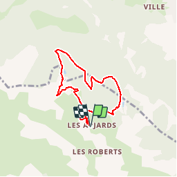

14,7 km | 26 km-effort


Utilisateur


Application GPS de randonnée GRATUITE
 SityTrail
IGN / Instituts géographiques
SityTrail World
Le monde est à vous
Randonnée Raquettes à neige de 6,4 km à découvrir à Provence-Alpes-Côte d'Azur, Hautes-Alpes, Freissinières. Cette randonnée est proposée par markford.
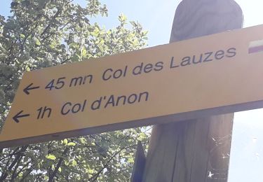
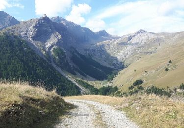
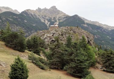
Tour Classique.
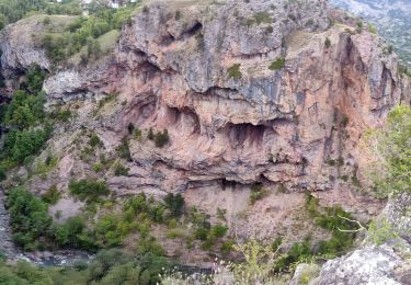
Bel Vues sur Des Ecrins et Guillestre/Montdauphine. Pic Le Simous ideal pour cassé le croûte.

Marche
Marche

Marche
Marche
Marche
Marche
Marche
Marche
Marche