![](/images/other/stat-length.png)
![Randonnée Marche Olette - rando autour d'Evol - Photo](https://media.geolcdn.com/t/1900/400/ext.pjpeg?maxdim=2&url=https%3A%2F%2Fservices.sitytrail.com%2FGeolivesWS%2FDownloadMedia.ashx%3FTrailID%3D658583%26Media%3D20161110144632.jpg)
rando autour d'Evol
ThonyM
Utilisateur
![Longueur](/images/other/stat-length.png)
Longueur
17,4 km
![Altitude max](https://static1.geolcdn.com/siteimages/upload/files/1508320355ic_sort_altitude_max_24dp.png)
Altitude max
1664 m
![Dénivelé positif](https://static1.geolcdn.com/siteimages/upload/files/1508320355ic_sort_den_pos_24dp.png)
Dénivelé positif
914 m
![Km-Effort](/images/other/stat-length.png)
Km-Effort
30 km
![Altitude min](https://static1.geolcdn.com/siteimages/upload/files/1508320355ic_sort_altitude_min_24dp.png)
Altitude min
790 m
![Dénivelé négatif](https://static1.geolcdn.com/siteimages/upload/files/1508320355ic_sort_den_neg_24dp.png)
Dénivelé négatif
917 m
![Boucle](https://static1.geolcdn.com/siteimages/upload/files/16400158638029165_repeat_loop_refresh_sync_direction_icon.png)
Boucle
Oui
Date de création :
2016-11-10 00:00:00.0
Dernière modification :
2016-11-10 00:00:00.0
![Marche](https://static1.geolcdn.com/sitytour/trail-icons/101.png)
6h07
Difficulté : Moyen
![Scannez ce code QR pour ouvrir la randonnée dans l'application SityTrail](https://capi.geolives.com/qq0zvz2zws4bq2lad0pu/sitytour/trails/658583/qr.png?size=200)
Application GPS de randonnée GRATUITE
À propos
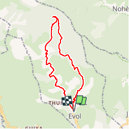
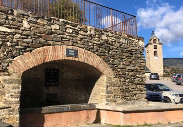
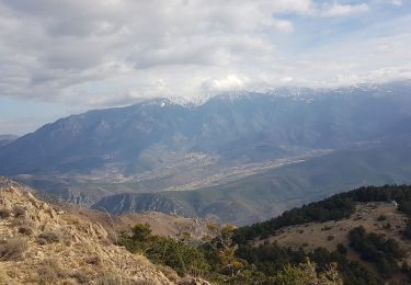
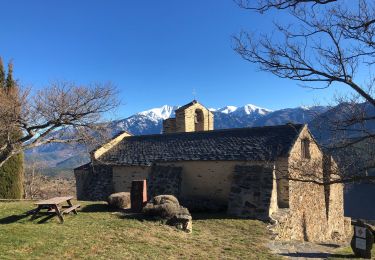
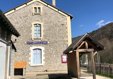
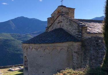
Randonnée Marche de 17,4 km à découvrir à Occitanie, Pyrénées-Orientales, Olette. Cette randonnée est proposée par ThonyM.
Description
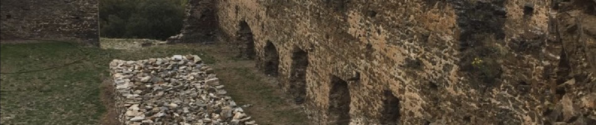
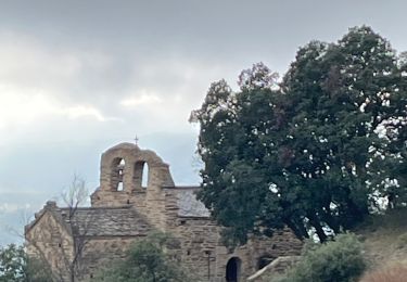
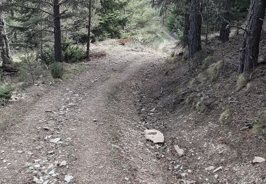
Pas de difficulté majeure. Dénivelé 904m dénivelé - 897m. Un très bel Orri sur le retour et le château d'Evol qui mérite une petite halte
Localisation
Pays :
France
Région :
Occitanie
Département/Province :
Pyrénées-Orientales
Commune :
Olette
Localité :
Unknown
Départ:(Dec)
Départ:(UTM)
438762 ; 4713451 (31T) N.
Commentaires
Randonnées à proximité
![Randonnée Marche Olette - Evol village et chateau ( Olette) - Photo](https://media.geolcdn.com/t/375/260/ext.jpg?maxdim=2&url=https%3A%2F%2Fstatic1.geolcdn.com%2Fsiteimages%2Fupload%2Ffiles%2F1553511878bg_sport_marche.png)
![Marche Marche](https://static1.geolcdn.com/sitytour/trail-icons/101.png)
Evol village et chateau ( Olette)
Marche
Facile
(1)
Olette,
Occitanie,
Pyrénées-Orientales,
France
![](/images/other/stat-length.png)
3,2 km | 5,6 km-effort
1h 16min
![](https://static1.geolcdn.com/siteimages/upload/files/16400158638029165_repeat_loop_refresh_sync_direction_icon.png)
Oui
![Randonnée Marche Jujols - Jujols 1 - Photo](https://media.geolcdn.com/t/375/260/ext.jpg?maxdim=2&url=https%3A%2F%2Fstatic1.geolcdn.com%2Fsiteimages%2Fupload%2Ffiles%2F1553511878bg_sport_marche.png)
![Marche Marche](https://static1.geolcdn.com/sitytour/trail-icons/101.png)
Jujols 1
Marche
Moyen
(1)
Jujols,
Occitanie,
Pyrénées-Orientales,
France
![](/images/other/stat-length.png)
13,2 km | 22 km-effort
4h 2min
![](https://static1.geolcdn.com/siteimages/upload/files/16400158638029165_repeat_loop_refresh_sync_direction_icon.png)
Oui
![Randonnée sport Serdinya - 20241101 Flassa - Photo](https://media.geolcdn.com/t/375/260/f07b9580-16b6-4e63-93d6-f8d7129b2a58.jpg&format=jpg&maxdim=2)
20241101 Flassa
sport
Très facile
Serdinya,
Occitanie,
Pyrénées-Orientales,
France
![](/images/other/stat-length.png)
13,6 km | 25 km-effort
Inconnu
![](https://static1.geolcdn.com/siteimages/upload/files/16400158638029165_repeat_loop_refresh_sync_direction_icon.png)
Oui
![Randonnée Marche Jujols - jujols marbre rouge - Photo](https://media.geolcdn.com/t/375/260/d6c9b4b1-cdb0-48e3-bb77-be480f69b8dc.jpg&format=jpg&maxdim=2)
![Marche Marche](https://static1.geolcdn.com/sitytour/trail-icons/101.png)
jujols marbre rouge
Marche
Très difficile
Jujols,
Occitanie,
Pyrénées-Orientales,
France
![](/images/other/stat-length.png)
16,5 km | 28 km-effort
9h 13min
![](https://static1.geolcdn.com/siteimages/upload/files/16400158638029165_repeat_loop_refresh_sync_direction_icon.png)
Oui
![Randonnée Marche Canaveilles - 20221120 Canaveilles - Llar - Photo](https://media.geolcdn.com/t/375/260/027e0715-7eae-4325-8722-3c8908e90175.jpg&format=jpg&maxdim=2)
![Marche Marche](https://static1.geolcdn.com/sitytour/trail-icons/101.png)
20221120 Canaveilles - Llar
Marche
Moyen
Canaveilles,
Occitanie,
Pyrénées-Orientales,
France
![](/images/other/stat-length.png)
11 km | 20 km-effort
3h 15min
![](https://static1.geolcdn.com/siteimages/upload/files/16400158638029165_repeat_loop_refresh_sync_direction_icon.png)
Oui
![Randonnée Marche Serdinya - flassa. taratera 850 positif 13km 4h30 - Photo](https://media.geolcdn.com/t/375/260/b3222516-f8b3-464a-ab73-685b2064e32d.jpg&format=jpg&maxdim=2)
![Marche Marche](https://static1.geolcdn.com/sitytour/trail-icons/101.png)
flassa. taratera 850 positif 13km 4h30
Marche
Très difficile
Serdinya,
Occitanie,
Pyrénées-Orientales,
France
![](/images/other/stat-length.png)
13,8 km | 25 km-effort
4h 21min
![](https://static1.geolcdn.com/siteimages/upload/files/16400158638029165_repeat_loop_refresh_sync_direction_icon.png)
Oui
![Randonnée Marche Olette - 20211216 Olette - Photo](https://media.geolcdn.com/t/375/260/0a1ec878-6117-4da5-804f-f7b247baa177.jpg&format=jpg&maxdim=2)
![Marche Marche](https://static1.geolcdn.com/sitytour/trail-icons/101.png)
20211216 Olette
Marche
Moyen
Olette,
Occitanie,
Pyrénées-Orientales,
France
![](/images/other/stat-length.png)
16 km | 28 km-effort
5h 8min
![](https://static1.geolcdn.com/siteimages/upload/files/16400158638029165_repeat_loop_refresh_sync_direction_icon.png)
Oui
![Randonnée Marche Olette - 20210403 boucle Olette par Evol - Photo](https://media.geolcdn.com/t/375/260/5c172bb2-668b-4905-9dce-2682f331eea1.jpg&format=jpg&maxdim=2)
![Marche Marche](https://static1.geolcdn.com/sitytour/trail-icons/101.png)
20210403 boucle Olette par Evol
Marche
Difficile
Olette,
Occitanie,
Pyrénées-Orientales,
France
![](/images/other/stat-length.png)
18 km | 32 km-effort
5h 31min
![](https://static1.geolcdn.com/siteimages/upload/files/16400158638029165_repeat_loop_refresh_sync_direction_icon.png)
Oui
![Randonnée Marche Jujols - 20210103 Jujols sentier des bergeries +++ - Photo](https://media.geolcdn.com/t/375/260/73e92cc2-7baa-45c6-b83c-f1c73626916e.jpg&format=jpg&maxdim=2)
![Marche Marche](https://static1.geolcdn.com/sitytour/trail-icons/101.png)
20210103 Jujols sentier des bergeries +++
Marche
Moyen
(1)
Jujols,
Occitanie,
Pyrénées-Orientales,
France
![](/images/other/stat-length.png)
13,1 km | 25 km-effort
4h 23min
![](https://static1.geolcdn.com/siteimages/upload/files/16400158638029165_repeat_loop_refresh_sync_direction_icon.png)
Oui