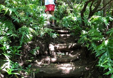
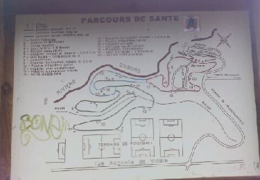
Randonnée Marche Saint-Pierre - visite notre dame de la paix - Photo

visite notre dame de la paix

 francejpp
francejpp

Utilisateur

© OpenStreetMap contributors
Longueur
Longueur
21 km
Altitude max
Altitude max
1624 m
Dénivelé positif
Dénivelé positif
1038 m
Km-Effort
Km-Effort  
34 km
Altitude min
Altitude min
629 m
Dénivelé négatif
Dénivelé négatif
1039 m
Boucle
Boucle
Oui
Date de création :
2016-10-29 00:00:00.0
Dernière modification :
2016-10-29 00:00:00.0

(0 Avis)

Marche
Marche
6h22
Difficulté : Moyen

Scannez ce code QR pour ouvrir la randonnée dans l'application SityTrail

Application GPS de randonnée GRATUITE

Logo SityTrail SityTrail

IGN / Instituts géographiques

Télécharger SityTrail sur l'App Store Télécharger SityTrail sur Google Play

Logo SityTrail SityTrail World

Le monde est à vous

Télécharger SityTrail sur l'App Store Télécharger SityTrail sur Google Play Télécharger SityTrail sur Huawei AppGallery

À propos

Randonnée Marche de 21 km à découvrir à La Réunion, Inconnu, Saint-Pierre. Cette randonnée est proposée par francejpp.

Profil altimétrique

Localisation

Pays :
France
Région :
La Réunion
Département/Province :
Inconnu
Commune :
Saint-Pierre
Localité :
Unknown
Départ:(Dec)
Départ:(UTM)
349195 ; 7642548 (40K) S.

Randonnées à proximité

Randonnée Marche Saint-Pierre - Piton Mont Vert 20190217 SH - Photo
Marche
YCDBSOYA

Marche

Moyen
(1)
Saint-Pierre, La Réunion, Inconnu, France
2,3 km | 3,7 km-effort
1h 42min
Oui
Randonnée Marche Le Tampon - La Réunion - Boucle du parcours sportif de Bel Air, par la ravine de la rivière d'abord. - Photo
Marche
olive2b

Marche

Facile
Le Tampon, La Réunion, Inconnu, France
4 km | 5,5 km-effort
1h 22min
Oui
Randonnée Marche Le Tampon - 2023 11-12-reconnaissance de la ravine cascade  - Photo
Marche
Remi44184532

Marche

Facile
Le Tampon, La Réunion, Inconnu, France
1,7 km | 2,6 km-effort
21min
Non
Randonnée Course à pied Le Tampon - parcours de santé du bel air au tampon - Photo
Course à pied
francejpp

Course à pied

Facile
(1)
Le Tampon, La Réunion, Inconnu, France
6 km | 8,2 km-effort
1h 54min
Oui
Randonnée Marche Petite-Île - Grande Anse - Course de l'ail -2 - Photo
Marche
tracegps

Marche

Moyen
Petite-Île, La Réunion, Inconnu, France
3,8 km | 7 km-effort
3h 0min
Non
Randonnée sport Saint-Pierre - RandoPitons.re #1488 - La remontée de la Ravine des Cafres depuis le Domaine Vidot à Montvert les Hauts - Photo
sport
Thierry Boisselier

sport

Très facile
Saint-Pierre, La Réunion, Inconnu, France
10 km | 16,1 km-effort
Inconnu
Oui
Randonnée Marche Saint-Pierre - Foulée des fraises  - Photo
Marche
willyd643

Marche

Très facile
Saint-Pierre, La Réunion, Inconnu, France
19 km | 33 km-effort
8h 53min
Oui
Randonnée Marche Saint-Pierre - piton mt vert - Photo
Marche
tvessiot

Marche

Facile
Saint-Pierre, La Réunion, Inconnu, France
1,9 km | 3,1 km-effort
1h 20min
Oui
Randonnée Marche Le Tampon - parcours de santé la Pointe - Photo
Marche
andreausloos

Marche

Très facile
Le Tampon, La Réunion, Inconnu, France
2,9 km | 3,7 km-effort
38min
Oui


Fermer
Mes abonnements