![](/images/other/stat-length.png)
![Randonnée Marche Thiers-sur-Thève - Thiers sur Thève 9.3 km - Photo](https://media.geolcdn.com/t/1900/400/ext.pjpeg?maxdim=2&url=https%3A%2F%2Fstatic1.geolcdn.com%2Fsiteimages%2Fupload%2Ffiles%2F1553511878bg_sport_marche.png)
Thiers sur Thève 9.3 km
GOELERANDO2
Utilisateur
![Longueur](/images/other/stat-length.png)
Longueur
9,3 km
![Altitude max](https://static1.geolcdn.com/siteimages/upload/files/1508320355ic_sort_altitude_max_24dp.png)
Altitude max
88 m
![Dénivelé positif](https://static1.geolcdn.com/siteimages/upload/files/1508320355ic_sort_den_pos_24dp.png)
Dénivelé positif
79 m
![Km-Effort](/images/other/stat-length.png)
Km-Effort
10,4 km
![Altitude min](https://static1.geolcdn.com/siteimages/upload/files/1508320355ic_sort_altitude_min_24dp.png)
Altitude min
56 m
![Dénivelé négatif](https://static1.geolcdn.com/siteimages/upload/files/1508320355ic_sort_den_neg_24dp.png)
Dénivelé négatif
73 m
![Boucle](https://static1.geolcdn.com/siteimages/upload/files/16400158638029165_repeat_loop_refresh_sync_direction_icon.png)
Boucle
Non
Date de création :
2016-10-12 00:00:00.0
Dernière modification :
2016-10-12 00:00:00.0
![Marche](https://static1.geolcdn.com/sitytour/trail-icons/101.png)
2h17
Difficulté : Moyen
![Scannez ce code QR pour ouvrir la randonnée dans l'application SityTrail](https://capi.geolives.com/qq0zvz2zws4bq2lad0pu/sitytour/trails/644986/qr.png?size=200)
Application GPS de randonnée GRATUITE
À propos
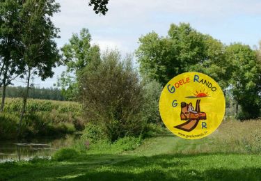
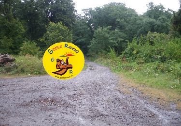
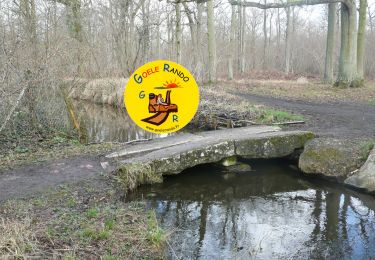
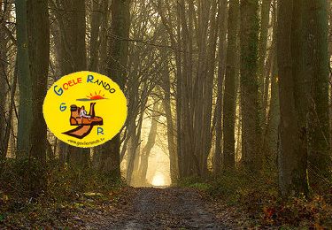
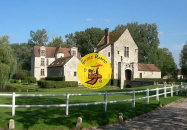
Randonnée Marche de 9,3 km à découvrir à Hauts-de-France, Oise, Thiers-sur-Thève. Cette randonnée est proposée par GOELERANDO2.
Description
Parking et départ Centre ville (Château ruiné) de Thiers sur Thève. Carte IGN 2412 OT
Long. 2°34.28' E
Lat. 49°9.18'N A/R 37 KM
Localisation
Pays :
France
Région :
Hauts-de-France
Département/Province :
Oise
Commune :
Thiers-sur-Thève
Localité :
Unknown
Départ:(Dec)
Départ:(UTM)
468729 ; 5444537 (31U) N.
Commentaires
Randonnées à proximité
![Randonnée Marche Orry-la-Ville - Dans la forêt des moines - Orry-la-Ville - Photo](https://media.geolcdn.com/t/375/260/ext.jpg?maxdim=2&url=https%3A%2F%2Fservices.sitytrail.com%2FGeolivesWS%2FDownloadMedia.ashx%3FTrailID%3D112753%26Media%3D11974_6.jpg)
![Marche Marche](https://static1.geolcdn.com/sitytour/trail-icons/101.png)
Dans la forêt des moines - Orry-la-Ville
Marche
Moyen
(2)
Orry-la-Ville,
Hauts-de-France,
Oise,
France
![](/images/other/stat-length.png)
9,2 km | 11,2 km-effort
2h 30min
![](https://static1.geolcdn.com/siteimages/upload/files/16400158638029165_repeat_loop_refresh_sync_direction_icon.png)
Oui
![Randonnée Marche Orry-la-Ville - SM_MONTGRESIN_EST_8.2Km - Photo](https://media.geolcdn.com/t/375/260/311cd4bc-107d-4955-a31f-0f6e6e4d5e34.jpg&format=jpg&maxdim=2)
![Marche Marche](https://static1.geolcdn.com/sitytour/trail-icons/101.png)
SM_MONTGRESIN_EST_8.2Km
Marche
Moyen
(6)
Orry-la-Ville,
Hauts-de-France,
Oise,
France
![](/images/other/stat-length.png)
8,2 km | 9,2 km-effort
1h 51min
![](https://static1.geolcdn.com/siteimages/upload/files/16400158638029165_repeat_loop_refresh_sync_direction_icon.png)
Oui
![Randonnée Marche Ver-sur-Launette - SM_LOISY_8.5Km - Photo](https://media.geolcdn.com/t/375/260/11537f1c-9100-4fb5-a43a-20a54cad8fb4.jpg&format=jpg&maxdim=2)
![Marche Marche](https://static1.geolcdn.com/sitytour/trail-icons/101.png)
SM_LOISY_8.5Km
Marche
Moyen
(3)
Ver-sur-Launette,
Hauts-de-France,
Oise,
France
![](/images/other/stat-length.png)
8,7 km | 9,7 km-effort
2h 12min
![](https://static1.geolcdn.com/siteimages/upload/files/16400158638029165_repeat_loop_refresh_sync_direction_icon.png)
Oui
![Randonnée Marche Senlis - SM_ERMENONVILLE Mais Forest BIAT_7.9Km - Photo](https://media.geolcdn.com/t/375/260/24a0ed61-5581-429f-adcb-b6eee500650a.jpg&format=jpg&maxdim=2)
![Marche Marche](https://static1.geolcdn.com/sitytour/trail-icons/101.png)
SM_ERMENONVILLE Mais Forest BIAT_7.9Km
Marche
Moyen
(3)
Senlis,
Hauts-de-France,
Oise,
France
![](/images/other/stat-length.png)
7,9 km | 8,9 km-effort
2h 1min
![](https://static1.geolcdn.com/siteimages/upload/files/16400158638029165_repeat_loop_refresh_sync_direction_icon.png)
Oui
![Randonnée Marche Thiers-sur-Thève - MR_THIERS-sur-THEVE_EST_La Pistole_5.9Km - Photo](https://media.geolcdn.com/t/375/260/418b7a7a-8a65-467c-a85e-c3a7d7833284.jpg&format=jpg&maxdim=2)
![Marche Marche](https://static1.geolcdn.com/sitytour/trail-icons/101.png)
MR_THIERS-sur-THEVE_EST_La Pistole_5.9Km
Marche
Moyen
(3)
Thiers-sur-Thève,
Hauts-de-France,
Oise,
France
![](/images/other/stat-length.png)
5,9 km | 6,6 km-effort
1h 30min
![](https://static1.geolcdn.com/siteimages/upload/files/16400158638029165_repeat_loop_refresh_sync_direction_icon.png)
Oui
![Randonnée Marche Mont-l'Évêque - SM_MONT-L'EVEQUE_8Km - Photo](https://media.geolcdn.com/t/375/260/c5d9fe69-6f06-4add-9173-2e50cb01e4b9.jpg&format=jpg&maxdim=2)
![Marche Marche](https://static1.geolcdn.com/sitytour/trail-icons/101.png)
SM_MONT-L'EVEQUE_8Km
Marche
Moyen
(5)
Mont-l'Évêque,
Hauts-de-France,
Oise,
France
![](/images/other/stat-length.png)
8,1 km | 9,1 km-effort
1h 59min
![](https://static1.geolcdn.com/siteimages/upload/files/16400158638029165_repeat_loop_refresh_sync_direction_icon.png)
Oui
![Randonnée Marche Pontarmé - MR_PONTARME-OUEST_4.9Km - Photo](https://media.geolcdn.com/t/375/260/dbbf6bf6-6d64-4082-9691-d7914590c7ad.jpg&format=jpg&maxdim=2)
![Marche Marche](https://static1.geolcdn.com/sitytour/trail-icons/101.png)
MR_PONTARME-OUEST_4.9Km
Marche
Facile
(2)
Pontarmé,
Hauts-de-France,
Oise,
France
![](/images/other/stat-length.png)
4,9 km | 5,5 km-effort
1h 12min
![](https://static1.geolcdn.com/siteimages/upload/files/16400158638029165_repeat_loop_refresh_sync_direction_icon.png)
Oui
![Randonnée Marche Thiers-sur-Thève - MR_THIERS-sur-THEVE_5.3Km - Photo](https://media.geolcdn.com/t/375/260/8206a345-c774-4e26-a6f6-8b17a9efeb0f.jpg&format=jpg&maxdim=2)
![Marche Marche](https://static1.geolcdn.com/sitytour/trail-icons/101.png)
MR_THIERS-sur-THEVE_5.3Km
Marche
Moyen
(4)
Thiers-sur-Thève,
Hauts-de-France,
Oise,
France
![](/images/other/stat-length.png)
5,3 km | 6 km-effort
1h 22min
![](https://static1.geolcdn.com/siteimages/upload/files/16400158638029165_repeat_loop_refresh_sync_direction_icon.png)
Oui
![Randonnée Marche Ver-sur-Launette - MR_LOISY-Nord_5.2Km - Photo](https://media.geolcdn.com/t/375/260/a1315c8f-b9f5-4658-8b4d-cccdf0e3798a.jpg&format=jpg&maxdim=2)
![Marche Marche](https://static1.geolcdn.com/sitytour/trail-icons/101.png)
MR_LOISY-Nord_5.2Km
Marche
Facile
(1)
Ver-sur-Launette,
Hauts-de-France,
Oise,
France
![](/images/other/stat-length.png)
5,2 km | 5,9 km-effort
1h 19min
![](https://static1.geolcdn.com/siteimages/upload/files/16400158638029165_repeat_loop_refresh_sync_direction_icon.png)
Oui