![](/images/other/stat-length.png)
![Randonnée Marche Bellême - Bellême - La Herse 9,7 Km - Photo](https://media.geolcdn.com/t/1900/400/ext.pjpeg?maxdim=2&url=https%3A%2F%2Fstatic1.geolcdn.com%2Fsiteimages%2Fupload%2Ffiles%2F1553511878bg_sport_marche.png)
Bellême - La Herse 9,7 Km
ODDAD78
Utilisateur
![Longueur](/images/other/stat-length.png)
![Altitude max](https://static1.geolcdn.com/siteimages/upload/files/1508320355ic_sort_altitude_max_24dp.png)
![Dénivelé positif](https://static1.geolcdn.com/siteimages/upload/files/1508320355ic_sort_den_pos_24dp.png)
![Km-Effort](/images/other/stat-length.png)
![Altitude min](https://static1.geolcdn.com/siteimages/upload/files/1508320355ic_sort_altitude_min_24dp.png)
![Dénivelé négatif](https://static1.geolcdn.com/siteimages/upload/files/1508320355ic_sort_den_neg_24dp.png)
![Boucle](https://static1.geolcdn.com/siteimages/upload/files/16400158638029165_repeat_loop_refresh_sync_direction_icon.png)
![Marche](https://static1.geolcdn.com/sitytour/trail-icons/101.png)
2h48
Difficulté : Difficile
![Scannez ce code QR pour ouvrir la randonnée dans l'application SityTrail](https://capi.geolives.com/qq0zvz2zws4bq2lad0pu/sitytour/trails/644151/qr.png?size=200)
Application GPS de randonnée GRATUITE
À propos
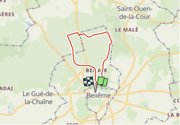
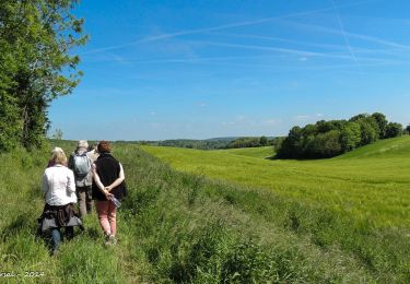
Randonnée Marche de 9,7 km à découvrir à Normandie, Orne, Bellême. Cette randonnée est proposée par ODDAD78.
Description
Départ : Bellême, place de la République Arrivée : Bellême, place de la République Balisage : PR
Communes : 1. Bellême
2. Saint-Martin-du-Vieux-Bellême 3. Sérigny
4. Saint-Ouen-de-la-Cour
5. Eperrais
1. Descendre les marches à gauche du perron de la mairie, longer la place Liégeard et emprunter la rue de la Herse.
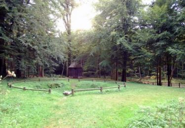
2. Au lieu-dit « Clos-Fleuri » (ancienne maisonnette de garde-barrière), suivre à droite pendant 500 m l’ancienne voie ferrée Bellême-Mortagne, bordée de peupliers, puis, prendre à droite la route forestière (la Sablonnière Rouge) pour pénétrer dans la forêt domaniale. Venir sur la route forestière de la Baudonnière puis à droite au carrefour des Sept-Bras.
3. Traverser le carrefour, prendre la route forestière du Château à gauche en direction d’Eperrais (Nord) où l’on rejoint le GR 22.
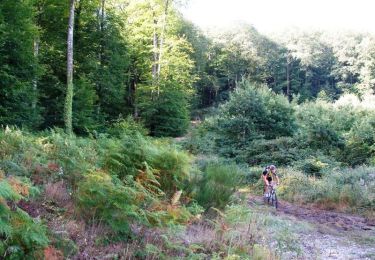
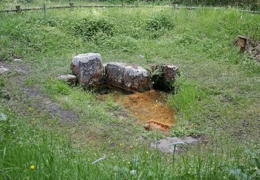
4. S’engager à gauche sur le chemin en limite des parcelles. Couper la route forestière de Mortagne et, après un parcours accidenté (bien suivre le balisage du GR 22), passer à gauche de l’étang de la Herse. Attention : PRUDENCE : Longer la D 938 à gauche sur 100 m, puis la traverser.
5. Prendre le chemin de droite, puis suivre la route forestière de Saint-Léonard à gauche pendant 500 m. Prendre à gauche le chemin de l’ancienne voie ferrée. Passer sous un pont et poursuivre sur 400 m jusqu’à l’amorce du virage.
6. Laisser le chemin de droite (GR 22) et continuer sur l’ancienne voie ferrée jusqu'à traverser avec prudence (les voitures arrivent vite) la D 938. Contourner la barrière et poursuivre tout droit jusqu'à sortir de la forêt.
7. Passer le lieu-dit « Bel-Air » et poursuivre tout droit pour retrouver le Clos-Fleuri. A partir de là, on rejoint l’itinéraire utilisé à l’aller pour revenir à Bellême.
(Pas à pas Rando-Perche)
Localisation
Commentaires
Randonnées à proximité
![Randonnée Marche Belforêt-en-Perche - Chêne séculaire - Bellême - Photo](https://media.geolcdn.com/t/375/260/ext.jpg?maxdim=2&url=https%3A%2F%2Fservices.sitytrail.com%2FGeolivesWS%2FDownloadMedia.ashx%3FTrailID%3D111658%26Media%3D7896_2.jpg)
![Marche Marche](https://static1.geolcdn.com/sitytour/trail-icons/101.png)
Marche
![](/images/other/stat-length.png)
![](https://static1.geolcdn.com/siteimages/upload/files/16400158638029165_repeat_loop_refresh_sync_direction_icon.png)
![Randonnée V.T.T. Bellême - La Bell'Rando 2005 - Photo](https://media.geolcdn.com/t/375/260/ext.jpg?maxdim=2&url=https%3A%2F%2Fservices.sitytrail.com%2FGeolivesWS%2FDownloadMedia.ashx%3FTrailID%3D101083%26Media%3D573_2.jpg)
![V.T.T. V.T.T.](https://static1.geolcdn.com/sitytour/trail-icons/202.png)
V.T.T.
![](/images/other/stat-length.png)
![](https://static1.geolcdn.com/siteimages/upload/files/16400158638029165_repeat_loop_refresh_sync_direction_icon.png)
![Randonnée Marche Bellême - de belleme a l'etang de la herse - Photo](https://media.geolcdn.com/t/375/260/cf5fb921-4c5a-49a3-9ce7-3714cc541daf.jpg&format=jpg&maxdim=2)
![Marche Marche](https://static1.geolcdn.com/sitytour/trail-icons/101.png)
Marche
![](/images/other/stat-length.png)
![](https://static1.geolcdn.com/siteimages/upload/files/16400158638029165_repeat_loop_refresh_sync_direction_icon.png)
![Randonnée A pied Saint-Martin-du-Vieux-Bellême - Chêne séculaire - Photo](https://media.geolcdn.com/t/375/260/1e7dc81d-cfa6-49bd-86cc-f4a86c5edf07.jpeg&format=jpg&maxdim=2)
![A pied A pied](https://static1.geolcdn.com/sitytour/trail-icons/100.png)
A pied
![](/images/other/stat-length.png)
![](https://static1.geolcdn.com/siteimages/upload/files/16400158638029165_repeat_loop_refresh_sync_direction_icon.png)
![Randonnée Vélo électrique Bellême - circuit des vallées bellemoises - Photo](https://media.geolcdn.com/t/375/260/8942d37a-44b6-4034-87b6-86b0b9a49d8c.jpg&format=jpg&maxdim=2)
![Vélo électrique Vélo électrique](https://static1.geolcdn.com/sitytour/trail-icons/205.png)
Vélo électrique
![](/images/other/stat-length.png)
![](https://static1.geolcdn.com/siteimages/upload/files/16400158638029165_repeat_loop_refresh_sync_direction_icon.png)
![Randonnée Marche Bellême - Bellême - Mortagne-au-Perche 23 km - Photo](https://media.geolcdn.com/t/375/260/648b0c04-c9f6-4954-a7eb-873b2f717454.jpg&format=jpg&maxdim=2)
![Marche Marche](https://static1.geolcdn.com/sitytour/trail-icons/101.png)
Marche
![](/images/other/stat-length.png)
![](https://static1.geolcdn.com/siteimages/upload/files/16400158638029165_repeat_loop_refresh_sync_direction_icon.png)
![Randonnée Marche Bellême - Bellême - Nocé/Courboyer 17 km - Photo](https://media.geolcdn.com/t/375/260/0a669ee2-665f-435c-8b9c-5b0346d2e0a4.jpg&format=jpg&maxdim=2)
![Marche Marche](https://static1.geolcdn.com/sitytour/trail-icons/101.png)
Marche
![](/images/other/stat-length.png)
![](https://static1.geolcdn.com/siteimages/upload/files/16400158638029165_repeat_loop_refresh_sync_direction_icon.png)
![Randonnée Marche Bellême - Bellême - Gémages 15 km - Photo](https://media.geolcdn.com/t/375/260/23f7282d-ffa3-4b2e-a94a-5dc4af001232.jpg&format=jpg&maxdim=2)
![Marche Marche](https://static1.geolcdn.com/sitytour/trail-icons/101.png)
Marche
![](/images/other/stat-length.png)
![](https://static1.geolcdn.com/siteimages/upload/files/16400158638029165_repeat_loop_refresh_sync_direction_icon.png)
![Randonnée Marche Bellême - Bellême - La Perrière 12 km - Photo](https://media.geolcdn.com/t/375/260/b423f935-0a19-479d-aaad-bc5a9bf55dc8.jpg&format=jpg&maxdim=2)
![Marche Marche](https://static1.geolcdn.com/sitytour/trail-icons/101.png)
Marche
![](/images/other/stat-length.png)
![](https://static1.geolcdn.com/siteimages/upload/files/16400158638029165_repeat_loop_refresh_sync_direction_icon.png)