![](/images/other/stat-length.png)
![Randonnée Marche nordique Jemeppe-sur-Sambre - VNW - 20161008 - Trail Homme de Spy 2016 - Photo](https://media.geolcdn.com/t/1900/400/ext.pjpeg?maxdim=2&url=https%3A%2F%2Fstatic1.geolcdn.com%2Fsiteimages%2Fupload%2Ffiles%2F1545311037marcheuse_200dpi.jpg)
VNW - 20161008 - Trail Homme de Spy 2016
hannodi
Utilisateur
![Longueur](/images/other/stat-length.png)
Longueur
19 km
![Altitude max](https://static1.geolcdn.com/siteimages/upload/files/1508320355ic_sort_altitude_max_24dp.png)
Altitude max
172 m
![Dénivelé positif](https://static1.geolcdn.com/siteimages/upload/files/1508320355ic_sort_den_pos_24dp.png)
Dénivelé positif
301 m
![Km-Effort](/images/other/stat-length.png)
Km-Effort
23 km
![Altitude min](https://static1.geolcdn.com/siteimages/upload/files/1508320355ic_sort_altitude_min_24dp.png)
Altitude min
92 m
![Dénivelé négatif](https://static1.geolcdn.com/siteimages/upload/files/1508320355ic_sort_den_neg_24dp.png)
Dénivelé négatif
301 m
![Boucle](https://static1.geolcdn.com/siteimages/upload/files/16400158638029165_repeat_loop_refresh_sync_direction_icon.png)
Boucle
Oui
Date de création :
2016-10-09 00:00:00.0
Dernière modification :
2016-10-09 00:00:00.0
![Marche nordique](https://static1.geolcdn.com/sitytour/trail-icons/102.png)
2h40
Difficulté : Facile
![Scannez ce code QR pour ouvrir la randonnée dans l'application SityTrail](https://capi.geolives.com/qq0zvz2zws4bq2lad0pu/sitytour/trails/643730/qr.png?size=200)
Application GPS de randonnée GRATUITE
À propos
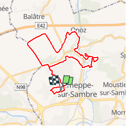
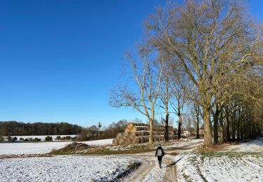
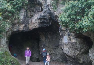
Randonnée Marche nordique de 19 km à découvrir à Wallonie, Namur, Jemeppe-sur-Sambre. Cette randonnée est proposée par hannodi.
Description
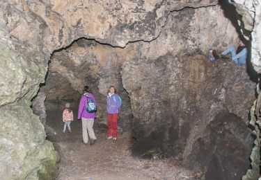
Trail de l'Homme de Spy 2016. Au premier carrefour, directement prendre à gauche. Une erreur suite à un fléchage léger et à une personne de l'organisation mal informée.
Localisation
Pays :
Belgique
Région :
Wallonie
Département/Province :
Namur
Commune :
Jemeppe-sur-Sambre
Localité :
Jemeppe-sur-Sambre
Départ:(Dec)
Départ:(UTM)
617642 ; 5591652 (31U) N.
Commentaires
Randonnées à proximité
![Randonnée Marche Jemeppe-sur-Sambre - RF-Na-01-Onoz_Petite-boucle - Photo](https://media.geolcdn.com/t/375/260/ext.jpg?maxdim=2&url=https%3A%2F%2Fservices.sitytrail.com%2FGeolivesWS%2FDownloadMedia.ashx%3FTrailID%3D545735%26Media%3Df68c7b52-4432-4018-b01d-0bb04e06ad16.jpg)
![Marche Marche](https://static1.geolcdn.com/sitytour/trail-icons/101.png)
RF-Na-01-Onoz_Petite-boucle
Marche
Facile
(10)
Jemeppe-sur-Sambre,
Wallonie,
Namur,
Belgique
![](/images/other/stat-length.png)
7,4 km | 8,9 km-effort
1h 59min
![](https://static1.geolcdn.com/siteimages/upload/files/16400158638029165_repeat_loop_refresh_sync_direction_icon.png)
Oui
![Randonnée Marche Jemeppe-sur-Sambre - De Balâtre à Tongrinne par la vallée de la Ligne - Photo](https://media.geolcdn.com/t/375/260/ext.jpg?maxdim=2&url=https%3A%2F%2Fservices.sitytrail.com%2FGeolivesWS%2FDownloadMedia.ashx%3FTrailID%3D95534%26Media%3De2db5dc2-0ab1-4cda-b9fd-3c87611cc9a3.jpg)
![Marche Marche](https://static1.geolcdn.com/sitytour/trail-icons/101.png)
De Balâtre à Tongrinne par la vallée de la Ligne
Marche
Facile
(1)
Jemeppe-sur-Sambre,
Wallonie,
Namur,
Belgique
![](/images/other/stat-length.png)
12,9 km | 15,4 km-effort
3h 0min
![](https://static1.geolcdn.com/siteimages/upload/files/16400158638029165_repeat_loop_refresh_sync_direction_icon.png)
Oui
![Randonnée Marche Sambreville - Balade à Sambreville - Auvelais - Photo](https://media.geolcdn.com/t/375/260/ext.jpg?maxdim=2&url=https%3A%2F%2Fservices.sitytrail.com%2FGeolivesWS%2FDownloadMedia.ashx%3FTrailID%3D90120%26Media%3D9923b524-2686-4b8f-a3af-4a51a0dec2b6.jpg)
![Marche Marche](https://static1.geolcdn.com/sitytour/trail-icons/101.png)
Balade à Sambreville - Auvelais
Marche
Facile
(1)
Sambreville,
Wallonie,
Namur,
Belgique
![](/images/other/stat-length.png)
10,1 km | 12,3 km-effort
2h 30min
![](https://static1.geolcdn.com/siteimages/upload/files/16400158638029165_repeat_loop_refresh_sync_direction_icon.png)
Oui
![Randonnée Marche Jemeppe-sur-Sambre - La petite boucle de Onoz - Photo](https://media.geolcdn.com/t/375/260/728a8926-dea5-48ea-8a91-8a3e4029625e.jpg&format=jpg&maxdim=2)
![Marche Marche](https://static1.geolcdn.com/sitytour/trail-icons/101.png)
La petite boucle de Onoz
Marche
Facile
(3)
Jemeppe-sur-Sambre,
Wallonie,
Namur,
Belgique
![](/images/other/stat-length.png)
7 km | 8,4 km-effort
1h 57min
![](https://static1.geolcdn.com/siteimages/upload/files/16400158638029165_repeat_loop_refresh_sync_direction_icon.png)
Oui
![Randonnée A pied Jemeppe-sur-Sambre - Sur les traces de l'homme de Spy à Jemeppe-sur-Sambre - Photo](https://media.geolcdn.com/t/375/260/0d4612b7-1403-4944-8642-8449664fec59.jpeg&format=jpg&maxdim=2)
![A pied A pied](https://static1.geolcdn.com/sitytour/trail-icons/100.png)
Sur les traces de l'homme de Spy à Jemeppe-sur-Sambre
A pied
Facile
(1)
Jemeppe-sur-Sambre,
Wallonie,
Namur,
Belgique
![](/images/other/stat-length.png)
3,5 km | 4,7 km-effort
1h 3min
![](https://static1.geolcdn.com/siteimages/upload/files/16400158638029165_repeat_loop_refresh_sync_direction_icon.png)
Oui
![Randonnée Marche Jemeppe-sur-Sambre - RF-Na-01-Onoz_Grande-boucle - Photo](https://media.geolcdn.com/t/375/260/ext.jpg?maxdim=2&url=https%3A%2F%2Fservices.sitytrail.com%2FGeolivesWS%2FDownloadMedia.ashx%3FTrailID%3D545736%26Media%3Dca5596bc-2473-4f40-bb0a-21932020469e.jpg)
![Marche Marche](https://static1.geolcdn.com/sitytour/trail-icons/101.png)
RF-Na-01-Onoz_Grande-boucle
Marche
Moyen
(7)
Jemeppe-sur-Sambre,
Wallonie,
Namur,
Belgique
![](/images/other/stat-length.png)
8,8 km | 10,5 km-effort
2h 19min
![](https://static1.geolcdn.com/siteimages/upload/files/16400158638029165_repeat_loop_refresh_sync_direction_icon.png)
Oui
![Randonnée V.T.T. Jemeppe-sur-Sambre - O2bikers_126_spy - Photo](https://media.geolcdn.com/t/375/260/ext.jpg?maxdim=2&url=https%3A%2F%2Fstatic1.geolcdn.com%2Fsiteimages%2Fupload%2Ffiles%2F1524743154velo.jpg)
![V.T.T. V.T.T.](https://static1.geolcdn.com/sitytour/trail-icons/202.png)
O2bikers_126_spy
V.T.T.
Très facile
(3)
Jemeppe-sur-Sambre,
Wallonie,
Namur,
Belgique
![](/images/other/stat-length.png)
32 km | 39 km-effort
5h 19min
![](https://static1.geolcdn.com/siteimages/upload/files/16400158638029165_repeat_loop_refresh_sync_direction_icon.png)
Oui
![V.T.T. V.T.T.](https://static1.geolcdn.com/sitytour/trail-icons/202.png)
VTT de Spy.
V.T.T.
Très difficile
(1)
Jemeppe-sur-Sambre,
Wallonie,
Namur,
Belgique
![](/images/other/stat-length.png)
48 km | 60 km-effort
4h 10min
![](https://static1.geolcdn.com/siteimages/upload/files/16400158638029165_repeat_loop_refresh_sync_direction_icon.png)
Oui
![V.T.T. V.T.T.](https://static1.geolcdn.com/sitytour/trail-icons/202.png)
VTT de Tamines à Maredsous par la Sibérie et les Sept meuses.
V.T.T.
Très facile
Aiseau-Presles,
Wallonie,
Hainaut,
Belgique
![](/images/other/stat-length.png)
82 km | 101 km-effort
Inconnu
![](https://static1.geolcdn.com/siteimages/upload/files/16400158638029165_repeat_loop_refresh_sync_direction_icon.png)
Oui