![](/images/other/stat-length.png)
![Randonnée Marche Mijas - CALA DE MIJAS - Photo](https://media.geolcdn.com/t/1900/400/ext.pjpeg?maxdim=2&url=https%3A%2F%2Fservices.sitytrail.com%2FGeolivesWS%2FDownloadMedia.ashx%3FTrailID%3D642379%26Media%3De0b95da2-ec56-4996-8e57-dae694daa766.png)
CALA DE MIJAS
HERRY
Utilisateur GUIDE
![Longueur](/images/other/stat-length.png)
![Altitude max](https://static1.geolcdn.com/siteimages/upload/files/1508320355ic_sort_altitude_max_24dp.png)
![Dénivelé positif](https://static1.geolcdn.com/siteimages/upload/files/1508320355ic_sort_den_pos_24dp.png)
![Km-Effort](/images/other/stat-length.png)
![Altitude min](https://static1.geolcdn.com/siteimages/upload/files/1508320355ic_sort_altitude_min_24dp.png)
![Dénivelé négatif](https://static1.geolcdn.com/siteimages/upload/files/1508320355ic_sort_den_neg_24dp.png)
![Boucle](https://static1.geolcdn.com/siteimages/upload/files/16400158638029165_repeat_loop_refresh_sync_direction_icon.png)
![Marche](https://static1.geolcdn.com/sitytour/trail-icons/101.png)
2h17
Difficulté : Très facile
![Scannez ce code QR pour ouvrir la randonnée dans l'application SityTrail](https://capi.geolives.com/qq0zvz2zws4bq2lad0pu/sitytour/trails/642379/qr.png?size=200)
Application GPS de randonnée GRATUITE
À propos
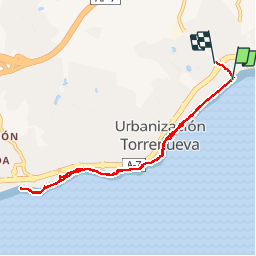
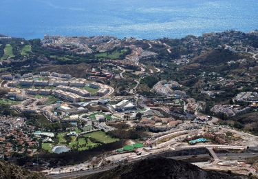
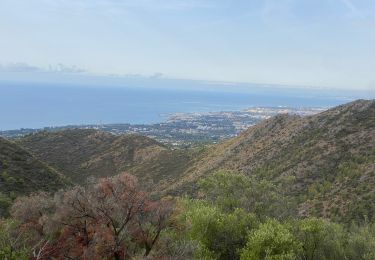
Randonnée Marche de 9,6 km à découvrir à Andalousie, Malaga, Mijas. Cette randonnée est proposée par HERRY.
Description
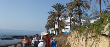
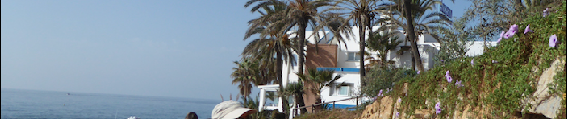
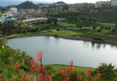
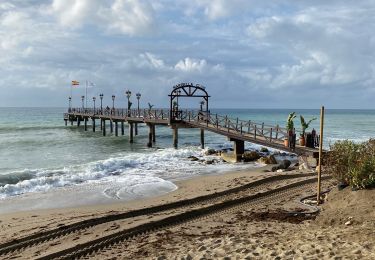
Agréable promenade le long de la côte sur un sentier aménagé de 4.3km aller.Le sentier est tantôt pavé de dalles béton, tantôt de pontons bois . Le parcours sinueux passe le long de bars de plage, de criques paisibles et de promontoires rocheux. Ne pas oublier de s'arrêter déguster un plat de poissons dans l'un des bars -restaurants de plage. Le sentier commence près de la tour de la cala. Il est préférable de laisser la voiture sur le grand parking gratuit situé de l'autre côté de l'A7 (point de départ du tracé)
Localisation
Commentaires
Randonnées à proximité
![Randonnée A pied Coín - Sendero El Nacimiento - Cerro Alaminos - Photo](https://media.geolcdn.com/t/375/260/f58e2d3d-208a-4ded-8f2d-f6a802b6019b.jpeg&format=jpg&maxdim=2)
![A pied A pied](https://static1.geolcdn.com/sitytour/trail-icons/100.png)
A pied
![](/images/other/stat-length.png)
![](https://static1.geolcdn.com/siteimages/upload/files/16400158638029165_repeat_loop_refresh_sync_direction_icon.png)
![Randonnée A pied Coín - Sendero Camino de la Fuente - Photo](https://media.geolcdn.com/t/375/260/1e28f2df-3698-432c-acda-9bd1d840870d.jpeg&format=jpg&maxdim=2)
![A pied A pied](https://static1.geolcdn.com/sitytour/trail-icons/100.png)
A pied
![](/images/other/stat-length.png)
![](https://static1.geolcdn.com/siteimages/upload/files/16400158638029165_repeat_loop_refresh_sync_direction_icon.png)
![Randonnée A pied Mijas - Mina de la Trinidad - Photo](https://media.geolcdn.com/t/375/260/1e0af33e-8a09-466a-bc66-c0362222d276.jpeg&format=jpg&maxdim=2)
![A pied A pied](https://static1.geolcdn.com/sitytour/trail-icons/100.png)
A pied
![](/images/other/stat-length.png)
![](https://static1.geolcdn.com/siteimages/upload/files/16400158638029165_repeat_loop_refresh_sync_direction_icon.png)
![Randonnée A pied Benalmádena - Los Leñadores - Photo](https://media.geolcdn.com/t/375/260/133b459f-dde0-483b-a09a-f74a9313255a.jpeg&format=jpg&maxdim=2)
![A pied A pied](https://static1.geolcdn.com/sitytour/trail-icons/100.png)
A pied
![](/images/other/stat-length.png)
![](https://static1.geolcdn.com/siteimages/upload/files/16400158638029165_repeat_loop_refresh_sync_direction_icon.png)
![Randonnée A pied Alhaurín de la Torre - Los Cazadores - Photo](https://media.geolcdn.com/t/375/260/6c9567c9-b9d8-4bc4-a79f-af645f742f02.jpeg&format=jpg&maxdim=2)
![A pied A pied](https://static1.geolcdn.com/sitytour/trail-icons/100.png)
A pied
![](/images/other/stat-length.png)
![](https://static1.geolcdn.com/siteimages/upload/files/16400158638029165_repeat_loop_refresh_sync_direction_icon.png)
![Randonnée A pied Benalmádena - El Quejigal - Photo](https://media.geolcdn.com/t/375/260/0ad071a9-a81c-4965-8f3b-ad2d5f1fc294.jpeg&format=jpg&maxdim=2)
![A pied A pied](https://static1.geolcdn.com/sitytour/trail-icons/100.png)
A pied
![](/images/other/stat-length.png)
![](https://static1.geolcdn.com/siteimages/upload/files/16400158638029165_repeat_loop_refresh_sync_direction_icon.png)
![Randonnée Marche Marbella - Club Med Marbella - Mirador de Los Gitanos - Photo](https://media.geolcdn.com/t/375/260/2dfe0b36-a643-4909-ab59-9cb91c6db5a7.jpeg&format=jpg&maxdim=2)
![Marche Marche](https://static1.geolcdn.com/sitytour/trail-icons/101.png)
Marche
![](/images/other/stat-length.png)
![](https://static1.geolcdn.com/siteimages/upload/files/16400158638029165_repeat_loop_refresh_sync_direction_icon.png)
![Randonnée Marche Marbella - Club Med Marbella - Purto Banus - Photo](https://media.geolcdn.com/t/375/260/37bb16ac-3c1f-4888-a4a9-bd0b9ccb6a43.jpeg&format=jpg&maxdim=2)
![Marche Marche](https://static1.geolcdn.com/sitytour/trail-icons/101.png)
Marche
![](/images/other/stat-length.png)
![](https://static1.geolcdn.com/siteimages/upload/files/16400158638029165_repeat_loop_refresh_sync_direction_icon.png)
![Randonnée Marche Marbella - Club Med - Ruines Ermitage franciscains - Photo](https://media.geolcdn.com/t/375/260/8cbb162a-8c3a-4046-a1a4-a97b695bb99c.jpeg&format=jpg&maxdim=2)
![Marche Marche](https://static1.geolcdn.com/sitytour/trail-icons/101.png)
Marche
![](/images/other/stat-length.png)
![](https://static1.geolcdn.com/siteimages/upload/files/16400158638029165_repeat_loop_refresh_sync_direction_icon.png)