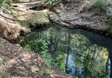
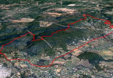
17,6 km | 24 km-effort
toutour fontingon adapté
petipeto
Utilisateur
Longueur
15,6 km
Altitude max
768 m
Dénivelé positif
294 m
Km-Effort
19,5 km
Altitude min
671 m
Dénivelé négatif
305 m
Boucle
Oui
Date de création :
2016-09-24 00:00:00.0
Dernière modification :
2016-09-24 00:00:00.0
3h21
Difficulté : Inconnu
Application GPS de randonnée GRATUITE
À propos
Randonnée Marche de 15,6 km à découvrir à Provence-Alpes-Côte d'Azur, Var, Tourtour. Cette randonnée est proposée par petipeto.
Localisation
Pays :
France
Région :
Provence-Alpes-Côte d'Azur
Département/Province :
Var
Commune :
Tourtour
Localité :
Unknown
Départ:(Dec)
Départ:(UTM)
282490 ; 4830547 (32T) N.
Commentaires
Randonnées à proximité
2023-10-31 Villecroz - Tourtour et tourisme
Marche
Moyen
Villecroze,
Provence-Alpes-Côte d'Azur,
Var,
France
5h 28min
Oui
Villecroze de Chapelles en Grottes
Marche
Très difficile
Villecroze,
Provence-Alpes-Côte d'Azur,
Var,
France
19,9 km | 28 km-effort
5h 49min
Oui
Tourtour - Les Moulières
Marche
Moyen
(1)
Tourtour,
Provence-Alpes-Côte d'Azur,
Var,
France
13,1 km | 15,6 km-effort
5h 0min
Oui
fox
Autre activité
Moyen
(1)
Villecroze,
Provence-Alpes-Côte d'Azur,
Var,
France
42 km | 52 km-effort
2h 24min
Oui
st bart
V.T.T.
Difficile
(1)
Villecroze,
Provence-Alpes-Côte d'Azur,
Var,
France
33 km | 42 km-effort
2h 20min
Oui
giant vs haibike
V.T.T.
Moyen
(1)
Villecroze,
Provence-Alpes-Côte d'Azur,
Var,
France
29 km | 36 km-effort
1h 49min
Oui
VILLECROZE TOURTOUR N
Marche
Très difficile
Villecroze,
Provence-Alpes-Côte d'Azur,
Var,
France
15,1 km | 21 km-effort
4h 33min
Oui
Villecroze- Domaine Saint Jean
Marche
Facile
Villecroze,
Provence-Alpes-Côte d'Azur,
Var,
France
4,3 km | 5,4 km-effort
1h 16min
Non
Autour de Villecroze - Chapelles, Parcs et jardins
Marche
Moyen
Villecroze,
Provence-Alpes-Côte d'Azur,
Var,
France
15,8 km | 21 km-effort
7h 0min
Oui