![](/images/other/stat-length.png)
![Randonnée Marche Sainte-Colombe-de-la-Commanderie - Sainte Colombe au roc de Majorque - Photo](https://media.geolcdn.com/t/1900/400/ext.pjpeg?maxdim=2&url=https%3A%2F%2Fservices.sitytrail.com%2FGeolivesWS%2FDownloadMedia.ashx%3FTrailID%3D630140%26Media%3D20160912141107.jpg)
Sainte Colombe au roc de Majorque
ThonyM
Utilisateur
![Longueur](/images/other/stat-length.png)
Longueur
17,5 km
![Altitude max](https://static1.geolcdn.com/siteimages/upload/files/1508320355ic_sort_altitude_max_24dp.png)
Altitude max
439 m
![Dénivelé positif](https://static1.geolcdn.com/siteimages/upload/files/1508320355ic_sort_den_pos_24dp.png)
Dénivelé positif
499 m
![Km-Effort](/images/other/stat-length.png)
Km-Effort
24 km
![Altitude min](https://static1.geolcdn.com/siteimages/upload/files/1508320355ic_sort_altitude_min_24dp.png)
Altitude min
160 m
![Dénivelé négatif](https://static1.geolcdn.com/siteimages/upload/files/1508320355ic_sort_den_neg_24dp.png)
Dénivelé négatif
499 m
![Boucle](https://static1.geolcdn.com/siteimages/upload/files/16400158638029165_repeat_loop_refresh_sync_direction_icon.png)
Boucle
Oui
Date de création :
2016-09-12 00:00:00.0
Dernière modification :
2016-09-12 00:00:00.0
![Marche](https://static1.geolcdn.com/sitytour/trail-icons/101.png)
6h08
Difficulté : Moyen
![Scannez ce code QR pour ouvrir la randonnée dans l'application SityTrail](https://capi.geolives.com/qq0zvz2zws4bq2lad0pu/sitytour/trails/630140/qr.png?size=200)
Application GPS de randonnée GRATUITE
À propos
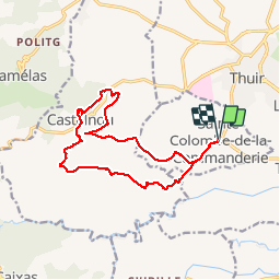
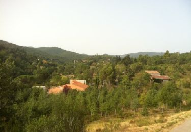
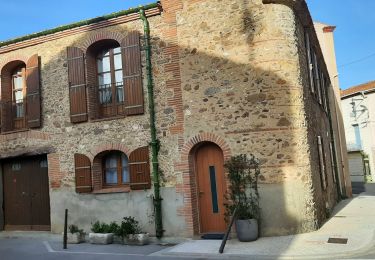
Randonnée Marche de 17,5 km à découvrir à Occitanie, Pyrénées-Orientales, Sainte-Colombe-de-la-Commanderie. Cette randonnée est proposée par ThonyM.
Description
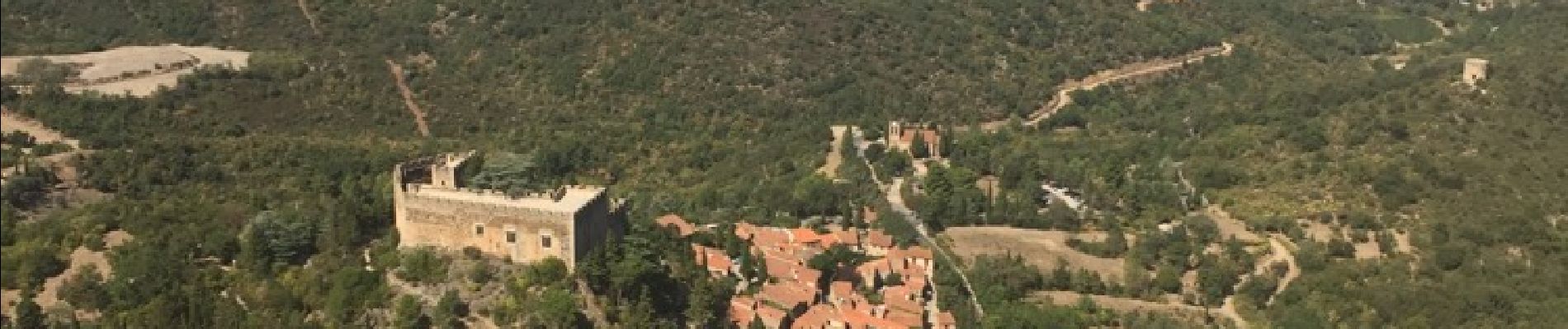
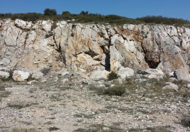
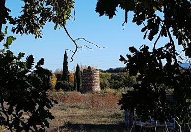
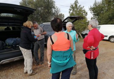
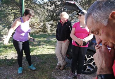
Sainte Colombe de la Commanderie vers Castelnou et le Roc de Majorque. Belle randonnée pour l'automne
Localisation
Pays :
France
Région :
Occitanie
Département/Province :
Pyrénées-Orientales
Commune :
Sainte-Colombe-de-la-Commanderie
Localité :
Unknown
Départ:(Dec)
Départ:(UTM)
479241 ; 4718053 (31T) N.
Commentaires
Randonnées à proximité
![Randonnée Marche Llupia - 66 LLUPIA - FOURQUES - TERRATS promenade dans les ASPRES et son vignoble - Photo](https://media.geolcdn.com/t/375/260/ext.jpg?maxdim=2&url=https%3A%2F%2Fservices.sitytrail.com%2FGeolivesWS%2FDownloadMedia.ashx%3FTrailID%3D464008%26Media%3D20150825183450.jpg)
![Marche Marche](https://static1.geolcdn.com/sitytour/trail-icons/101.png)
66 LLUPIA - FOURQUES - TERRATS promenade dans les ASPRES et son vignoble
Marche
Moyen
(1)
Llupia,
Occitanie,
Pyrénées-Orientales,
France
![](/images/other/stat-length.png)
15 km | 18,2 km-effort
2h 36min
![](https://static1.geolcdn.com/siteimages/upload/files/16400158638029165_repeat_loop_refresh_sync_direction_icon.png)
Oui
![Randonnée Marche Castelnou - CASTELNOU 66 - CAMELAS - ermitage San Marti de La Roca - Photo](https://media.geolcdn.com/t/375/260/ext.jpg?maxdim=2&url=https%3A%2F%2Fservices.sitytrail.com%2FGeolivesWS%2FDownloadMedia.ashx%3FTrailID%3D429684%26Media%3D20150604190036.jpg)
![Marche Marche](https://static1.geolcdn.com/sitytour/trail-icons/101.png)
CASTELNOU 66 - CAMELAS - ermitage San Marti de La Roca
Marche
Difficile
(1)
Castelnou,
Occitanie,
Pyrénées-Orientales,
France
![](/images/other/stat-length.png)
10,8 km | 16,7 km-effort
2h 19min
![](https://static1.geolcdn.com/siteimages/upload/files/16400158638029165_repeat_loop_refresh_sync_direction_icon.png)
Oui
![Randonnée Marche Thuir - Thuir à Castelnou - Photo](https://media.geolcdn.com/t/375/260/ext.jpg?maxdim=2&url=https%3A%2F%2Fservices.sitytrail.com%2FGeolivesWS%2FDownloadMedia.ashx%3FTrailID%3D258395%26Media%3Dfix__20140318123220.jpg)
![Marche Marche](https://static1.geolcdn.com/sitytour/trail-icons/101.png)
Thuir à Castelnou
Marche
Moyen
(1)
Thuir,
Occitanie,
Pyrénées-Orientales,
France
![](/images/other/stat-length.png)
14,1 km | 20 km-effort
4h 13min
![](https://static1.geolcdn.com/siteimages/upload/files/16400158638029165_repeat_loop_refresh_sync_direction_icon.png)
Oui
![Randonnée Marche Fourques - Fourques - Photo](https://media.geolcdn.com/t/375/260/554d37ab-d297-46df-9c75-286bb2188b39.jpg&format=jpg&maxdim=2)
![Marche Marche](https://static1.geolcdn.com/sitytour/trail-icons/101.png)
Fourques
Marche
Très facile
(1)
Fourques,
Occitanie,
Pyrénées-Orientales,
France
![](/images/other/stat-length.png)
14,2 km | 16,4 km-effort
5h 17min
![](https://static1.geolcdn.com/siteimages/upload/files/16400158638029165_repeat_loop_refresh_sync_direction_icon.png)
Oui
![Randonnée Marche Castelnou - Thuir - Photo](https://media.geolcdn.com/t/375/260/859f847a-b7fe-48a7-a491-a2880e534b4c.jpg&format=jpg&maxdim=2)
![Marche Marche](https://static1.geolcdn.com/sitytour/trail-icons/101.png)
Thuir
Marche
Très facile
(1)
Castelnou,
Occitanie,
Pyrénées-Orientales,
France
![](/images/other/stat-length.png)
9,3 km | 12,1 km-effort
4h 4min
![](https://static1.geolcdn.com/siteimages/upload/files/16400158638029165_repeat_loop_refresh_sync_direction_icon.png)
Non
![Randonnée Marche Castelnou - castel nous - Photo](https://media.geolcdn.com/t/375/260/735ce854-126b-4b61-b12b-e2ee30b4f64c.jpg&format=jpg&maxdim=2)
![Marche Marche](https://static1.geolcdn.com/sitytour/trail-icons/101.png)
castel nous
Marche
Très facile
(1)
Castelnou,
Occitanie,
Pyrénées-Orientales,
France
![](/images/other/stat-length.png)
11,9 km | 16,7 km-effort
4h 0min
![](https://static1.geolcdn.com/siteimages/upload/files/16400158638029165_repeat_loop_refresh_sync_direction_icon.png)
Oui
![Randonnée Marche Sainte-Colombe-de-la-Commanderie - THUIR 66 - Castelnou - Ste Colombe de la C. - Photo](https://media.geolcdn.com/t/375/260/ext.jpg?maxdim=2&url=https%3A%2F%2Fstatic1.geolcdn.com%2Fsiteimages%2Fupload%2Ffiles%2F1553511878bg_sport_marche.png)
![Marche Marche](https://static1.geolcdn.com/sitytour/trail-icons/101.png)
THUIR 66 - Castelnou - Ste Colombe de la C.
Marche
Moyen
(2)
Sainte-Colombe-de-la-Commanderie,
Occitanie,
Pyrénées-Orientales,
France
![](/images/other/stat-length.png)
14,8 km | 21 km-effort
2h 56min
![](https://static1.geolcdn.com/siteimages/upload/files/16400158638029165_repeat_loop_refresh_sync_direction_icon.png)
Oui
![Randonnée Marche Montauriol - Montauriol : les points de vue. - Photo](https://media.geolcdn.com/t/375/260/ext.jpg?maxdim=2&url=https%3A%2F%2Fservices.sitytrail.com%2FGeolivesWS%2FDownloadMedia.ashx%3FTrailID%3D141755%26Media%3D20120727092924.jpg)
![Marche Marche](https://static1.geolcdn.com/sitytour/trail-icons/101.png)
Montauriol : les points de vue.
Marche
Facile
(4)
Montauriol,
Occitanie,
Pyrénées-Orientales,
France
![](/images/other/stat-length.png)
4 km | 5,3 km-effort
1h 8min
![](https://static1.geolcdn.com/siteimages/upload/files/16400158638029165_repeat_loop_refresh_sync_direction_icon.png)
Oui
![Randonnée Marche Fourques - fourques sentier des histoires - Photo](https://media.geolcdn.com/t/375/260/e71b4094-d9a3-4d1b-99f0-5a91254525b9.jpg&format=jpg&maxdim=2)
![Marche Marche](https://static1.geolcdn.com/sitytour/trail-icons/101.png)
fourques sentier des histoires
Marche
Moyen
Fourques,
Occitanie,
Pyrénées-Orientales,
France
![](/images/other/stat-length.png)
9,1 km | 10,9 km-effort
2h 47min
![](https://static1.geolcdn.com/siteimages/upload/files/16400158638029165_repeat_loop_refresh_sync_direction_icon.png)
Oui