![](/images/other/stat-length.png)
![Randonnée Marche Châteauroux-les-Alpes - Lac de la Dent et Vallon du Tissap - Photo](https://media.geolcdn.com/t/1900/400/ext.pjpeg?maxdim=2&url=https%3A%2F%2Fservices.sitytrail.com%2FGeolivesWS%2FDownloadMedia.ashx%3FTrailID%3D626411%26Media%3Dfix__20160904144606.jpg)
Lac de la Dent et Vallon du Tissap
BLANCHET
Utilisateur
![Longueur](/images/other/stat-length.png)
Longueur
13,4 km
![Altitude max](https://static1.geolcdn.com/siteimages/upload/files/1508320355ic_sort_altitude_max_24dp.png)
Altitude max
2461 m
![Dénivelé positif](https://static1.geolcdn.com/siteimages/upload/files/1508320355ic_sort_den_pos_24dp.png)
Dénivelé positif
912 m
![Km-Effort](/images/other/stat-length.png)
Km-Effort
26 km
![Altitude min](https://static1.geolcdn.com/siteimages/upload/files/1508320355ic_sort_altitude_min_24dp.png)
Altitude min
1647 m
![Dénivelé négatif](https://static1.geolcdn.com/siteimages/upload/files/1508320355ic_sort_den_neg_24dp.png)
Dénivelé négatif
926 m
![Boucle](https://static1.geolcdn.com/siteimages/upload/files/16400158638029165_repeat_loop_refresh_sync_direction_icon.png)
Boucle
Oui
Date de création :
2016-09-05 00:00:00.0
Dernière modification :
2016-09-05 00:00:00.0
![Marche](https://static1.geolcdn.com/sitytour/trail-icons/101.png)
9h28
Difficulté : Moyen
![Scannez ce code QR pour ouvrir la randonnée dans l'application SityTrail](https://capi.geolives.com/qq0zvz2zws4bq2lad0pu/sitytour/trails/626411/qr.png?size=200)
Application GPS de randonnée GRATUITE
À propos
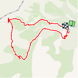
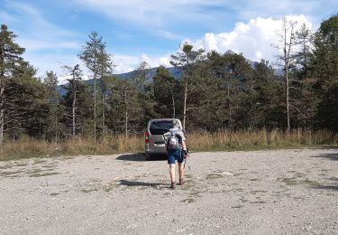
Randonnée Marche de 13,4 km à découvrir à Provence-Alpes-Côte d'Azur, Hautes-Alpes, Châteauroux-les-Alpes. Cette randonnée est proposée par BLANCHET.
Description
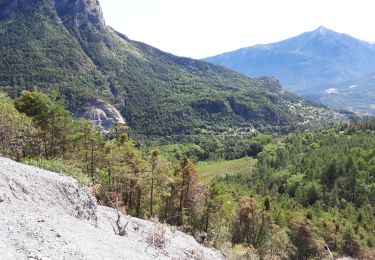
la montée est raide!
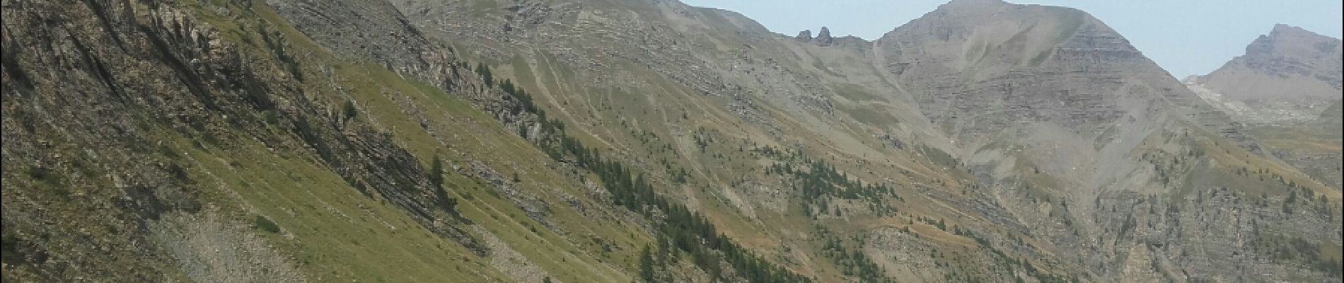
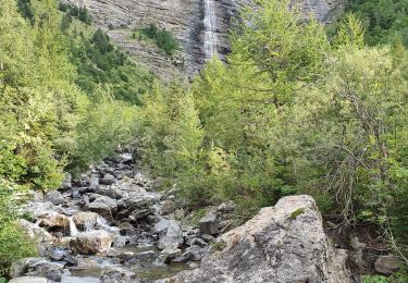
La descente vers la cabane du Tissap se fait dans les casses .
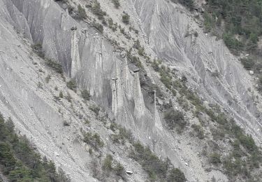
Il faut franchir plusieurs barres rocheuses que l on ne voit que quand on est dessus.
Les herbages sont très glissants.
Prudence !!!
Localisation
Pays :
France
Région :
Provence-Alpes-Côte d'Azur
Département/Province :
Hautes-Alpes
Commune :
Châteauroux-les-Alpes
Localité :
Unknown
Départ:(Dec)
Départ:(UTM)
297469 ; 4946526 (32T) N.
Commentaires
Randonnées à proximité
![Randonnée Marche Châteauroux-les-Alpes - Cascade de la pisse (boucle) - Photo](https://media.geolcdn.com/t/375/260/ext.jpg?maxdim=2&url=https%3A%2F%2Fservices.sitytrail.com%2FGeolivesWS%2FDownloadMedia.ashx%3FTrailID%3D455276%26Media%3Dfix__20150806173304.jpg)
![Marche Marche](https://static1.geolcdn.com/sitytour/trail-icons/101.png)
Cascade de la pisse (boucle)
Marche
Très facile
(1)
Châteauroux-les-Alpes,
Provence-Alpes-Côte d'Azur,
Hautes-Alpes,
France
![](/images/other/stat-length.png)
8,8 km | 12,4 km-effort
2h 17min
![](https://static1.geolcdn.com/siteimages/upload/files/16400158638029165_repeat_loop_refresh_sync_direction_icon.png)
Oui
![Randonnée Marche Châteauroux-les-Alpes - Le Mourre Froid en boucle - Photo](https://media.geolcdn.com/t/375/260/9b8ad952-5731-4aa9-89af-6deece14a669.jpg&format=jpg&maxdim=2)
![Marche Marche](https://static1.geolcdn.com/sitytour/trail-icons/101.png)
Le Mourre Froid en boucle
Marche
Très difficile
Châteauroux-les-Alpes,
Provence-Alpes-Côte d'Azur,
Hautes-Alpes,
France
![](/images/other/stat-length.png)
16 km | 35 km-effort
6h 51min
![](https://static1.geolcdn.com/siteimages/upload/files/16400158638029165_repeat_loop_refresh_sync_direction_icon.png)
Oui
![Randonnée Marche Châteauroux-les-Alpes - EMBRUN Jour 1 - Photo](https://media.geolcdn.com/t/375/260/d9396b19-b145-421d-9a18-40870191a398.jpg&format=jpg&maxdim=2)
![Marche Marche](https://static1.geolcdn.com/sitytour/trail-icons/101.png)
EMBRUN Jour 1
Marche
Moyen
Châteauroux-les-Alpes,
Provence-Alpes-Côte d'Azur,
Hautes-Alpes,
France
![](/images/other/stat-length.png)
11,6 km | 17,4 km-effort
4h 14min
![](https://static1.geolcdn.com/siteimages/upload/files/16400158638029165_repeat_loop_refresh_sync_direction_icon.png)
Oui
![Randonnée Marche Châteauroux-les-Alpes - la cascade de la Pisse - Photo](https://media.geolcdn.com/t/375/260/fb47a976-7b88-4f5d-b9a4-7570b5e8b3ed.jpg&format=jpg&maxdim=2)
![Marche Marche](https://static1.geolcdn.com/sitytour/trail-icons/101.png)
la cascade de la Pisse
Marche
Moyen
Châteauroux-les-Alpes,
Provence-Alpes-Côte d'Azur,
Hautes-Alpes,
France
![](/images/other/stat-length.png)
11,1 km | 15,9 km-effort
4h 26min
![](https://static1.geolcdn.com/siteimages/upload/files/16400158638029165_repeat_loop_refresh_sync_direction_icon.png)
Oui
![Randonnée Marche Châteauroux-les-Alpes - Vallon du Rabioux - Photo](https://media.geolcdn.com/t/375/260/e8dce668-5f44-4dc8-9400-46c9bd326c47.jpg&format=jpg&maxdim=2)
![Marche Marche](https://static1.geolcdn.com/sitytour/trail-icons/101.png)
Vallon du Rabioux
Marche
Facile
Châteauroux-les-Alpes,
Provence-Alpes-Côte d'Azur,
Hautes-Alpes,
France
![](/images/other/stat-length.png)
12,1 km | 22 km-effort
4h 5min
![](https://static1.geolcdn.com/siteimages/upload/files/16400158638029165_repeat_loop_refresh_sync_direction_icon.png)
Oui
![Randonnée Marche Châteauroux-les-Alpes - Cascade de la Pise Chateauroux - Photo](https://media.geolcdn.com/t/375/260/6baeb563-0002-42af-a290-dddaacbc4dd8.jpg&format=jpg&maxdim=2)
![Marche Marche](https://static1.geolcdn.com/sitytour/trail-icons/101.png)
Cascade de la Pise Chateauroux
Marche
Facile
Châteauroux-les-Alpes,
Provence-Alpes-Côte d'Azur,
Hautes-Alpes,
France
![](/images/other/stat-length.png)
11 km | 15,7 km-effort
3h 31min
![](https://static1.geolcdn.com/siteimages/upload/files/16400158638029165_repeat_loop_refresh_sync_direction_icon.png)
Oui
![Randonnée Marche Châteauroux-les-Alpes - Cascade de la pisse (un grand classique) - Photo](https://media.geolcdn.com/t/375/260/e0e43610-7af5-4a71-8017-c77f435dad7a.jpg&format=jpg&maxdim=2)
![Marche Marche](https://static1.geolcdn.com/sitytour/trail-icons/101.png)
Cascade de la pisse (un grand classique)
Marche
Très facile
Châteauroux-les-Alpes,
Provence-Alpes-Côte d'Azur,
Hautes-Alpes,
France
![](/images/other/stat-length.png)
10,9 km | 16,2 km-effort
3h 31min
![](https://static1.geolcdn.com/siteimages/upload/files/16400158638029165_repeat_loop_refresh_sync_direction_icon.png)
Oui
![Randonnée Marche Embrun - tour ENTRE CHÂTEAUROUX ET EMBRUN - Photo](https://media.geolcdn.com/t/375/260/ext.jpg?maxdim=2&url=https%3A%2F%2Fservices.sitytrail.com%2FGeolivesWS%2FDownloadMedia.ashx%3FTrailID%3D436210%26Media%3Dfix__20150621121000.jpg)
![Marche Marche](https://static1.geolcdn.com/sitytour/trail-icons/101.png)
tour ENTRE CHÂTEAUROUX ET EMBRUN
Marche
Moyen
Embrun,
Provence-Alpes-Côte d'Azur,
Hautes-Alpes,
France
![](/images/other/stat-length.png)
12,1 km | 20 km-effort
4h 11min
![](https://static1.geolcdn.com/siteimages/upload/files/16400158638029165_repeat_loop_refresh_sync_direction_icon.png)
Oui
![Randonnée Marche Châteauroux-les-Alpes - Clos Jaunier - cabane de Soleil Boeuf - Photo](https://media.geolcdn.com/t/375/260/ext.jpg?maxdim=2&url=https%3A%2F%2Fservices.sitytrail.com%2FGeolivesWS%2FDownloadMedia.ashx%3FTrailID%3D435456%26Media%3Dfix__20150619113051.jpg)
![Marche Marche](https://static1.geolcdn.com/sitytour/trail-icons/101.png)
Clos Jaunier - cabane de Soleil Boeuf
Marche
Facile
Châteauroux-les-Alpes,
Provence-Alpes-Côte d'Azur,
Hautes-Alpes,
France
![](/images/other/stat-length.png)
5,4 km | 10,8 km-effort
2h 3min
![](https://static1.geolcdn.com/siteimages/upload/files/16400158638029165_repeat_loop_refresh_sync_direction_icon.png)
Oui