Randonnée V.T.T. Contrevoz - Belley-Préveyzieu-Cheignieu - Photo

Belley-Préveyzieu-Cheignieu

 jeannot01
jeannot01

Utilisateur

© OpenStreetMap contributors
Longueur
Longueur
38 km
Altitude max
Altitude max
539 m
Dénivelé positif
Dénivelé positif
996 m
Km-Effort
Km-Effort  
51 km
Altitude min
Altitude min
231 m
Dénivelé négatif
Dénivelé négatif
993 m
Boucle
Boucle
Non
Date de création :
2016-08-24 00:00:00.0
Dernière modification :
2019-08-26 15:58:44.464

(0 Avis)

V.T.T.
V.T.T.
2h41
Difficulté : Difficile

Scannez ce code QR pour ouvrir la randonnée dans l'application SityTrail

Application GPS de randonnée GRATUITE

Logo SityTrail SityTrail

IGN / Instituts géographiques

Télécharger SityTrail sur l'App Store Télécharger SityTrail sur Google Play

Logo SityTrail SityTrail World

Le monde est à vous

Télécharger SityTrail sur l'App Store Télécharger SityTrail sur Google Play Télécharger SityTrail sur Huawei AppGallery

À propos

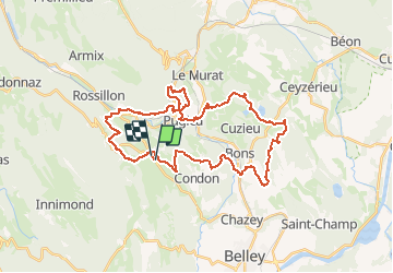
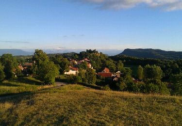
Randonnée V.T.T. de 38 km à découvrir à Auvergne-Rhône-Alpes, Ain, Contrevoz. Cette randonnée est proposée par jeannot01.

Description

Très belle rando avec de magnifiques descentes un peu technique en Single.
Les montées sont parfois un peu raide mais jamais très techniques.
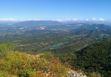
Passage dans les vignes du Manicle avec belle vue sur les alpes.
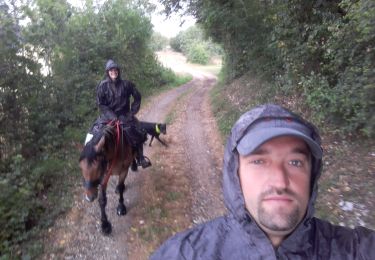
Profil altimétrique

Localisation

Pays :
France
Région :
Auvergne-Rhône-Alpes
Département/Province :
Ain
Commune :
Contrevoz
Localité :
Unknown
Départ:(Dec)
Départ:(UTM)
704352 ; 5075533 (31T) N.

Randonnées à proximité

Randonnée Randonnée équestre Saint-Germain-les-Paroisses - repérage st germain inimond cheval - Photo
Randonnée équestre
Nolene

Randonnée équestre

Moyen
(1)
Saint-Germain-les-Paroisses, Auvergne-Rhône-Alpes, Ain, France
14,6 km | 21 km-effort
5h 7min
Non
Randonnée V.T.T. Cuzieu - Cuzieu Vongnes - Photo
V.T.T.
jeannot01

V.T.T.

Moyen
(1)
Cuzieu, Auvergne-Rhône-Alpes, Ain, France
16,4 km | 21 km-effort
2h 5min
Oui
Randonnée V.T.T. Andert-et-Condon - Boucle sous Gevrin  - Photo
V.T.T.
sandrine-s01

V.T.T.

Facile
(1)
Andert-et-Condon, Auvergne-Rhône-Alpes, Ain, France
13,1 km | 17,1 km-effort
1h 1min
Oui
Randonnée Marche Virieu-le-Grand - virieu - Cascades de Dard - Photo
Marche
aurel69

Marche

Moyen
(2)
Virieu-le-Grand, Auvergne-Rhône-Alpes, Ain, France
9,2 km | 11,9 km-effort
3h 53min
Oui
Randonnée V.T.T. Innimond - tentanet la graye - Photo
V.T.T.
malc

V.T.T.

Très difficile
Innimond, Auvergne-Rhône-Alpes, Ain, France
48 km | 75 km-effort
3h 50min
Oui
Randonnée V.T.T. Innimond - innimond-Mollard de don - Photo
V.T.T.
malc

V.T.T.

Moyen
(2)
Innimond, Auvergne-Rhône-Alpes, Ain, France
24 km | 33 km-effort
2h 15min
Oui
Randonnée Marche Innimond - Le tour du Fays avec le mollard Rond - Photo
Marche
malc

Marche

Facile
Innimond, Auvergne-Rhône-Alpes, Ain, France
7,8 km | 9,4 km-effort
2h 0min
Oui
Randonnée V.T.T. Saint-Germain-les-Paroisses - 6-5-15 - Photo
V.T.T.
jeannot01

V.T.T.

Très facile
(1)
Saint-Germain-les-Paroisses, Auvergne-Rhône-Alpes, Ain, France
25 km | 37 km-effort
2h 57min
Oui
Randonnée V.T.T. Innimond - innimond lompnaz - Photo
V.T.T.
malc

V.T.T.

Moyen
Innimond, Auvergne-Rhône-Alpes, Ain, France
16,4 km | 24 km-effort
1h 36min
Non


Fermer
Mes abonnements