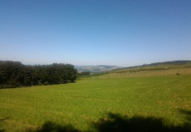
14 km | 18 km-effort
bouloc
vinc2788
Utilisateur
Longueur
11,5 km
Altitude max
1101 m
Dénivelé positif
269 m
Km-Effort
15,1 km
Altitude min
946 m
Dénivelé négatif
269 m
Boucle
Oui
Date de création :
2016-07-19 00:00:00.0
Dernière modification :
2016-07-19 00:00:00.0
2h58
Difficulté : Facile
Application GPS de randonnée GRATUITE
À propos
Randonnée Marche de 11,5 km à découvrir à Occitanie, Aveyron, Salles-Curan. Cette randonnée est proposée par vinc2788.
Description
champêtre eolien
Localisation
Pays :
France
Région :
Occitanie
Département/Province :
Aveyron
Commune :
Salles-Curan
Localité :
Unknown
Départ:(Dec)
Départ:(UTM)
489240 ; 4888868 (31T) N.
Commentaires
Randonnées à proximité
2021-09-05 Sahut -Col de Poulzinières
Marche
Moyen
Castelnau-Pégayrols,
Occitanie,
Aveyron,
France
16 km | 21 km-effort
4h 50min
Oui
castelnau-rouviaguet-les fadarelles
Course à pied
Moyen
Castelnau-Pégayrols,
Occitanie,
Aveyron,
France
11,7 km | 17,5 km-effort
2h 2min
Non
mauriac. mont seigne
Marche
Très facile
Saint-Laurent-de-Lévézou,
Occitanie,
Aveyron,
France
11,1 km | 15,1 km-effort
2h 51min
Oui
Castelnau-Pégayrols estalane St Beauzély Barruques
Trail
Moyen
Castelnau-Pégayrols,
Occitanie,
Aveyron,
France
21 km | 30 km-effort
2h 0min
Oui
2021-09-07 Sahut - Col de Poulzinières -Galinouse
Marche
Facile
(1)
Castelnau-Pégayrols,
Occitanie,
Aveyron,
France
9,6 km | 12,7 km-effort
3h 0min
Oui
BOULOC EN AVEYRON
Marche
Facile
Salles-Curan,
Occitanie,
Aveyron,
France
4 km | 5,2 km-effort
1h 6min
Oui
Castelnau Montjaux Roquetaillade
Trail
Moyen
Castelnau-Pégayrols,
Occitanie,
Aveyron,
France
23 km | 32 km-effort
1h 55min
Oui
Grand tour du lac
Vélo électrique
Moyen
Curan,
Occitanie,
Aveyron,
France
74 km | 93 km-effort
5h 0min
Oui