Randonnée Vélo Tielt-Winge - Tielt Gempemolen - Photo
 KoenV
KoenV

Utilisateur

© OpenStreetMap contributors
Longueur
Longueur
40 km
Altitude max
Altitude max
97 m
Dénivelé positif
Dénivelé positif
442 m
Km-Effort
Km-Effort  
46 km
Altitude min
Altitude min
27 m
Dénivelé négatif
Dénivelé négatif
446 m
Boucle
Boucle
Oui
Date de création :
2016-07-20 00:00:00.0
Dernière modification :
2016-07-20 00:00:00.0

(0 Avis)

Vélo
Vélo
2h40
Difficulté : Difficile

Scannez ce code QR pour ouvrir la randonnée dans l'application SityTrail

Application GPS de randonnée GRATUITE

Logo SityTrail SityTrail

IGN / Instituts géographiques

Télécharger SityTrail sur l'App Store Télécharger SityTrail sur Google Play

Logo SityTrail SityTrail World

Le monde est à vous

Télécharger SityTrail sur l'App Store Télécharger SityTrail sur Google Play Télécharger SityTrail sur Huawei AppGallery

À propos

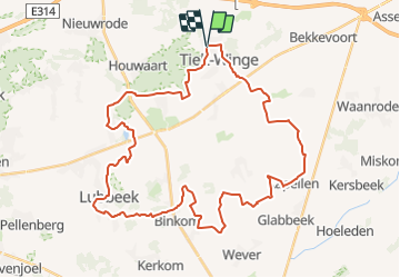
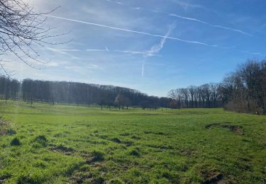
Randonnée Vélo de 40 km à découvrir à Flandre, Brabant flamand, Tielt-Winge. Cette randonnée est proposée par KoenV.

Description

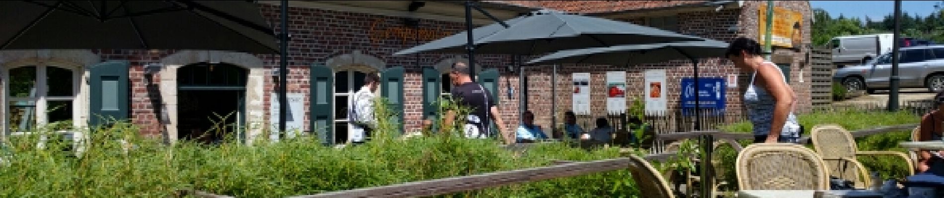
Zeer heuvelachtige fietsroute door het Hageland. Maar 1 stopplaats onderweg: de Gempemolen.

Profil altimétrique

Photos

Points d'intérêt

Point d'intérêt Bekkevoort - Militair grondstation - Photo
KoenV
Point d'intérêt Lubbeek - Oude tractor - Photo
KoenV
LUBBEEK 
Point d'intérêt Tielt-Winge - Gempemolen - Photo
KoenV
TIELT-WINGE 

Localisation

Pays :
Belgique
Région :
Flandre
Département/Province :
Brabant flamand
Commune :
Tielt-Winge
Localité :
Tielt
Départ:(Dec)
Départ:(UTM)
633667 ; 5644906 (31U) N.

Randonnées à proximité

Randonnée A pied Holsbeek - Wingewandeling - Photo
A pied
PRO

A pied

Facile
Holsbeek, Flandre, Brabant flamand, Belgique
3,3 km | 3,6 km-effort
48min
Oui
Randonnée A pied Holsbeek - Peersewandeling - Photo
A pied
PRO

A pied

Facile
Holsbeek, Flandre, Brabant flamand, Belgique
3,4 km | 3,9 km-effort
52min
Oui
Randonnée A pied Holsbeek - Domeinwandeling - Photo
A pied
PRO

A pied

Facile
Holsbeek, Flandre, Brabant flamand, Belgique
3,2 km | 3,5 km-effort
47min
Oui
Randonnée A pied Aerschot - Rillaarse Heuvelswandeling - Photo
A pied
PRO

A pied

Facile
Aerschot, Flandre, Brabant flamand, Belgique
12,2 km | 14,6 km-effort
3h 18min
Oui
Randonnée A pied Tielt-Winge - Tieltse Motte Oranje bol - Photo
A pied
PRO

A pied

Facile
Tielt-Winge, Flandre, Brabant flamand, Belgique
8,4 km | 9,5 km-effort
2h 10min
Oui
Randonnée A pied Tielt-Winge - Tieltse Motte Rode driehoek - Photo
A pied
PRO

A pied

Facile
Tielt-Winge, Flandre, Brabant flamand, Belgique
10,3 km | 11,6 km-effort
2h 38min
Oui
Randonnée Marche Tielt-Winge - Houwaert kerk - Photo
Marche
u0001643

Marche

Très facile
(2)
Tielt-Winge, Flandre, Brabant flamand, Belgique
8,7 km | 10,1 km-effort
2h 34min
Oui
Randonnée Marche Holsbeek - Autour de Roeselberg sur le GR 512 - Photo
Marche
dauzata

Marche

Facile
Holsbeek, Flandre, Brabant flamand, Belgique
20 km | 23 km-effort
4h 32min
Oui
Randonnée Marche Tielt-Winge - La randonnée d’Alsberg et son escalier d’observation - Photo
Marche
GUIDE+

Marche

Moyen
Tielt-Winge, Flandre, Brabant flamand, Belgique
6,4 km | 7,3 km-effort
1h 39min
Oui


Fermer
Mes abonnements