Randonnée Marche Bonneuil - Bonneuil 29-06-2016 - Photo
 jmrobin
jmrobin

Utilisateur

© OpenStreetMap contributors
Longueur
Longueur
14,8 km
Altitude max
Altitude max
155 m
Dénivelé positif
Dénivelé positif
244 m
Km-Effort
Km-Effort  
18,1 km
Altitude min
Altitude min
65 m
Dénivelé négatif
Dénivelé négatif
243 m
Boucle
Boucle
Oui
Date de création :
2019-03-04 10:37:52.618
Dernière modification :
2019-03-04 10:37:52.648

(0 Avis)

Marche
Marche
3h21
Difficulté : Moyen

Scannez ce code QR pour ouvrir la randonnée dans l'application SityTrail

Application GPS de randonnée GRATUITE

Logo SityTrail SityTrail

IGN / Instituts géographiques

Télécharger SityTrail sur l'App Store Télécharger SityTrail sur Google Play

Logo SityTrail SityTrail World

Le monde est à vous

Télécharger SityTrail sur l'App Store Télécharger SityTrail sur Google Play Télécharger SityTrail sur Huawei AppGallery

À propos

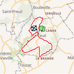
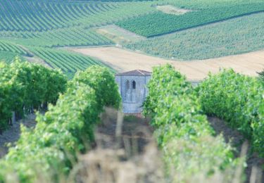
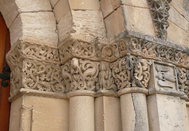
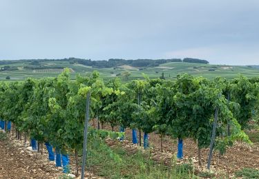
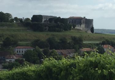
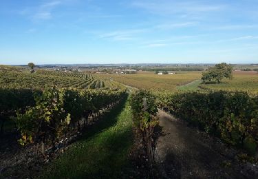
Randonnée Marche de 14,8 km à découvrir à Nouvelle-Aquitaine, Charente, Bonneuil. Cette randonnée est proposée par jmrobin.

Profil altimétrique

Localisation

Pays :
France
Région :
Nouvelle-Aquitaine
Département/Province :
Charente
Commune :
Bonneuil
Localité :
Unknown
Départ:(Dec)
Départ:(UTM)
723085 ; 5050987 (30T) N.

Randonnées à proximité

Randonnée Moteur Saint-Preuil - Découvrez la Grande Champagne hors des sentiers battus - Photo
Moteur
Relais-Saint-Preuil

Moteur

Moyen
(3)
Saint-Preuil, Nouvelle-Aquitaine, Charente, France
53 km | 63 km-effort
2h 40min
Oui
Randonnée A pied Bellevigne - Chemin Boisné - Photo
A pied
PRO

A pied

Facile
Bellevigne, Nouvelle-Aquitaine, Charente, France
15,6 km | 17 km-effort
3h 51min
Non
Randonnée Marche Bouteville - Bouteville : Sentier des Chaumes Boissieres - Photo
Marche
alfreson

Marche

Bouteville, Nouvelle-Aquitaine, Charente, France
7,7 km | 9,1 km-effort
1h 53min
Oui
Randonnée Marche Bouteville - Bouteville (16120) - Photo
Marche
dorcier

Marche

Facile
Bouteville, Nouvelle-Aquitaine, Charente, France
14,5 km | 17,6 km-effort
3h 49min
Oui
Randonnée Marche Saint-Preuil - Circuit des fontaines et des lavoirs - Variante balisage Violet - Photo
Marche
neoroll44

Marche

Moyen
Saint-Preuil, Nouvelle-Aquitaine, Charente, France
12,8 km | 15,5 km-effort
3h 30min
Oui
Randonnée Marche nordique Lignières-Sonneville - Lignières Sonneville - Photo
Marche nordique
JACQUOU

Marche nordique

Facile
Lignières-Sonneville, Nouvelle-Aquitaine, Charente, France
14,4 km | 17,7 km-effort
3h 17min
Oui
Randonnée Marche Angeac-Charente - les indiens  - Photo
Marche
lancelisio

Marche

Très facile
Angeac-Charente, Nouvelle-Aquitaine, Charente, France
4,9 km | 5,6 km-effort
1h 33min
Oui
Randonnée Marche Saint-Preuil - Saint prémilitaire - Photo
Marche
poule16

Marche

Saint-Preuil, Nouvelle-Aquitaine, Charente, France
9,2 km | 11,1 km-effort
2h 36min
Oui


Fermer
Mes abonnements