


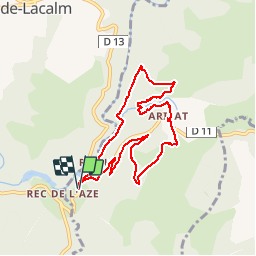

14,4 km | 20 km-effort


Utilisateur


Application GPS de randonnée GRATUITE
 SityTrail
IGN / Instituts géographiques
SityTrail World
Le monde est à vous
Randonnée Marche de 8,7 km à découvrir à Occitanie, Tarn, Arifat. Cette randonnée est proposée par jpipacific.
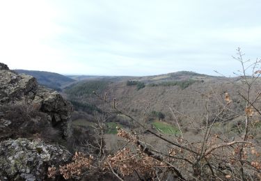
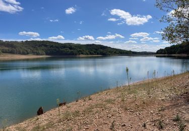
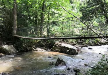
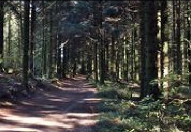
Belle randonnée avec de bons dénivelés. Passage du pont des cascades par un pont suspendu très sympa. La fin du parcours se fait dans une exploitation forestière très boueuse et chemin défoncé par des engins. Il vaut mieux prévoir un autre parcours après la route avant Cadarlés.
Marche
Marche
Marche
Marche
V.T.T.

Marche

Vélo électrique
Marche
Marche