

La ceinture verte de Strasbourg

VacheKiri67
Utilisateur

Longueur
21 km

Altitude max
155 m

Dénivelé positif
208 m

Km-Effort
23 km

Altitude min
125 m

Dénivelé négatif
200 m
Boucle
Non
Date de création :
2016-05-22 00:00:00.0
Dernière modification :
2016-05-22 00:00:00.0
5h21
Difficulté : Difficile

Application GPS de randonnée GRATUITE
À propos
Randonnée Marche de 21 km à découvrir à Grand Est, Bas-Rhin, Strasbourg. Cette randonnée est proposée par VacheKiri67.
Description
Faite le 22/05/2016 avec notre fils de 11 ans. Balisage anneau rouge de bout en bout. Voir http://www.tourisme-alsace.com/medias/pdf/randonnee/67-16-ceinture-verte-de-strasbourg.pdf
Notre départ s'est fait depuis la Rotonde à Cronenbourg, ce qui rallonge le circuit.
Localisation
Pays :
France
Région :
Grand Est
Département/Province :
Bas-Rhin
Commune :
Strasbourg
Localité :
Unknown
Départ:(Dec)
Départ:(UTM)
405993 ; 5382749 (32U) N.
Commentaires
Randonnées à proximité

Strasbourg - Centre historique


Marche
Facile
(3)
Strasbourg,
Grand Est,
Bas-Rhin,
France

8 km | 9,2 km-effort
2h 11min
Non
Histoires d'eaux.... et de forêts au nord de Strasbourg


Marche
Difficile
(1)
Strasbourg,
Grand Est,
Bas-Rhin,
France

26 km | 28 km-effort
5h 57min
Oui

Untitled


Marche
Très facile
(1)
Strasbourg,
Grand Est,
Bas-Rhin,
France

6,1 km | 7 km-effort
1h 42min
Oui
Strasbourg Krutenau Université


Marche
Moyen
(1)
Strasbourg,
Grand Est,
Bas-Rhin,
France

5,3 km | 6,1 km-effort
1h 23min
Oui

marchepop bischheim 10km 2021


Marche
Très facile
(1)
Bischheim,
Grand Est,
Bas-Rhin,
France

10,7 km | 11,8 km-effort
2h 31min
Oui

20241213 Wolfisheim


sport
Très facile
Wolfisheim,
Grand Est,
Bas-Rhin,
France

7,5 km | 8,1 km-effort
Inconnu
Oui
La ceinture verte de Strasbourg


Marche
Moyen
Strasbourg,
Grand Est,
Bas-Rhin,
France

19,8 km | 22 km-effort
4h 6min
Oui

Strasbourg - Obernay 2024


Marche
Moyen
(2)
Strasbourg,
Grand Est,
Bas-Rhin,
France

7 km | 8,4 km-effort
1h 53min
Non


 SityTrail


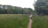


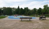


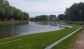
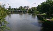


Laissez vous surprendre ! Un tour insolite de Strasbourg au vert en passant par les grands parcs de la ville.