![](/images/other/stat-length.png)
Le saut du loup
neoroll44
Utilisateur
![Longueur](/images/other/stat-length.png)
Longueur
8,6 km
![Altitude max](https://static1.geolcdn.com/siteimages/upload/files/1508320355ic_sort_altitude_max_24dp.png)
Altitude max
141 m
![Dénivelé positif](https://static1.geolcdn.com/siteimages/upload/files/1508320355ic_sort_den_pos_24dp.png)
Dénivelé positif
219 m
![Km-Effort](/images/other/stat-length.png)
Km-Effort
11,6 km
![Altitude min](https://static1.geolcdn.com/siteimages/upload/files/1508320355ic_sort_altitude_min_24dp.png)
Altitude min
0 m
![Dénivelé négatif](https://static1.geolcdn.com/siteimages/upload/files/1508320355ic_sort_den_neg_24dp.png)
Dénivelé négatif
225 m
![Boucle](https://static1.geolcdn.com/siteimages/upload/files/16400158638029165_repeat_loop_refresh_sync_direction_icon.png)
Boucle
Oui
Date de création :
2016-05-09 00:00:00.0
Dernière modification :
2016-05-09 00:00:00.0
![Marche](https://static1.geolcdn.com/sitytour/trail-icons/101.png)
3h00
Difficulté : Difficile
![Scannez ce code QR pour ouvrir la randonnée dans l'application SityTrail](https://capi.geolives.com/qq0zvz2zws4bq2lad0pu/sitytour/trails/564539/qr.png?size=200)
Application GPS de randonnée GRATUITE
À propos
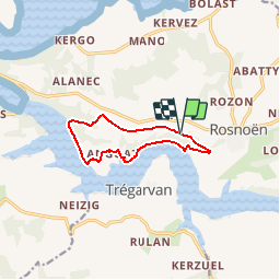
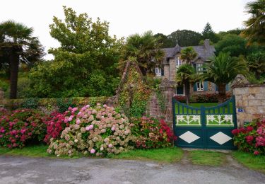
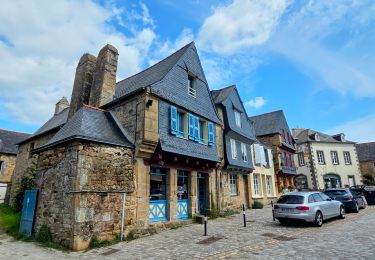
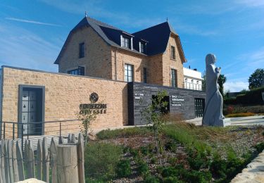
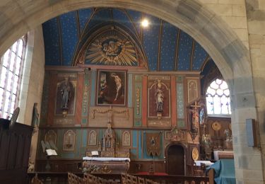
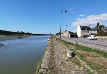
Randonnée Marche de 8,6 km à découvrir à Bretagne, Finistère, Rosnoën. Cette randonnée est proposée par neoroll44.
Description
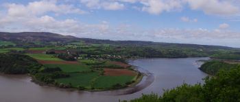
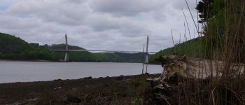
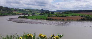
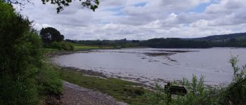
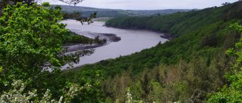
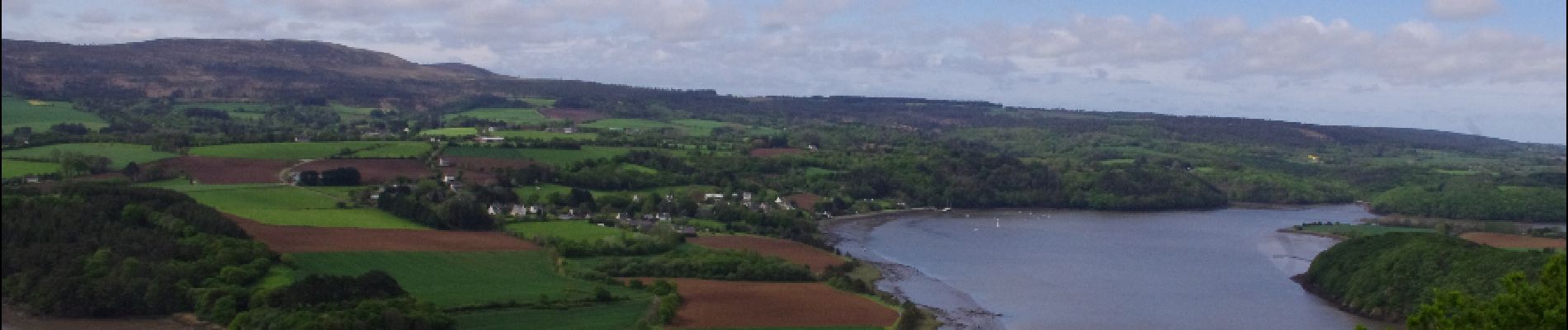
Les bords de l'Aulne près de Rosnoën. De belles vues sur l'Aulne. Des parties difficiles le long de la berge et en forêt. Des parties impraticables à marée haute. Attention aux horaires et coefficients de marée.
Localisation
Pays :
France
Région :
Bretagne
Département/Province :
Finistère
Commune :
Rosnoën
Localité :
Unknown
Départ:(Dec)
Départ:(UTM)
409932 ; 5346230 (30U) N.
Commentaires
Randonnées à proximité
![Randonnée Marche Le Faou - GR34 Le Faou -- Rangoulic - Photo](https://media.geolcdn.com/t/375/260/18c0dca4-5c39-42e4-8316-bd6c3dd72709.jpg&format=jpg&maxdim=2)
![Marche Marche](https://static1.geolcdn.com/sitytour/trail-icons/101.png)
GR34 Le Faou -- Rangoulic
Marche
Très difficile
Le Faou,
Bretagne,
Finistère,
France
![](/images/other/stat-length.png)
18,3 km | 25 km-effort
5h 38min
![](https://static1.geolcdn.com/siteimages/upload/files/16400158638029165_repeat_loop_refresh_sync_direction_icon.png)
Non
![Randonnée Marche Landévennec - Landévennec - boucles locales et GR34 - 13.8km 250m 4h10 (35mn) - 2019 09 12 - Photo](https://media.geolcdn.com/t/375/260/ed0a847b-b2f3-4f8e-b6b5-8e6353637e62.jpg&format=jpg&maxdim=2)
![Marche Marche](https://static1.geolcdn.com/sitytour/trail-icons/101.png)
Landévennec - boucles locales et GR34 - 13.8km 250m 4h10 (35mn) - 2019 09 12
Marche
Facile
Landévennec,
Bretagne,
Finistère,
France
![](/images/other/stat-length.png)
13,8 km | 17,2 km-effort
4h 10min
![](https://static1.geolcdn.com/siteimages/upload/files/16400158638029165_repeat_loop_refresh_sync_direction_icon.png)
Oui
![Randonnée Marche Trégarvan - Menez Hom_10,3km_Trace GPS - Photo](https://media.geolcdn.com/t/375/260/ext.jpg?maxdim=2&url=https%3A%2F%2Fstatic1.geolcdn.com%2Fsiteimages%2Fupload%2Ffiles%2F1553511878bg_sport_marche.png)
![Marche Marche](https://static1.geolcdn.com/sitytour/trail-icons/101.png)
Menez Hom_10,3km_Trace GPS
Marche
Moyen
(1)
Trégarvan,
Bretagne,
Finistère,
France
![](/images/other/stat-length.png)
10,2 km | 14 km-effort
3h 0min
![](https://static1.geolcdn.com/siteimages/upload/files/16400158638029165_repeat_loop_refresh_sync_direction_icon.png)
Oui
![Randonnée Marche Trégarvan - TREGARVAN_6,7km_Trace GPS - Photo](https://media.geolcdn.com/t/375/260/ext.jpg?maxdim=2&url=https%3A%2F%2Fstatic1.geolcdn.com%2Fsiteimages%2Fupload%2Ffiles%2F1553511878bg_sport_marche.png)
![Marche Marche](https://static1.geolcdn.com/sitytour/trail-icons/101.png)
TREGARVAN_6,7km_Trace GPS
Marche
Facile
(1)
Trégarvan,
Bretagne,
Finistère,
France
![](/images/other/stat-length.png)
6,7 km | 8,4 km-effort
1h 50min
![](https://static1.geolcdn.com/siteimages/upload/files/16400158638029165_repeat_loop_refresh_sync_direction_icon.png)
Oui
![Randonnée Marche Le Faou - Visite express du centre historique de Le Faou - Photo](https://media.geolcdn.com/t/375/260/904406ee-aa12-46c4-a3f2-893fdc7c38f2.jpg&format=jpg&maxdim=2)
![Marche Marche](https://static1.geolcdn.com/sitytour/trail-icons/101.png)
Visite express du centre historique de Le Faou
Marche
Très facile
Le Faou,
Bretagne,
Finistère,
France
![](/images/other/stat-length.png)
2,3 km | 2,5 km-effort
33min
![](https://static1.geolcdn.com/siteimages/upload/files/16400158638029165_repeat_loop_refresh_sync_direction_icon.png)
Oui
![Randonnée Marche Landévennec - LANDÉVENNEC - Photo](https://media.geolcdn.com/t/375/260/3aa9913a-4da7-4716-a24d-72b5f897ad92.jpg&format=jpg&maxdim=2)
![Marche Marche](https://static1.geolcdn.com/sitytour/trail-icons/101.png)
LANDÉVENNEC
Marche
Difficile
Landévennec,
Bretagne,
Finistère,
France
![](/images/other/stat-length.png)
19,4 km | 25 km-effort
4h 41min
![](https://static1.geolcdn.com/siteimages/upload/files/16400158638029165_repeat_loop_refresh_sync_direction_icon.png)
Non
![Randonnée Marche Le Faou - GRP_Crozon_CB_01_Le-Faou_Argol_20200919 - Photo](https://media.geolcdn.com/t/375/260/fbd34cbb-bebb-46b9-8e23-76c365c1b8c8.jpg&format=jpg&maxdim=2)
![Marche Marche](https://static1.geolcdn.com/sitytour/trail-icons/101.png)
GRP_Crozon_CB_01_Le-Faou_Argol_20200919
Marche
Moyen
Le Faou,
Bretagne,
Finistère,
France
![](/images/other/stat-length.png)
15,9 km | 21 km-effort
4h 31min
![](https://static1.geolcdn.com/siteimages/upload/files/16400158638029165_repeat_loop_refresh_sync_direction_icon.png)
Non
![Randonnée Marche Le Faou - La randonnée du Faou - Photo](https://media.geolcdn.com/t/375/260/52fdc54d-e20e-467f-ae3e-b4bd86da525e.jpg&format=jpg&maxdim=2)
![Marche Marche](https://static1.geolcdn.com/sitytour/trail-icons/101.png)
La randonnée du Faou
Marche
Moyen
Le Faou,
Bretagne,
Finistère,
France
![](/images/other/stat-length.png)
9,4 km | 11,6 km-effort
3h 37min
![](https://static1.geolcdn.com/siteimages/upload/files/16400158638029165_repeat_loop_refresh_sync_direction_icon.png)
Oui
![Randonnée A pied Saint-Nic - Circuit du Menez-Hom - Photo](https://media.geolcdn.com/t/375/260/760775ab-c8f5-4115-9a49-824ff941c9f9.jpeg&format=jpg&maxdim=2)
![A pied A pied](https://static1.geolcdn.com/sitytour/trail-icons/100.png)
Circuit du Menez-Hom
A pied
Facile
Saint-Nic,
Bretagne,
Finistère,
France
![](/images/other/stat-length.png)
4,8 km | 6 km-effort
1h 22min
![](https://static1.geolcdn.com/siteimages/upload/files/16400158638029165_repeat_loop_refresh_sync_direction_icon.png)
Non