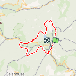

14 km | 19,8 km-effort


Utilisateur


Application GPS de randonnée GRATUITE
 SityTrail
IGN / Instituts géographiques
SityTrail World
Le monde est à vous
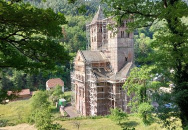
Randonnée Marche de 12,7 km à découvrir à Grand Est, Haut-Rhin, Murbach. Cette randonnée est proposée par DanielROLLET.
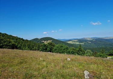
Reco ASPV Grand Ballon avec Marie, Gérard, Bruno et moi.
Une erreur aprés le Lac du Ballon pour attaquer le triangle jaune
8h30 à 12h30

Marche

Marche

A pied

A pied

Marche

Marche

Marche
Marche