![](/images/other/stat-length.png)
![Randonnée Marche Berlare - Berlare broek (6,5km) (StepAway.be) - Photo](https://media.geolcdn.com/t/1900/400/ext.pjpeg?maxdim=2&url=https%3A%2F%2Fstatic1.geolcdn.com%2Fsiteimages%2Fupload%2Ffiles%2F1553511878bg_sport_marche.png)
Berlare broek (6,5km) (StepAway.be)
corry.vandenbroeke
Utilisateur
![Longueur](/images/other/stat-length.png)
Longueur
6,6 km
![Altitude max](https://static1.geolcdn.com/siteimages/upload/files/1508320355ic_sort_altitude_max_24dp.png)
Altitude max
18 m
![Dénivelé positif](https://static1.geolcdn.com/siteimages/upload/files/1508320355ic_sort_den_pos_24dp.png)
Dénivelé positif
63 m
![Km-Effort](/images/other/stat-length.png)
Km-Effort
7,5 km
![Altitude min](https://static1.geolcdn.com/siteimages/upload/files/1508320355ic_sort_altitude_min_24dp.png)
Altitude min
-3 m
![Dénivelé négatif](https://static1.geolcdn.com/siteimages/upload/files/1508320355ic_sort_den_neg_24dp.png)
Dénivelé négatif
63 m
![Boucle](https://static1.geolcdn.com/siteimages/upload/files/16400158638029165_repeat_loop_refresh_sync_direction_icon.png)
Boucle
Oui
Date de création :
2016-10-26 00:00:00.0
Dernière modification :
2016-10-26 00:00:00.0
![Marche](https://static1.geolcdn.com/sitytour/trail-icons/101.png)
1h38
Difficulté : Très facile
![Scannez ce code QR pour ouvrir la randonnée dans l'application SityTrail](https://capi.geolives.com/qq0zvz2zws4bq2lad0pu/sitytour/trails/545993/qr.png?size=200)
Application GPS de randonnée GRATUITE
À propos
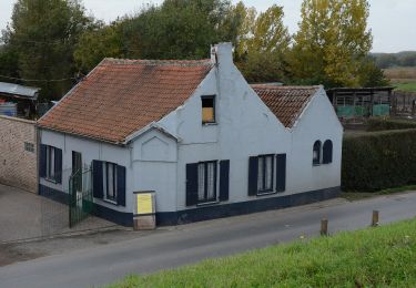
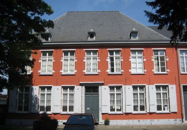
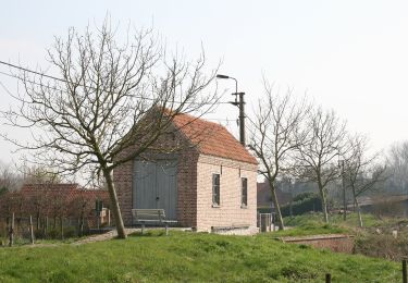
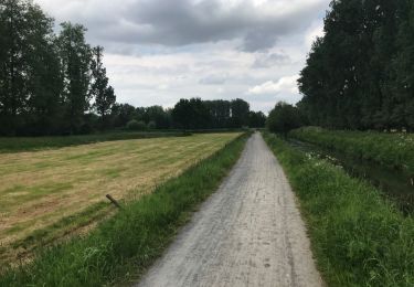
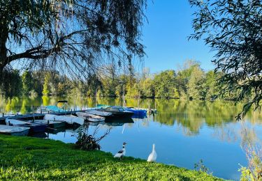
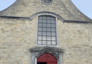
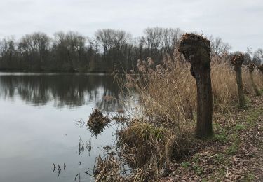
Randonnée Marche de 6,6 km à découvrir à Flandre, Flandre orientale, Berlare. Cette randonnée est proposée par corry.vandenbroeke.
Description
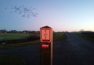
Start: Café 'De Turfput' - Turfputstraat 53 - 9290 Berlare. Ideale wandeling voor Nordic walking (Zachte ondergrond). Deze wandeling wordt U gratis aangeboden door www.StepAway.be
Localisation
Pays :
Belgique
Région :
Flandre
Département/Province :
Flandre orientale
Commune :
Berlare
Localité :
Berlare
Départ:(Dec)
Départ:(UTM)
570255 ; 5653687 (31U) N.
Commentaires
Randonnées à proximité
![Randonnée A pied Wichelen - GR128 Wichelen-Moorsel - Photo](https://media.geolcdn.com/t/375/260/0bfeb446-8ee2-4ed5-bd25-8ba2d6f0c64c.jpg&format=jpg&maxdim=2)
![A pied A pied](https://static1.geolcdn.com/sitytour/trail-icons/100.png)
GR128 Wichelen-Moorsel
A pied
Difficile
(1)
Wichelen,
Flandre,
Flandre orientale,
Belgique
![](/images/other/stat-length.png)
36 km | 40 km-effort
9h 4min
![](https://static1.geolcdn.com/siteimages/upload/files/16400158638029165_repeat_loop_refresh_sync_direction_icon.png)
Non
![Randonnée A pied Zele - Scheldemeersenpad - Photo](https://media.geolcdn.com/t/375/260/fbe7db51-af25-40aa-a60c-86b309dacd4b.jpeg&format=jpg&maxdim=2)
![A pied A pied](https://static1.geolcdn.com/sitytour/trail-icons/100.png)
Scheldemeersenpad
A pied
Facile
Zele,
Flandre,
Flandre orientale,
Belgique
![](/images/other/stat-length.png)
6,2 km | 6,5 km-effort
1h 28min
![](https://static1.geolcdn.com/siteimages/upload/files/16400158638029165_repeat_loop_refresh_sync_direction_icon.png)
Non
![Randonnée A pied Zele - Tuymelaersroute - Photo](https://media.geolcdn.com/t/375/260/4f583542-6b5b-4dfb-a87d-f9be1e93b3c7.jpeg&format=jpg&maxdim=2)
![A pied A pied](https://static1.geolcdn.com/sitytour/trail-icons/100.png)
Tuymelaersroute
A pied
Facile
Zele,
Flandre,
Flandre orientale,
Belgique
![](/images/other/stat-length.png)
8,3 km | 8,8 km-effort
1h 59min
![](https://static1.geolcdn.com/siteimages/upload/files/16400158638029165_repeat_loop_refresh_sync_direction_icon.png)
Oui
![Randonnée A pied Berlare - Bareldonkpad nr 16 - Photo](https://media.geolcdn.com/t/375/260/ef2ab241-3be4-4b98-96f6-9e8b90d7008e.jpeg&format=jpg&maxdim=2)
![A pied A pied](https://static1.geolcdn.com/sitytour/trail-icons/100.png)
Bareldonkpad nr 16
A pied
Facile
Berlare,
Flandre,
Flandre orientale,
Belgique
![](/images/other/stat-length.png)
11,7 km | 12,8 km-effort
2h 54min
![](https://static1.geolcdn.com/siteimages/upload/files/16400158638029165_repeat_loop_refresh_sync_direction_icon.png)
Oui
![Randonnée Marche Berlare - Donk 18 km - Photo](https://media.geolcdn.com/t/375/260/ext.jpg?maxdim=2&url=https%3A%2F%2Fservices.sitytrail.com%2FGeolivesWS%2FDownloadMedia.ashx%3FTrailID%3D962643%26Media%3D20180510141949.jpg)
![Marche Marche](https://static1.geolcdn.com/sitytour/trail-icons/101.png)
Donk 18 km
Marche
Très facile
Berlare,
Flandre,
Flandre orientale,
Belgique
![](/images/other/stat-length.png)
18,4 km | 20 km-effort
4h 7min
![](https://static1.geolcdn.com/siteimages/upload/files/16400158638029165_repeat_loop_refresh_sync_direction_icon.png)
Oui
![Randonnée Marche Berlare - Promenade autour du Donkmeer à Berlare - Photo](https://media.geolcdn.com/t/375/260/0c89e2c9-0c2e-4a25-9f57-4a3ecb0855b8.jpeg&format=jpg&maxdim=2)
![Marche Marche](https://static1.geolcdn.com/sitytour/trail-icons/101.png)
Promenade autour du Donkmeer à Berlare
Marche
Facile
Berlare,
Flandre,
Flandre orientale,
Belgique
![](/images/other/stat-length.png)
4,6 km | 4,9 km-effort
1h 7min
![](https://static1.geolcdn.com/siteimages/upload/files/16400158638029165_repeat_loop_refresh_sync_direction_icon.png)
Oui
![Randonnée Marche Termonde - 20221105 WSV De Zilverdistel 12 km - Photo](https://media.geolcdn.com/t/375/260/f0740830-4014-4d00-b480-755cf6828853.jpg&format=jpg&maxdim=2)
![Marche Marche](https://static1.geolcdn.com/sitytour/trail-icons/101.png)
20221105 WSV De Zilverdistel 12 km
Marche
Moyen
Termonde,
Flandre,
Flandre orientale,
Belgique
![](/images/other/stat-length.png)
12,6 km | 13,3 km-effort
2h 30min
![](https://static1.geolcdn.com/siteimages/upload/files/16400158638029165_repeat_loop_refresh_sync_direction_icon.png)
Oui
![Randonnée A pied Berlare - Donkmeer Route - Photo](https://media.geolcdn.com/t/375/260/ext.jpg?maxdim=2&url=https%3A%2F%2Fstatic1.geolcdn.com%2Fsiteimages%2Fupload%2Ffiles%2F1545311037marcheuse_200dpi.jpg)
![A pied A pied](https://static1.geolcdn.com/sitytour/trail-icons/100.png)
Donkmeer Route
A pied
Facile
Berlare,
Flandre,
Flandre orientale,
Belgique
![](/images/other/stat-length.png)
3,8 km | 4,2 km-effort
56min
![](https://static1.geolcdn.com/siteimages/upload/files/16400158638029165_repeat_loop_refresh_sync_direction_icon.png)
Oui
![Randonnée Marche Berlare - Rond Donkmeer en Nieuwdonk - Photo](https://media.geolcdn.com/t/375/260/bfe2dcfd-4f2b-482f-b611-bcdd11ad7d16.jpg&format=jpg&maxdim=2)
![Marche Marche](https://static1.geolcdn.com/sitytour/trail-icons/101.png)
Rond Donkmeer en Nieuwdonk
Marche
Facile
Berlare,
Flandre,
Flandre orientale,
Belgique
![](/images/other/stat-length.png)
6,6 km | 7,2 km-effort
1h 48min
![](https://static1.geolcdn.com/siteimages/upload/files/16400158638029165_repeat_loop_refresh_sync_direction_icon.png)
Oui