![](/images/other/stat-length.png)
![Randonnée Marche Stekene - Klein sinaai/ Stekene - Stiltewandeling (12km) (StepAway.be) - Photo](https://media.geolcdn.com/t/1900/400/ext.pjpeg?maxdim=2&url=https%3A%2F%2Fstatic1.geolcdn.com%2Fsiteimages%2Fupload%2Ffiles%2F1553511878bg_sport_marche.png)
Klein sinaai/ Stekene - Stiltewandeling (12km) (StepAway.be)
corry.vandenbroeke
Utilisateur
![Longueur](/images/other/stat-length.png)
Longueur
11,7 km
![Altitude max](https://static1.geolcdn.com/siteimages/upload/files/1508320355ic_sort_altitude_max_24dp.png)
Altitude max
10 m
![Dénivelé positif](https://static1.geolcdn.com/siteimages/upload/files/1508320355ic_sort_den_pos_24dp.png)
Dénivelé positif
62 m
![Km-Effort](/images/other/stat-length.png)
Km-Effort
12,5 km
![Altitude min](https://static1.geolcdn.com/siteimages/upload/files/1508320355ic_sort_altitude_min_24dp.png)
Altitude min
0 m
![Dénivelé négatif](https://static1.geolcdn.com/siteimages/upload/files/1508320355ic_sort_den_neg_24dp.png)
Dénivelé négatif
62 m
![Boucle](https://static1.geolcdn.com/siteimages/upload/files/16400158638029165_repeat_loop_refresh_sync_direction_icon.png)
Boucle
Oui
Date de création :
2016-05-05 00:00:00.0
Dernière modification :
2016-05-05 00:00:00.0
![Marche](https://static1.geolcdn.com/sitytour/trail-icons/101.png)
2h47
Difficulté : Très facile
![Scannez ce code QR pour ouvrir la randonnée dans l'application SityTrail](https://capi.geolives.com/qq0zvz2zws4bq2lad0pu/sitytour/trails/545907/qr.png?size=200)
Application GPS de randonnée GRATUITE
À propos
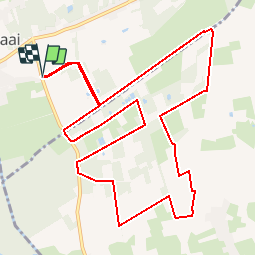
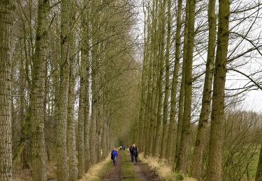
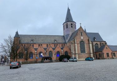
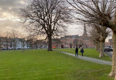
Randonnée Marche de 11,7 km à découvrir à Flandre, Flandre orientale, Stekene. Cette randonnée est proposée par corry.vandenbroeke.
Description
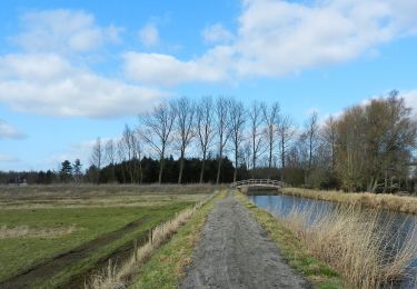
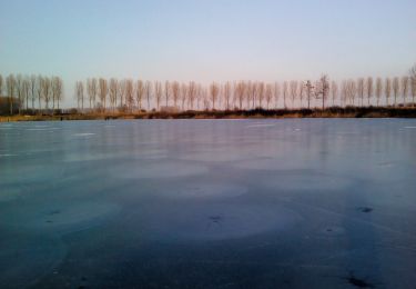
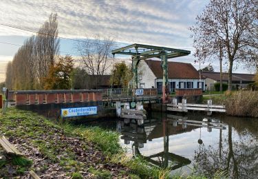
Start: Heimeersstraat - 9190 Stekene/Klein Sinaai. prachtige wandeling tussen de velden en langs het kanaal van Stekene. Deze wandeling wordt U gratis aangeboden door www.StepAway.be
Localisation
Pays :
Belgique
Région :
Flandre
Département/Province :
Flandre orientale
Commune :
Stekene
Localité :
Stekene
Départ:(Dec)
Départ:(UTM)
569818 ; 5670327 (31U) N.
Commentaires
Randonnées à proximité
![Randonnée A pied Lokeren - Liniewegelroute - Photo](https://media.geolcdn.com/t/375/260/62ae4cc3-6e72-4c51-bc3b-95bdff6e887b.jpeg&format=jpg&maxdim=2)
![A pied A pied](https://static1.geolcdn.com/sitytour/trail-icons/100.png)
Liniewegelroute
A pied
Facile
Lokeren,
Flandre,
Flandre orientale,
Belgique
![](/images/other/stat-length.png)
8,4 km | 9 km-effort
2h 2min
![](https://static1.geolcdn.com/siteimages/upload/files/16400158638029165_repeat_loop_refresh_sync_direction_icon.png)
Oui
![Randonnée A pied Moerbeke - Pereboomsgat Wandelroute - Photo](https://media.geolcdn.com/t/375/260/3a2bc327-0df1-42c6-8878-457c212415cf.jpeg&format=jpg&maxdim=2)
![A pied A pied](https://static1.geolcdn.com/sitytour/trail-icons/100.png)
Pereboomsgat Wandelroute
A pied
Facile
Moerbeke,
Flandre,
Flandre orientale,
Belgique
![](/images/other/stat-length.png)
8,5 km | 8,9 km-effort
2h 1min
![](https://static1.geolcdn.com/siteimages/upload/files/16400158638029165_repeat_loop_refresh_sync_direction_icon.png)
Non
![Randonnée Marche Stekene - Wullebos - Klein Sinaai (6km) (StepAway.be) - Photo](https://media.geolcdn.com/t/375/260/ext.jpg?maxdim=2&url=https%3A%2F%2Fstatic1.geolcdn.com%2Fsiteimages%2Fupload%2Ffiles%2F1553511878bg_sport_marche.png)
![Marche Marche](https://static1.geolcdn.com/sitytour/trail-icons/101.png)
Wullebos - Klein Sinaai (6km) (StepAway.be)
Marche
Facile
(1)
Stekene,
Flandre,
Flandre orientale,
Belgique
![](/images/other/stat-length.png)
5,9 km | 6,5 km-effort
1h 26min
![](https://static1.geolcdn.com/siteimages/upload/files/16400158638029165_repeat_loop_refresh_sync_direction_icon.png)
Oui
![Randonnée Marche Moerbeke - Moerbeke 26,5 km - Photo](https://media.geolcdn.com/t/375/260/35628380-609b-479d-af04-77325e1722d8.jpg&format=jpg&maxdim=2)
![Marche Marche](https://static1.geolcdn.com/sitytour/trail-icons/101.png)
Moerbeke 26,5 km
Marche
Moyen
Moerbeke,
Flandre,
Flandre orientale,
Belgique
![](/images/other/stat-length.png)
27 km | 28 km-effort
5h 44min
![](https://static1.geolcdn.com/siteimages/upload/files/16400158638029165_repeat_loop_refresh_sync_direction_icon.png)
Oui
![Randonnée A pied Saint-Nicolas - Fondatie van Boudeloroute - Photo](https://media.geolcdn.com/t/375/260/8e5b7271-48e9-4cd7-899b-9ae7b9cc4a80.jpeg&format=jpg&maxdim=2)
![A pied A pied](https://static1.geolcdn.com/sitytour/trail-icons/100.png)
Fondatie van Boudeloroute
A pied
Facile
Saint-Nicolas,
Flandre,
Flandre orientale,
Belgique
![](/images/other/stat-length.png)
6 km | 6,5 km-effort
1h 28min
![](https://static1.geolcdn.com/siteimages/upload/files/16400158638029165_repeat_loop_refresh_sync_direction_icon.png)
Oui
![Randonnée Marche Stekene - Stekene 24 km - Photo](https://media.geolcdn.com/t/375/260/fec1aeec-483e-4c6f-b7bd-2e96b05a7549.jpg&format=jpg&maxdim=2)
![Marche Marche](https://static1.geolcdn.com/sitytour/trail-icons/101.png)
Stekene 24 km
Marche
Moyen
Stekene,
Flandre,
Flandre orientale,
Belgique
![](/images/other/stat-length.png)
24 km | 26 km-effort
5h 33min
![](https://static1.geolcdn.com/siteimages/upload/files/16400158638029165_repeat_loop_refresh_sync_direction_icon.png)
Oui
![Randonnée Marche Saint-Nicolas - Sinaai bis 22,9 km - Photo](https://media.geolcdn.com/t/375/260/9fd9e1dc-7fca-48aa-aa20-c76237cf4a8e.jpg&format=jpg&maxdim=2)
![Marche Marche](https://static1.geolcdn.com/sitytour/trail-icons/101.png)
Sinaai bis 22,9 km
Marche
Facile
Saint-Nicolas,
Flandre,
Flandre orientale,
Belgique
![](/images/other/stat-length.png)
23 km | 24 km-effort
5h 12min
![](https://static1.geolcdn.com/siteimages/upload/files/16400158638029165_repeat_loop_refresh_sync_direction_icon.png)
Oui
![Randonnée Marche Saint-Nicolas - Sinaai 23 km - Photo](https://media.geolcdn.com/t/375/260/41153e4c-b05c-4034-85e3-cf7e03465de5.jpg&format=jpg&maxdim=2)
![Marche Marche](https://static1.geolcdn.com/sitytour/trail-icons/101.png)
Sinaai 23 km
Marche
Facile
Saint-Nicolas,
Flandre,
Flandre orientale,
Belgique
![](/images/other/stat-length.png)
23 km | 24 km-effort
5h 9min
![](https://static1.geolcdn.com/siteimages/upload/files/16400158638029165_repeat_loop_refresh_sync_direction_icon.png)
Oui
![Randonnée Marche Lokeren - liniewegel - Photo](https://media.geolcdn.com/t/375/260/ext.jpg?maxdim=2&url=https%3A%2F%2Fstatic1.geolcdn.com%2Fsiteimages%2Fupload%2Ffiles%2F1553511878bg_sport_marche.png)
![Marche Marche](https://static1.geolcdn.com/sitytour/trail-icons/101.png)
liniewegel
Marche
Très facile
(1)
Lokeren,
Flandre,
Flandre orientale,
Belgique
![](/images/other/stat-length.png)
8,4 km | 9 km-effort
Inconnu
![](https://static1.geolcdn.com/siteimages/upload/files/16400158638029165_repeat_loop_refresh_sync_direction_icon.png)
Oui