


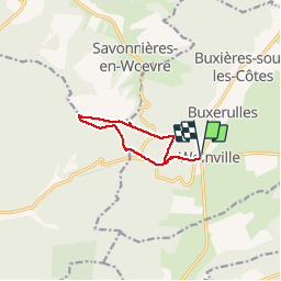

18,1 km | 20 km-effort


Utilisateur


Application GPS de randonnée GRATUITE
 SityTrail
IGN / Instituts géographiques
SityTrail World
Le monde est à vous
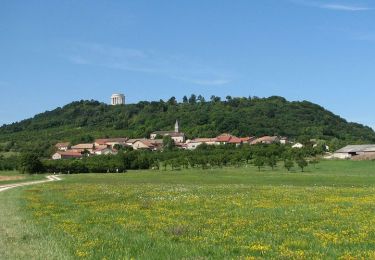
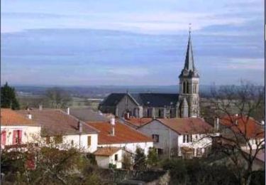
Randonnée Marche de 8 km à découvrir à Grand Est, Meuse, Buxières-sous-les-Côtes. Cette randonnée est proposée par kikkko.
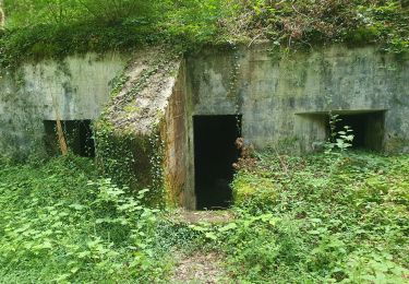
Agréable randonnée sous bois avec en chemin un autel allemand et le fameux menhir!
Très bien balisé par les amis des Côtes (rectangle vert)

V.T.T.
Marche
Marche
Marche
Marche
Marche

A pied
A pied

Marche