![](/images/other/stat-length.png)
![Randonnée Marche Nandrin - NANDRIN - Promenade de Yernée - Photo](https://media.geolcdn.com/t/1900/400/ext.pjpeg?maxdim=2&url=https%3A%2F%2Fservices.sitytrail.com%2FGeolivesWS%2FDownloadMedia.ashx%3FTrailID%3D517623%26Media%3D7ab957a9-1257-4946-923e-041eda79bd03.jpg)
NANDRIN - Promenade de Yernée
henrineupre
Utilisateur
![Longueur](/images/other/stat-length.png)
Longueur
9,1 km
![Altitude max](https://static1.geolcdn.com/siteimages/upload/files/1508320355ic_sort_altitude_max_24dp.png)
Altitude max
244 m
![Dénivelé positif](https://static1.geolcdn.com/siteimages/upload/files/1508320355ic_sort_den_pos_24dp.png)
Dénivelé positif
192 m
![Km-Effort](/images/other/stat-length.png)
Km-Effort
11,6 km
![Altitude min](https://static1.geolcdn.com/siteimages/upload/files/1508320355ic_sort_altitude_min_24dp.png)
Altitude min
101 m
![Dénivelé négatif](https://static1.geolcdn.com/siteimages/upload/files/1508320355ic_sort_den_neg_24dp.png)
Dénivelé négatif
195 m
![Boucle](https://static1.geolcdn.com/siteimages/upload/files/16400158638029165_repeat_loop_refresh_sync_direction_icon.png)
Boucle
Oui
![Balise](https://services.sitytrail.com/GeolivesWS/DownloadMedia.ashx?TrailID=517623&Media=balise.png)
Balise
Date de création :
2017-03-17 00:00:00.0
Dernière modification :
2017-03-17 00:00:00.0
![Marche](https://static1.geolcdn.com/sitytour/trail-icons/101.png)
2h30
Difficulté : Moyen
![Scannez ce code QR pour ouvrir la randonnée dans l'application SityTrail](https://capi.geolives.com/qq0zvz2zws4bq2lad0pu/sitytour/trails/517623/qr.png?size=200)
Application GPS de randonnée GRATUITE
À propos
Randonnée Marche de 9,1 km à découvrir à Wallonie, Liège, Nandrin. Cette randonnée est proposée par henrineupre.
Description
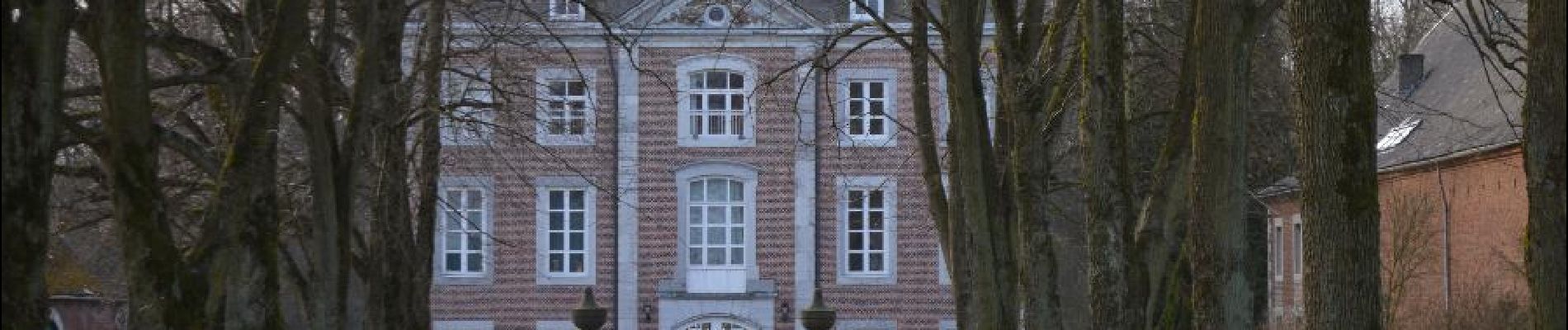
Le village en déclivité s’étire le long de la route d’Ombret, qui le traverse pour rejoindre la vallée, pour peu, on se croirait en Ardennes.
BALISE: losange rouge
Localisation
Pays :
Belgique
Région :
Wallonie
Département/Province :
Liège
Commune :
Nandrin
Localité :
Yernée-Fraineux
Départ:(Dec)
Départ:(UTM)
668807 ; 5600048 (31U) N.
Commentaires
Randonnées à proximité
![Randonnée Marche Modave - Rausa GR 575 bis - Photo](https://media.geolcdn.com/t/375/260/ext.jpg?maxdim=2&url=https%3A%2F%2Fstatic1.geolcdn.com%2Fsiteimages%2Fupload%2Ffiles%2F1553511878bg_sport_marche.png)
![Marche Marche](https://static1.geolcdn.com/sitytour/trail-icons/101.png)
Rausa GR 575 bis
Marche
Facile
(12)
Modave,
Wallonie,
Liège,
Belgique
![](/images/other/stat-length.png)
6 km | 7,7 km-effort
1h 38min
![](https://static1.geolcdn.com/siteimages/upload/files/16400158638029165_repeat_loop_refresh_sync_direction_icon.png)
Oui
![Randonnée Marche Amay - marche adeps jehay 10km 2024 - Photo](https://media.geolcdn.com/t/375/260/04b81805-d462-4e76-9141-5bf7a46a778a.jpg&format=jpg&maxdim=2)
![Marche Marche](https://static1.geolcdn.com/sitytour/trail-icons/101.png)
marche adeps jehay 10km 2024
Marche
Moyen
(1)
Amay,
Wallonie,
Liège,
Belgique
![](/images/other/stat-length.png)
9,8 km | 11,8 km-effort
2h 20min
![](https://static1.geolcdn.com/siteimages/upload/files/16400158638029165_repeat_loop_refresh_sync_direction_icon.png)
Oui
![Randonnée Marche Nandrin - Villers le temple . st jean sart . clemaude - Photo](https://media.geolcdn.com/t/375/260/c7438fda-ad3c-4a12-91ed-f3aabfc6b7ce.jpg&format=jpg&maxdim=2)
![Marche Marche](https://static1.geolcdn.com/sitytour/trail-icons/101.png)
Villers le temple . st jean sart . clemaude
Marche
Très facile
(1)
Nandrin,
Wallonie,
Liège,
Belgique
![](/images/other/stat-length.png)
7,9 km | 10,4 km-effort
2h 12min
![](https://static1.geolcdn.com/siteimages/upload/files/16400158638029165_repeat_loop_refresh_sync_direction_icon.png)
Oui
![Randonnée Marche Modave - MODAVE - Froide Fontaine - Photo](https://media.geolcdn.com/t/375/260/ext.jpg?maxdim=2&url=https%3A%2F%2Fservices.sitytrail.com%2FGeolivesWS%2FDownloadMedia.ashx%3FTrailID%3D163540%26Media%3Da9dfd4e0-07be-4695-be31-23a02d75fa1f.jpg)
![Marche Marche](https://static1.geolcdn.com/sitytour/trail-icons/101.png)
MODAVE - Froide Fontaine
Marche
Moyen
(2)
Modave,
Wallonie,
Liège,
Belgique
![](/images/other/stat-length.png)
8,6 km | 10,6 km-effort
2h 14min
![](https://static1.geolcdn.com/siteimages/upload/files/16400158638029165_repeat_loop_refresh_sync_direction_icon.png)
Oui
![Randonnée V.T.T. Amay - casse gueul - Photo](https://media.geolcdn.com/t/375/260/ext.jpg?maxdim=2&url=https%3A%2F%2Fservices.sitytrail.com%2FGeolivesWS%2FDownloadMedia.ashx%3FTrailID%3D285464%26Media%3Dfix__20140511121633.jpg)
![V.T.T. V.T.T.](https://static1.geolcdn.com/sitytour/trail-icons/202.png)
![Randonnée Marche Nandrin - promenade de la rochette : villers le temple - grand fond d'oxhe - villers le temple - Photo](https://media.geolcdn.com/t/375/260/6a65eaf0-07ca-4e09-ab79-c1ffba2fba6b.jpg&format=jpg&maxdim=2)
![Marche Marche](https://static1.geolcdn.com/sitytour/trail-icons/101.png)
promenade de la rochette : villers le temple - grand fond d'oxhe - villers le...
Marche
Moyen
(1)
Nandrin,
Wallonie,
Liège,
Belgique
![](/images/other/stat-length.png)
10 km | 13,3 km-effort
2h 47min
![](https://static1.geolcdn.com/siteimages/upload/files/16400158638029165_repeat_loop_refresh_sync_direction_icon.png)
Oui
![Randonnée Marche Modave - Stree reco 21 12 - Photo](https://media.geolcdn.com/t/375/260/ext.jpg?maxdim=2&url=https%3A%2F%2Fstatic1.geolcdn.com%2Fsiteimages%2Fupload%2Ffiles%2F1553511878bg_sport_marche.png)
![Marche Marche](https://static1.geolcdn.com/sitytour/trail-icons/101.png)
Stree reco 21 12
Marche
Moyen
(2)
Modave,
Wallonie,
Liège,
Belgique
![](/images/other/stat-length.png)
7,6 km | 9,3 km-effort
1h 55min
![](https://static1.geolcdn.com/siteimages/upload/files/16400158638029165_repeat_loop_refresh_sync_direction_icon.png)
Oui
![Randonnée Marche Amay - 20230726 - TOTEMUS Amay - 6.1 Km - Photo](https://media.geolcdn.com/t/375/260/4112cd7d-32fc-4690-94e7-6dc07eacc03d.jpeg&format=jpg&maxdim=2)
![Marche Marche](https://static1.geolcdn.com/sitytour/trail-icons/101.png)
20230726 - TOTEMUS Amay - 6.1 Km
Marche
Moyen
Amay,
Wallonie,
Liège,
Belgique
![](/images/other/stat-length.png)
6,1 km | 6,6 km-effort
1h 42min
![](https://static1.geolcdn.com/siteimages/upload/files/16400158638029165_repeat_loop_refresh_sync_direction_icon.png)
Oui
![Randonnée A pied Amay - Promenade d'Ombret - Photo](https://media.geolcdn.com/t/375/260/bbfa7314-541b-4540-af6f-869e2bd08b94.jpeg&format=jpg&maxdim=2)
![A pied A pied](https://static1.geolcdn.com/sitytour/trail-icons/100.png)