![](/images/other/stat-length.png)
![Randonnée Marche Aups - Aups-Notre Dame de Liesse rando - Photo](https://media.geolcdn.com/t/1900/400/ext.pjpeg?maxdim=2&url=https%3A%2F%2Fstatic1.geolcdn.com%2Fsiteimages%2Fupload%2Ffiles%2F1553511878bg_sport_marche.png)
Aups-Notre Dame de Liesse rando
Sugg
Utilisateur
![Longueur](/images/other/stat-length.png)
![Altitude max](https://static1.geolcdn.com/siteimages/upload/files/1508320355ic_sort_altitude_max_24dp.png)
![Dénivelé positif](https://static1.geolcdn.com/siteimages/upload/files/1508320355ic_sort_den_pos_24dp.png)
![Km-Effort](/images/other/stat-length.png)
![Altitude min](https://static1.geolcdn.com/siteimages/upload/files/1508320355ic_sort_altitude_min_24dp.png)
![Dénivelé négatif](https://static1.geolcdn.com/siteimages/upload/files/1508320355ic_sort_den_neg_24dp.png)
![Boucle](https://static1.geolcdn.com/siteimages/upload/files/16400158638029165_repeat_loop_refresh_sync_direction_icon.png)
![Marche](https://static1.geolcdn.com/sitytour/trail-icons/101.png)
5h53
Difficulté : Difficile
![Scannez ce code QR pour ouvrir la randonnée dans l'application SityTrail](https://capi.geolives.com/qq0zvz2zws4bq2lad0pu/sitytour/trails/495665/qr.png?size=200)
Application GPS de randonnée GRATUITE
À propos
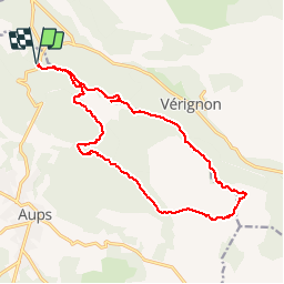
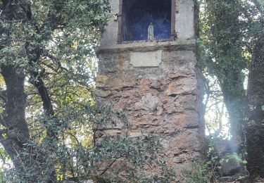
Randonnée Marche de 19 km à découvrir à Provence-Alpes-Côte d'Azur, Var, Aups. Cette randonnée est proposée par Sugg.
Description
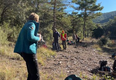
2015-11-18 Rando restons en Forme
Depuis le col de la Bigue.
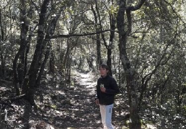
Effectué dans le sens inverse des aiguilles d'une montre, ce qui me paraît plus judicieux pour le plaisir.
Assez difficile par endroits pour des séniors.
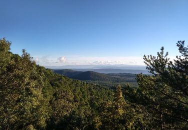
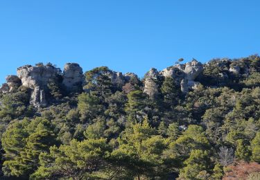
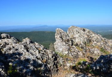
Le retour en crête est superbe et laisse de bons souvenirs.
Localisation
Commentaires
Randonnées à proximité
![Randonnée Marche Aups - Tour de la montagne des Espiguières - Photo](https://media.geolcdn.com/t/375/260/431b4009-bb72-41ce-bf82-1eb70c111177.jpg&format=jpg&maxdim=2)
![Marche Marche](https://static1.geolcdn.com/sitytour/trail-icons/101.png)
Marche
![](/images/other/stat-length.png)
![](https://static1.geolcdn.com/siteimages/upload/files/16400158638029165_repeat_loop_refresh_sync_direction_icon.png)
![Randonnée Marche Vérignon - 2024-01-30 Vérignon - Chapelle Saint Priest - Photo](https://media.geolcdn.com/t/375/260/bc33279d-e419-4c1d-b671-4cabd4fbe480.jpg&format=jpg&maxdim=2)
![Marche Marche](https://static1.geolcdn.com/sitytour/trail-icons/101.png)
Marche
![](/images/other/stat-length.png)
![](https://static1.geolcdn.com/siteimages/upload/files/16400158638029165_repeat_loop_refresh_sync_direction_icon.png)
![Randonnée Marche Aups - 2023-01-31 Col de la Bigue - Les Eyssariades - Photo](https://media.geolcdn.com/t/375/260/039bb7ef-09c0-4f59-a7b3-09433c82c531.jpg&format=jpg&maxdim=2)
![Marche Marche](https://static1.geolcdn.com/sitytour/trail-icons/101.png)
Marche
![](/images/other/stat-length.png)
![](https://static1.geolcdn.com/siteimages/upload/files/16400158638029165_repeat_loop_refresh_sync_direction_icon.png)
![Randonnée Marche Aups - 30-10-2022 Aups Sentier des Crêtes - Photo](https://media.geolcdn.com/t/375/260/032d8805-e093-4b3d-aca0-89dc5544919a.jpg&format=jpg&maxdim=2)
![Marche Marche](https://static1.geolcdn.com/sitytour/trail-icons/101.png)
Marche
![](/images/other/stat-length.png)
![](https://static1.geolcdn.com/siteimages/upload/files/16400158638029165_repeat_loop_refresh_sync_direction_icon.png)
![Randonnée Course à pied Moissac-Bellevue - TRAIL DE MOISSAC 2016 10KM +330 - Photo](https://media.geolcdn.com/t/375/260/ext.jpg?maxdim=2&url=https%3A%2F%2Fservices.sitytrail.com%2FGeolivesWS%2FDownloadMedia.ashx%3FTrailID%3D540393%26Media%3Dfix__20160319134649.jpg)
![Course à pied Course à pied](https://static1.geolcdn.com/sitytour/trail-icons/103.png)
Course à pied
![](/images/other/stat-length.png)
![](https://static1.geolcdn.com/siteimages/upload/files/16400158638029165_repeat_loop_refresh_sync_direction_icon.png)
![Randonnée Marche Aups - 2025-01-21 Montagne des Espiguières - Photo](https://media.geolcdn.com/t/375/260/1e29026a-5d46-486c-967e-572a0d99d84f.jpg&format=jpg&maxdim=2)
![Marche Marche](https://static1.geolcdn.com/sitytour/trail-icons/101.png)
Marche
![](/images/other/stat-length.png)
![](https://static1.geolcdn.com/siteimages/upload/files/16400158638029165_repeat_loop_refresh_sync_direction_icon.png)
![Randonnée Marche Vérignon - Verignon Notre Dame de Liesse Chapelle Saint Priest trace réelle - Photo](https://media.geolcdn.com/t/375/260/06e1804b-1eee-444e-ab93-f67bc999bfbe.jpg&format=jpg&maxdim=2)
![Marche Marche](https://static1.geolcdn.com/sitytour/trail-icons/101.png)
Marche
![](/images/other/stat-length.png)
![](https://static1.geolcdn.com/siteimages/upload/files/16400158638029165_repeat_loop_refresh_sync_direction_icon.png)
![Randonnée Marche Aups - Aups - Photo](https://media.geolcdn.com/t/375/260/fd86a7ef-4f3e-4db0-8d1f-50f58d38a091.jpg&format=jpg&maxdim=2)
![Marche Marche](https://static1.geolcdn.com/sitytour/trail-icons/101.png)
Marche
![](/images/other/stat-length.png)
![](https://static1.geolcdn.com/siteimages/upload/files/16400158638029165_repeat_loop_refresh_sync_direction_icon.png)