


7,6 km | 13,1 km-effort


Utilisateur


Application GPS de randonnée GRATUITE
 SityTrail
IGN / Instituts géographiques
SityTrail World
Le monde est à vous
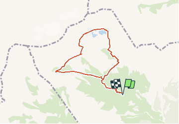
Randonnée Marche de 6,9 km à découvrir à Valais, Conthey, Chamoson. Cette randonnée est proposée par rpf.
Très jolie boucle autour de la superbe Dent de Chamosentze avec les magnifiques rencontres d''un bouquetin solitaire et d''un troupeau d''étagnes accompagnées de leurs petits. Une balade délicate au début de l''été car il y a encore beaucoup de neige sur le petit glacier et sur les lacs de la Forcla. A faire idéalement en août-septembre.
Départ à l''alpage de Chamosentze qu''on atteint par une route forestière en assez bon état.
Le parcours comporte des montées assez abruptes. Il se recoupe largement avec ceux de Tita Naire et Cabane Rambert.
Une balade de " www.toprando.ch "
Marche nordique
Marche
Marche


Marche

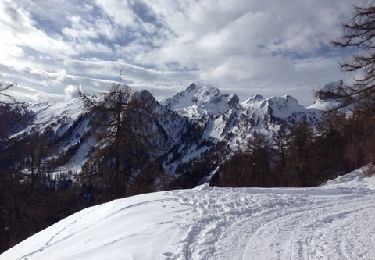
Raquettes à neige
Raquettes à neige